MyTopo
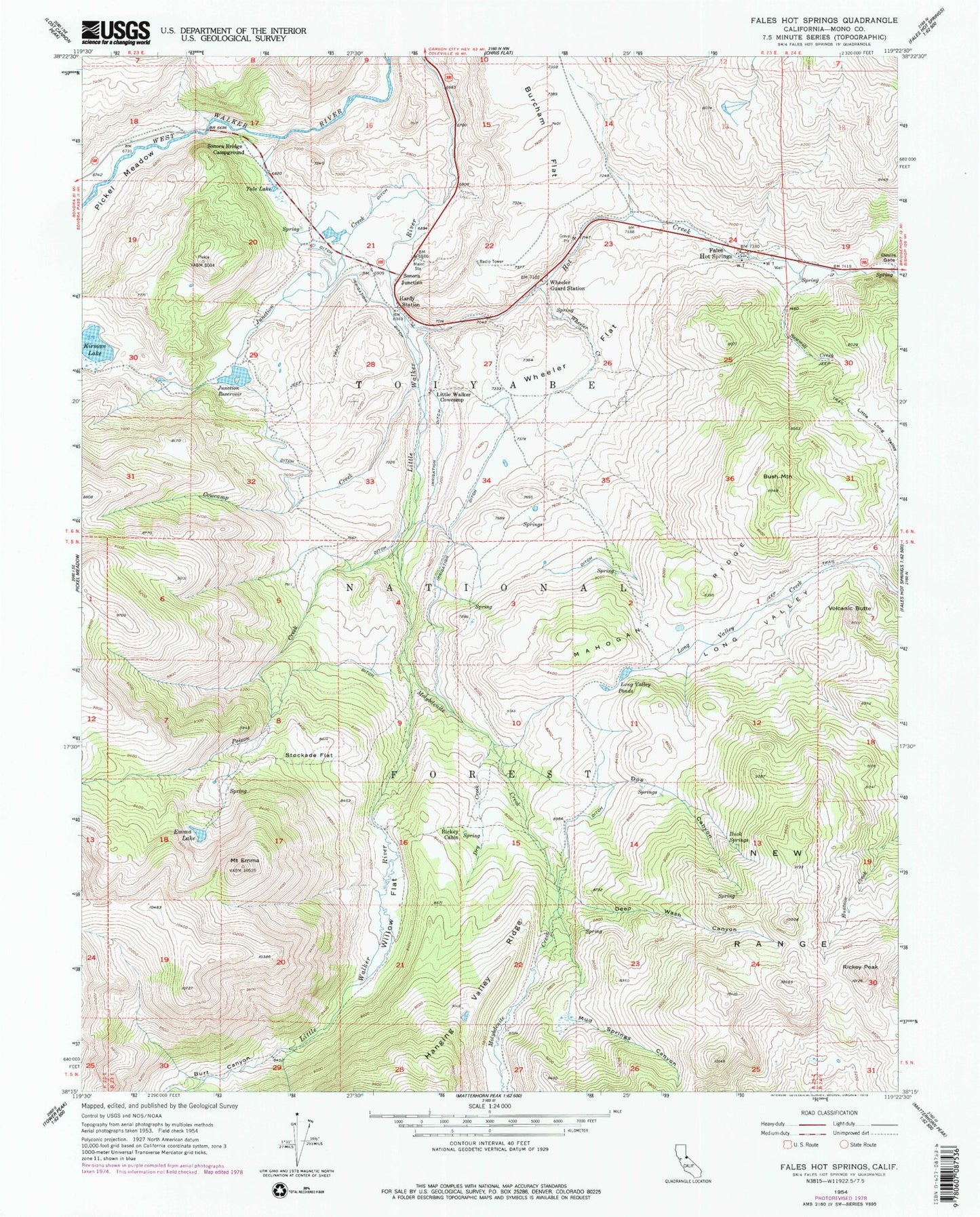
Classic USGS Fales Hot Springs California 7.5'x7.5' Topo Map
Couldn't load pickup availability
Historical USGS topographic quad map of Fales Hot Springs in the state of California. Typical map scale is 1:24,000, but may vary for certain years, if available. Print size: 24" x 27"
This quadrangle is in the following counties: Mono.
The map contains contour lines, roads, rivers, towns, and lakes. Printed on high-quality waterproof paper with UV fade-resistant inks, and shipped rolled.
Contains the following named places: Buck Springs, Bush Mountain, Cowcamp Creek, Deep Wash Canyon, Devils Gate, Doe Canyon, Dry Creek, Emma Lake, Hardy Station, Hot Creek, Junction Creek, Junction Reservoir, Little Long Valley, Little Walker Cowcamp, Long Valley, Long Valley Ponds, Mahogany Ridge, Mud Springs Canyon, Rickey Cabin, Rickey Peak, Sawmill Creek, New Range, Stockade Flat, Tule Lake, Volcanic Butte, Wheeler Flat, Willow Flat, Wheeler Creek, Molybdenite Creek, Burt Canyon, Burcham Flat, Kirman Lake, Poison Creek, Devils Gate Pack Station, Obsidian Campground, Mount Emma, Wheeler Guard Station, Fales Hot Springs, Sonora Junction, California Maintenance Station, Black Reservoir 538 Dam, Sonora Bridge Campground