MyTopo
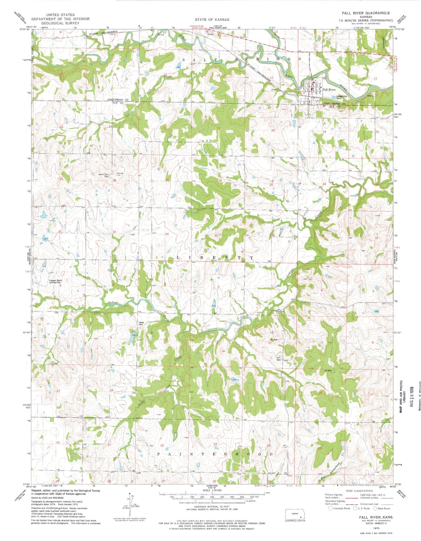
Classic USGS Fall River Kansas 7.5'x7.5' Topo Map
Couldn't load pickup availability
Historical USGS topographic quad map of Fall River in the state of Kansas. Map scale may vary for some years, but is generally around 1:24,000. Print size is approximately 24" x 27"
This quadrangle is in the following counties: Elk, Greenwood.
The map contains contour lines, roads, rivers, towns, and lakes. Printed on high-quality waterproof paper with UV fade-resistant inks, and shipped rolled.
Contains the following named places: Cave Springs, City of Fall River, Clogston Ranch Landing Strip, Fall River, Fall River Christian Church, Fall River Fire Department, Fall River Municipal Wastewater Treatment Facility, Fall River Post Office, Hideout School, Little Indian Creek, Little Salt Creek, Mount Zion Cemetery, North Pole School, Rule School, Salt Creek, Township of Liberty, Union Valley School, Victor School, Wade Cemetery