MyTopo
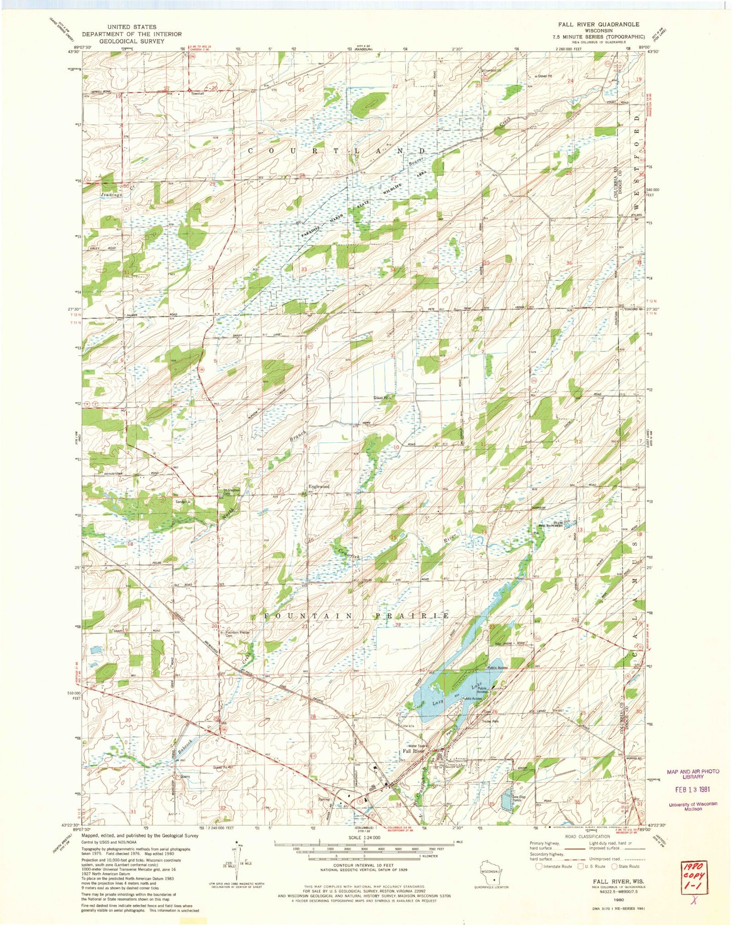
Classic USGS Fall River Wisconsin 7.5'x7.5' Topo Map
Couldn't load pickup availability
Historical USGS topographic quad map of Fall River in the state of Wisconsin. Map scale may vary for some years, but is generally around 1:24,000. Print size is approximately 24" x 27"
This quadrangle is in the following counties: Columbia, Dodge.
The map contains contour lines, roads, rivers, towns, and lakes. Printed on high-quality waterproof paper with UV fade-resistant inks, and shipped rolled.
Contains the following named places: Bennett School, Brace School, Courtland Bennett School, Courtland Church, Courtland Methodist Cemetery, England School, Englewood, Englewood School, Fall River, Fall River 2WP73 Dam, Fall River Cemetery, Fall River Elementary School, Fall River Middle / High School, Fall River Police Department, Fall River Post Office, Fall River Volunteer Fire Department, Fountain Prairie Airport, Fountain Prairie Cemetery, Lazy Lake, Lazy Lake 61, McKinley School, Paradise Marsh State Wildlife Area, Rust School, Saint Stephen Cemetery, Saint Stephen Church, Town of Fountain Prairie, Village of Fall River, ZIP Code: 53932