MyTopo
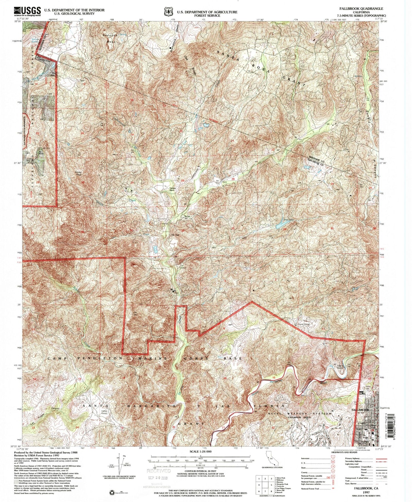
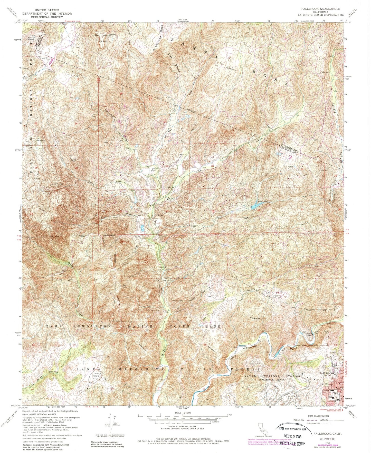
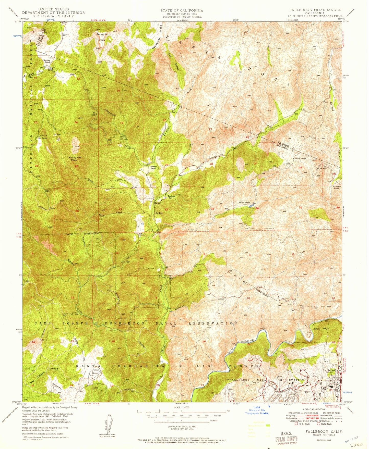
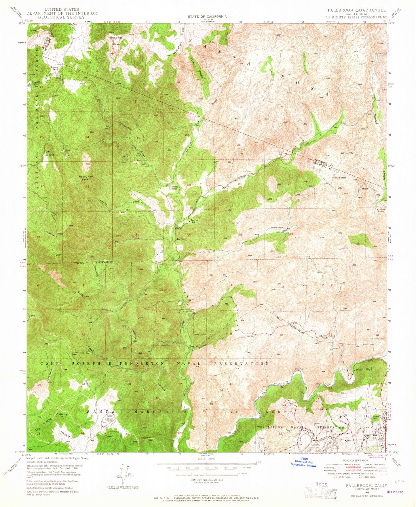
Classic USGS Fallbrook California 7.5'x7.5' Topo Map
Couldn't load pickup availability
Historical USGS topographic quad map of Fallbrook in the state of California. Map scale may vary for some years, but is generally around 1:24,000. Print size is approximately 24" x 27"
This quadrangle is in the following counties: Riverside, San Diego.
The map contains contour lines, roads, rivers, towns, and lakes. Printed on high-quality waterproof paper with UV fade-resistant inks, and shipped rolled.
Contains the following named places: Apostolic Assembly of the Faith in Christ Church, Avenaloca Mesa, California Department of Forestry and Fire Protection De Luz Fire Station 16, Camps Creek, Chapel of the Hill Foursquare Church, Church of Christ, Cottonwood Creek, De Luz, De Luz Elementary School, De Luz Heights, De Luz Volunteer Fire Department, Dittermore Ranch, Doville Ranch, Fallbrook, Fallbrook Branch San Diego County Library, Fallbrook Church of Christ, Fallbrook Division, Fallbrook First Baptist Church, Fallbrook Mercantile Shopping Center, Fallbrook Post Office, Fallbrook Street Elementary School, Fern Creek, Ferndale Ranch, First Christian Church, First Church of God, Garnsay Ranch, Jave Ranch, Johnson Ranch, Maie Ellis Elementary School, Marchant Ranch, Matthews 858 Dam, Oak Slope, Redonda Mesa, Richman Ranch, Roblar Creek, Rocky Peak, Ross Lake, Santa Margarita Groves, Sky Ranch, Village Park, Village Square Park, Willow Spring