
MyTopo
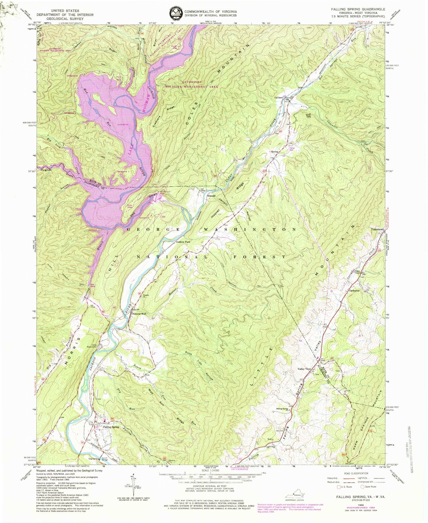
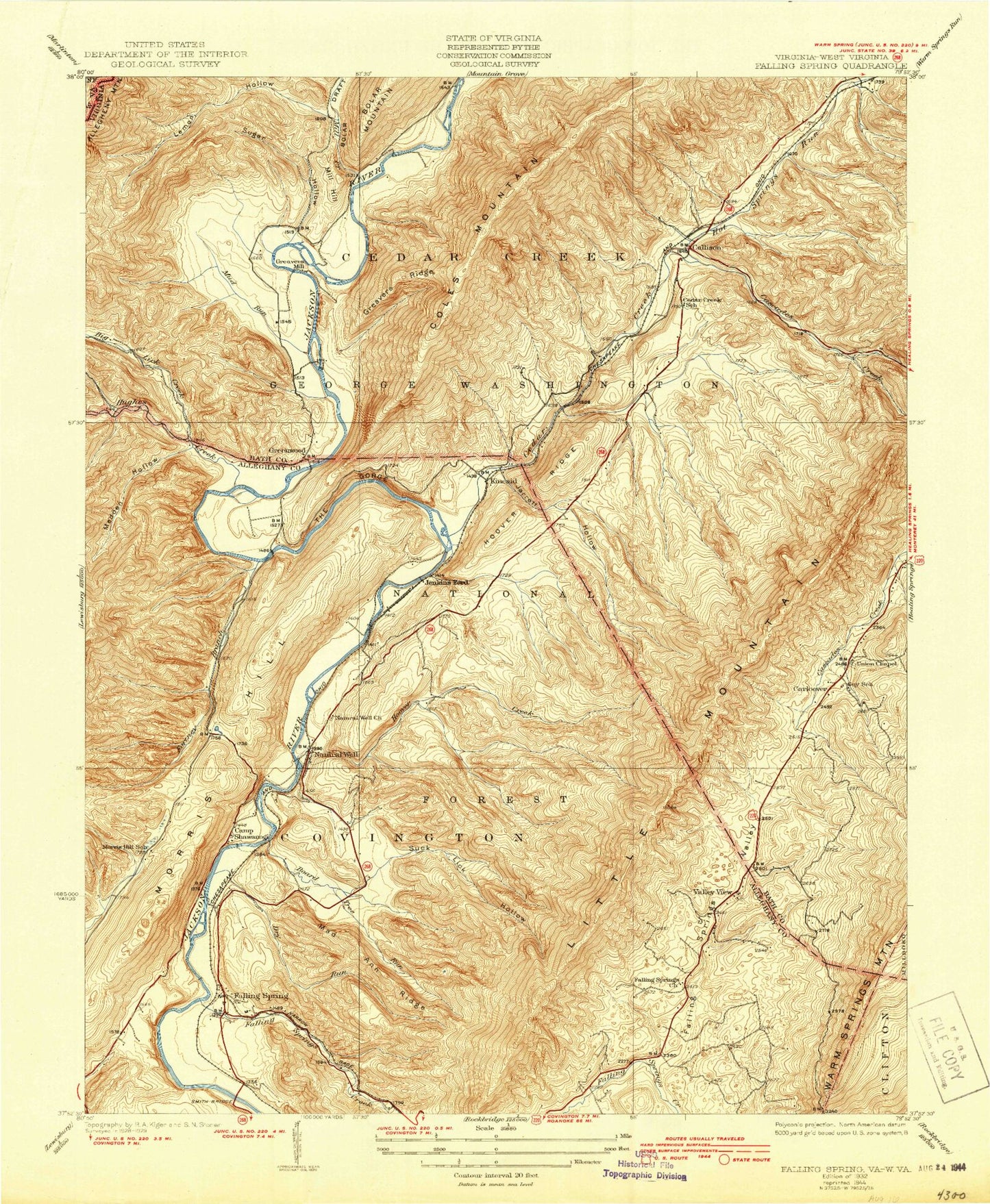
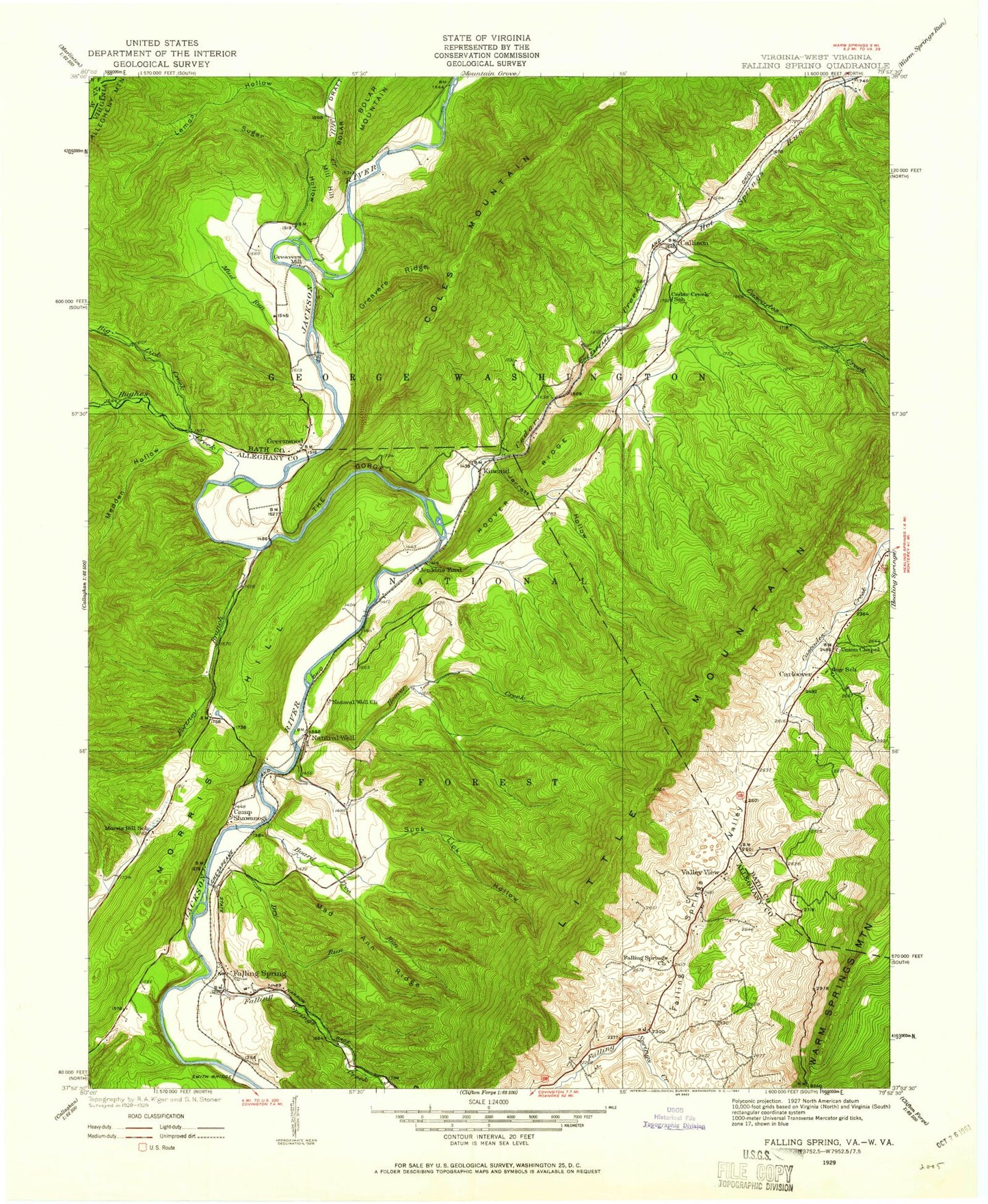
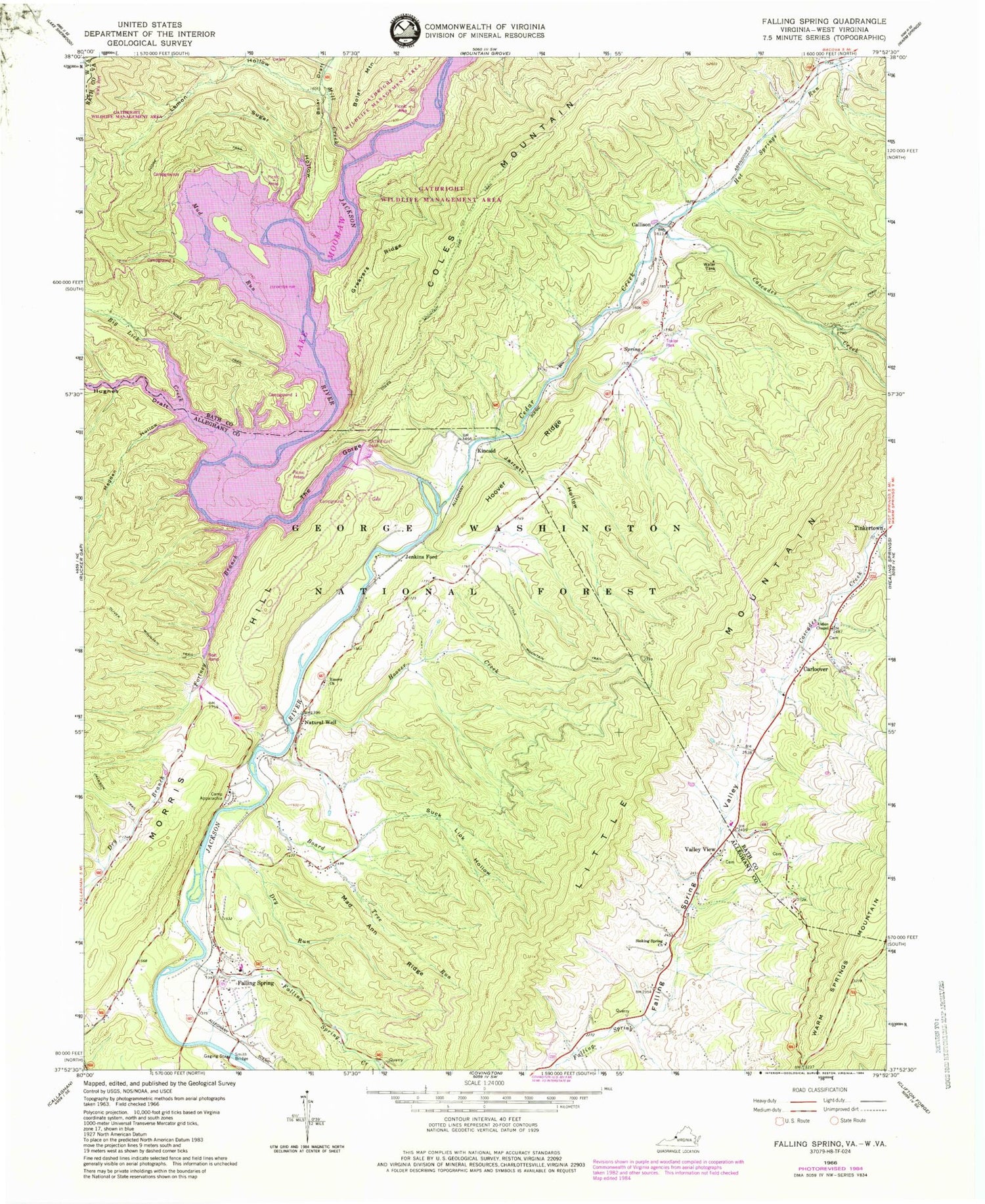
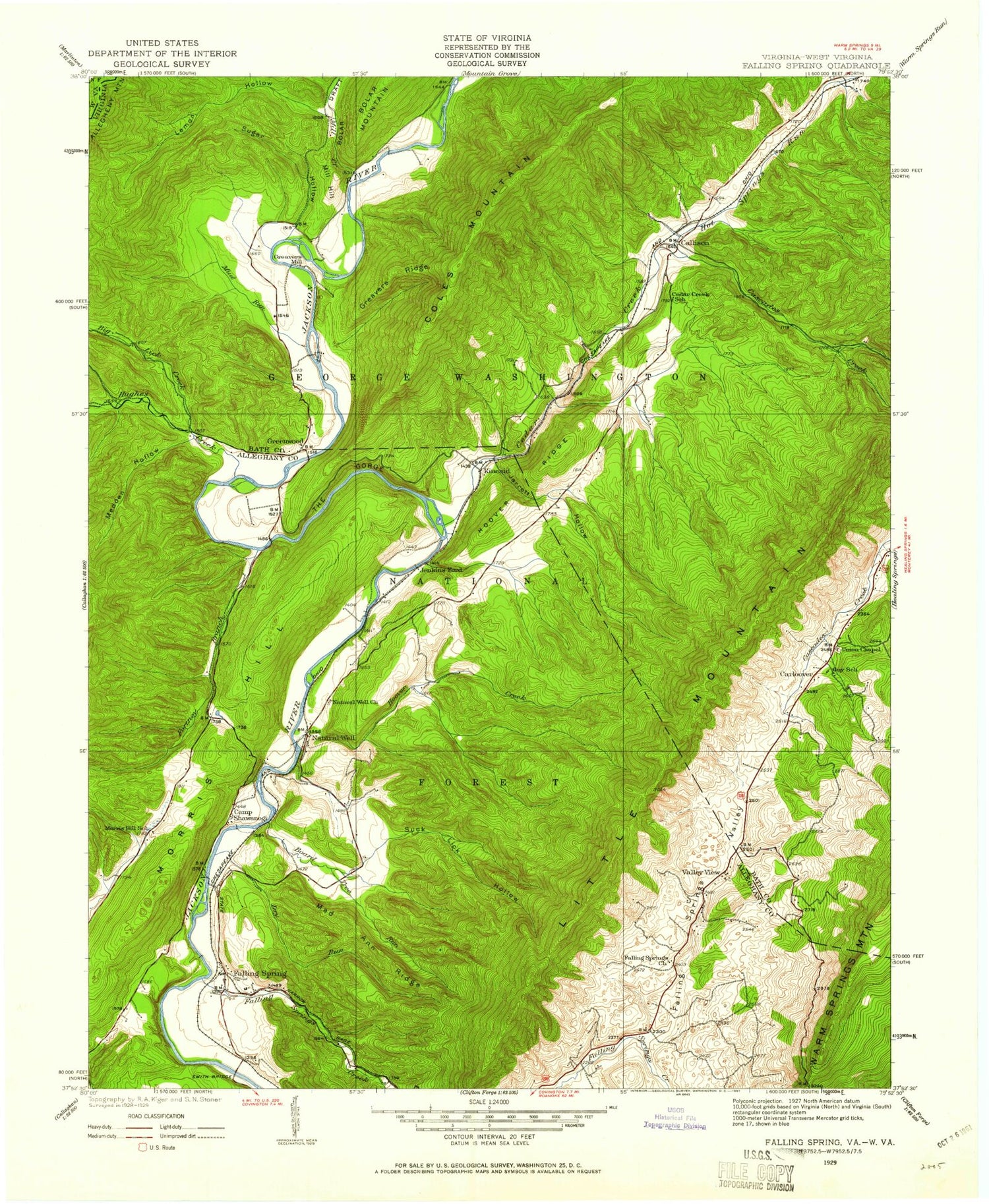
Classic USGS Falling Spring Virginia 7.5'x7.5' Topo Map
Couldn't load pickup availability
Historical USGS topographic quad map of Falling Spring in the state of Virginia. Typical map scale is 1:24,000, but may vary for certain years, if available. Print size: 24" x 27"
This quadrangle is in the following counties: Alleghany, Bath, Greenbrier.
The map contains contour lines, roads, rivers, towns, and lakes. Printed on high-quality waterproof paper with UV fade-resistant inks, and shipped rolled.
Contains the following named places: Big Lick Creek, Board Tree Run, Bolar Draft, Callison, Camp Appalachia, Cascades Creek, Cedar Creek, Coles Mountain, Coles Mountain Fire Trail, Dry Run, Emory Church, Falling Spring, Falling Spring Valley, Fortney Branch, Greavers Ridge, Hemlock Trail, Hoover Creek, Hoover Ridge, Hot Springs Run, Hughes Draft, Jarrett Hollow, Kelly Bridge, Lemon Hollow, Lodge Trail, Mad Ann Ridge, McAllister Bridge, Medden Hollow, Mill Creek, Mud Run, Natural Well, Sinking Spring Church, Smith Bridge, Suck Lick Hollow, Sugar Hollow, The Gorge, Union Chapel Presbyterian Church, Bolar Flat Picnic Area and Launch Ramp, Fortney Boat Launch Ramp, Morris Hill Campground, Morris Hill Picnic Area, Bolar Mountain Campground, Coles Mountain Picnic Area, Gathright Dam, Little Mountain Trail, Gathright Dam, Carloover, Jenkins Ford, Kincaid, Morris Hill, Valley View, Greenwood, Mill Hill, Perkins Point, Lake Moomaw, Falling Spring Creek, Greenwood (historical), Falling Spring Elementary School, Falling Spring Presbyterian Church, Hughes Creek, Big Lick Creek, Board Tree Run, Bolar Draft, Callison, Camp Appalachia, Cascades Creek, Cedar Creek, Coles Mountain, Coles Mountain Fire Trail, Dry Run, Emory Church, Falling Spring, Falling Spring Valley, Fortney Branch, Greavers Ridge, Hemlock Trail, Hoover Creek, Hoover Ridge, Hot Springs Run, Hughes Draft, Jarrett Hollow, Kelly Bridge, Lemon Hollow, Lodge Trail, Mad Ann Ridge, McAllister Bridge, Medden Hollow, Mill Creek, Mud Run, Natural Well, Sinking Spring Church, Smith Bridge, Suck Lick Hollow, Sugar Hollow, The Gorge, Union Chapel Presbyterian Church, Bolar Flat Picnic Area and Launch Ramp, Fortney Boat Launch Ramp, Morris Hill Campground, Morris Hill Picnic Area, Bolar Mountain Campground, Coles Mountain Picnic Area, Gathright Dam, Little Mountain Trail, Gathright Dam, Carloover, Jenkins Ford, Kincaid, Morris Hill, Valley View, Greenwood, Mill Hill, Perkins Point, Lake Moomaw, Falling Spring Creek, Greenwood (historical), Falling Spring Elementary School, Falling Spring Presbyterian Church, Hughes Creek