MyTopo
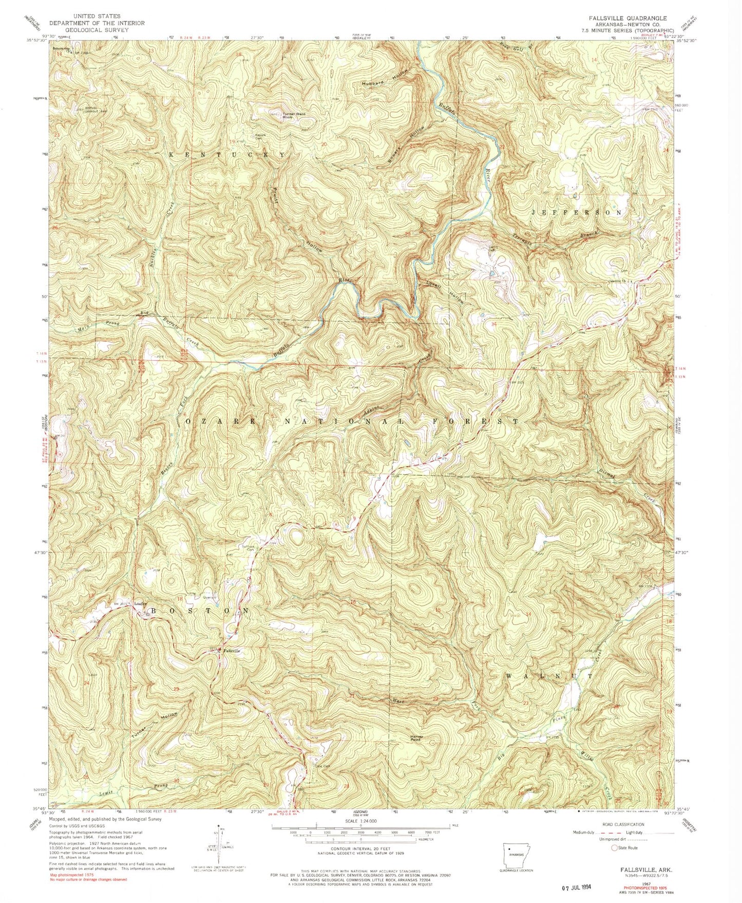
Classic USGS Fallsville Arkansas 7.5'x7.5' Topo Map
Couldn't load pickup availability
Historical USGS topographic quad map of Fallsville in the state of Arkansas. Typical map scale is 1:24,000, but may vary for certain years, if available. Print size: 24" x 27"
This quadrangle is in the following counties: Newton.
The map contains contour lines, roads, rivers, towns, and lakes. Printed on high-quality waterproof paper with UV fade-resistant inks, and shipped rolled.
Contains the following named places: Township of Boston, Cassville Cemetery, Adkins Creek, Boen Gulf Branch, Bowers Hollow, Case Cemetery, Cassville Church, Curtis Cemetery, Harvey Point, Hubbard Hollow, Kapark Cemetery, Loafer, Lovell Hollow, Main Prong Big Buffalo Creek, Nuckles Creek, Pruitt Hollow, Reeves Fork, Roberts Gap Church, Sullivan Cemetery, Terrapin Branch, Turner Hollow, Turner Ward Knob, Waterfall Hollow, West Fork Big Piney Creek, Willis Creek, Upper Buffalo Wilderness, Fallsville, Buffalo Lookout Tower, Buffalo Wild and Scenic River