MyTopo
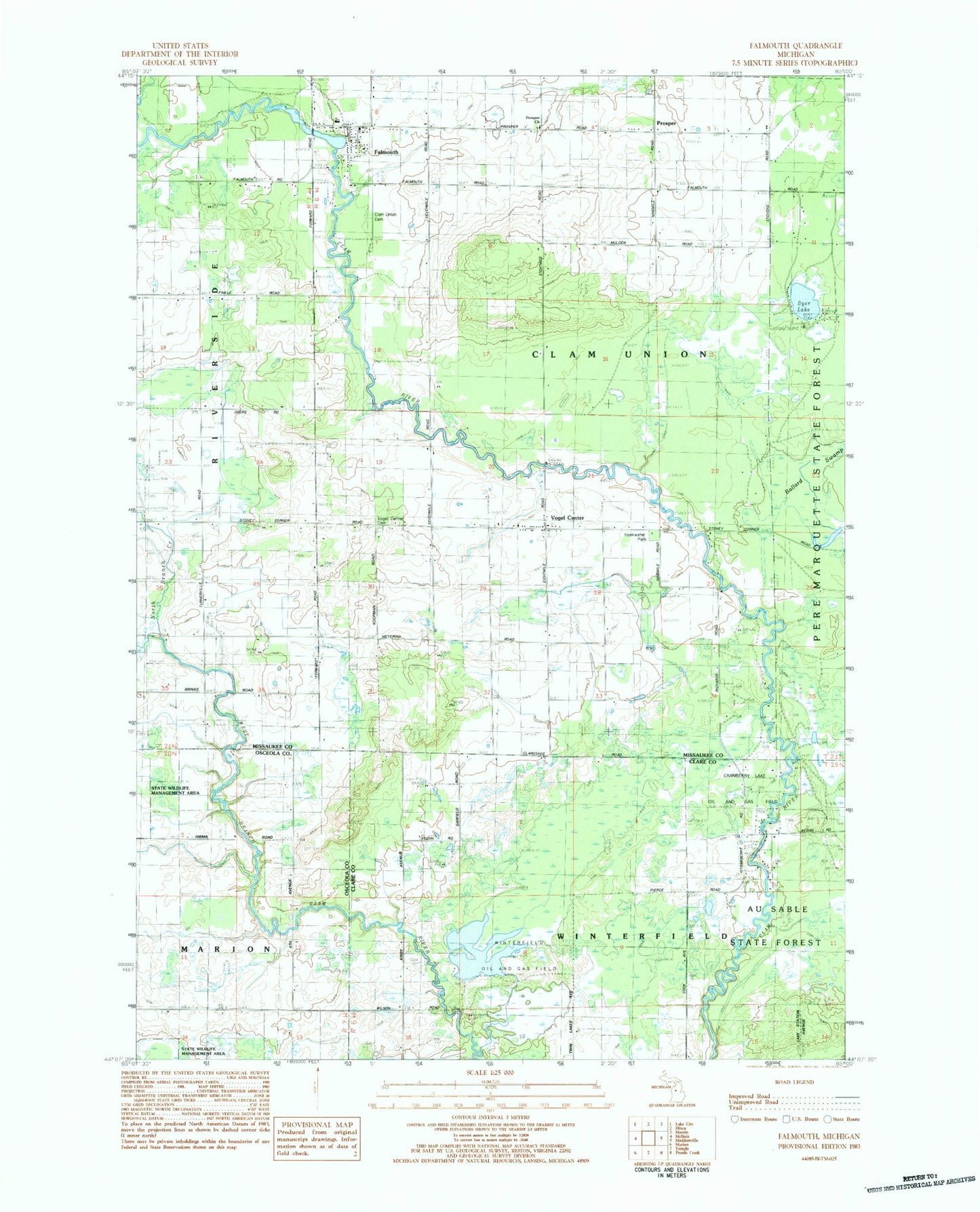
Classic USGS Falmouth Michigan 7.5'x7.5' Topo Map
Couldn't load pickup availability
Historical USGS topographic quad map of Falmouth in the state of Michigan. Map scale may vary for some years, but is generally around 1:24,000. Print size is approximately 24" x 27"
This quadrangle is in the following counties: Clare, Missaukee, Osceola.
The map contains contour lines, roads, rivers, towns, and lakes. Printed on high-quality waterproof paper with UV fade-resistant inks, and shipped rolled.
Contains the following named places: Austa Post Office, Ballard Swamp, Clam Union Cemetery, Clam Union Township Fire Department, Dyer Lake, Falmouth, Falmouth Area Library, Falmouth Census Designated Place, Falmouth Post Office, Falmouth Reformed Church, Falmouth Station, Forward Post Office, Hoekwater Park, Middle Branch Creek, Mosquito Creek, North Branch Creek, Prosper, Prosper Cemetery, Prosper Church, Prosper Post Office, Prosper School, Township of Clam Union, Vogel Center, Vogel Center Cemetery, Vogel Center Christian Church, Vogel Center Post Office