MyTopo
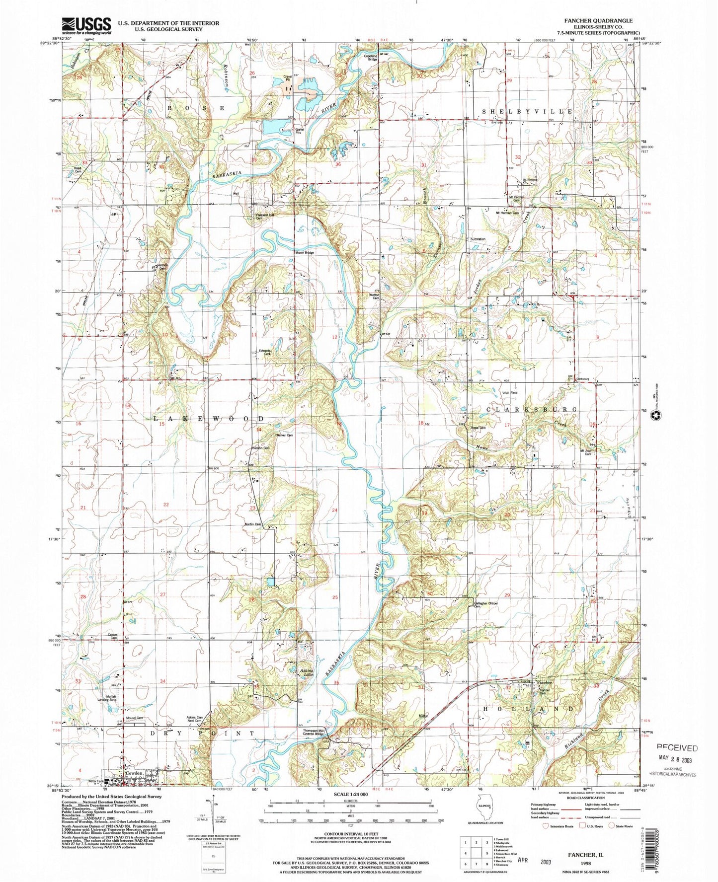
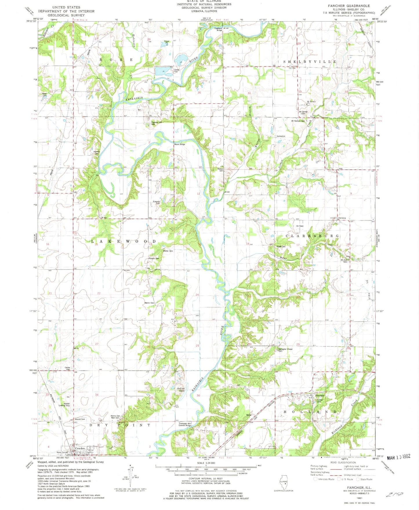
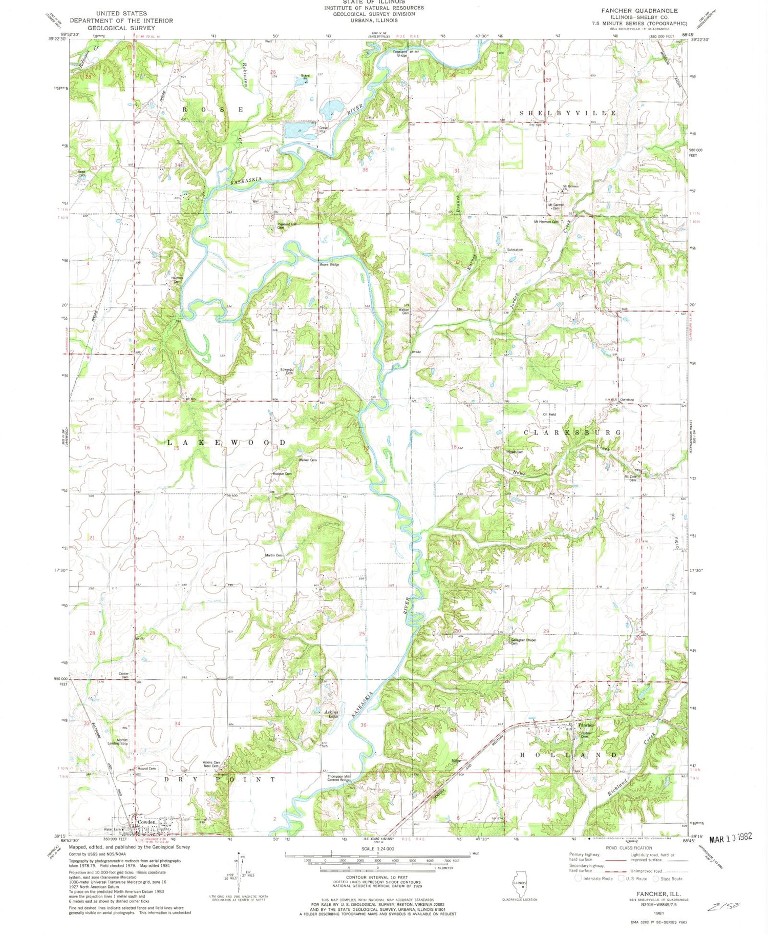
Classic USGS Fancher Illinois 7.5'x7.5' Topo Map
Couldn't load pickup availability
Historical USGS topographic quad map of Fancher in the state of Illinois. Map scale may vary for some years, but is generally around 1:24,000. Print size is approximately 24" x 27"
This quadrangle is in the following counties: Shelby.
The map contains contour lines, roads, rivers, towns, and lakes. Printed on high-quality waterproof paper with UV fade-resistant inks, and shipped rolled.
Contains the following named places: Askins Cemetery, Askins Lake, Black Log School, Boiling Springs School, Center Cemetery, Center School, Clarksburg, Copeland Bridge, Cowden Fire Protection District, Cowden Post Office, Edwards Cemetery, Fancher, Fortner Cemetery, Gallagher Chapel Cemetery, Grove School, Hackberry School, Harmon Cemetery, Harmon School, Hodson Cemetery, Howe Cemetery, Howe Creek, Jordan Creek, Karnes Branch, Martin Cemetery, Milne, Moffet Landing Strip, Moore Bridge, Mound Cemetery, Mount Carmel Cemetery, Mount Carmel Church, Mount Hermon Cemetery, Mount Hermon Church, Mount Tabor School, Mount Zion Cemetery, Neal Cemetery, Opossum Creek, Pleasant Hill Cemetery, Pleasant Hill Church, Reed Cemetery, Robinson Creek, Section School, Sylvan School, Thompson Mill Covered Bridge, Township of Clarksburg, Township of Lakewood, Walker Cemetery, Watton Cemetery, West Salem School, Zion Church, ZIP Code: 62438