MyTopo
Classic USGS Fannie Arkansas 7.5'x7.5' Topo Map
Couldn't load pickup availability
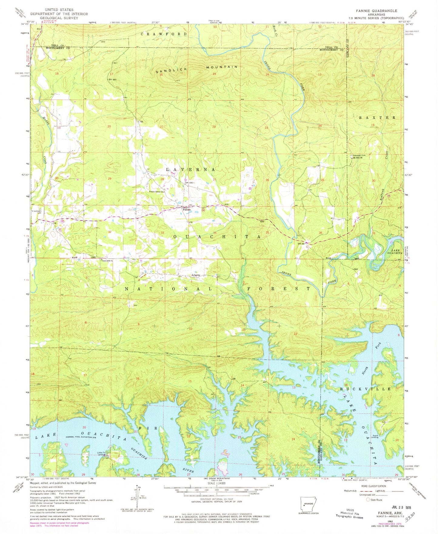
Historical USGS topographic quad map of Fannie in the state of Arkansas. Map scale may vary for some years, but is generally around 1:24,000. Print size is approximately 24" x 27"
This quadrangle is in the following counties: Garland, Montgomery, Yell.
The map contains contour lines, roads, rivers, towns, and lakes. Printed on high-quality waterproof paper with UV fade-resistant inks, and shipped rolled.
Contains the following named places: Avant Landing, Breashears Cemetery, Fannie, Haleys School, Lee Cemetery, Liberty, Little Fir Landing, Little Fir Public Use Area, Little Fir Recreation Site, Mount Zion Church, Oakwood, Oakwood Cemetery, Oakwood School, Pleasant Hill School, Prairie Grove Church of God, Redbank Creek, Rock Creek, Sandlick Mountain, Smith Creek, Township of Fannie, Township of Leverney, Union Hill Church, Union Hill School, ZIP Code: 71970