MyTopo
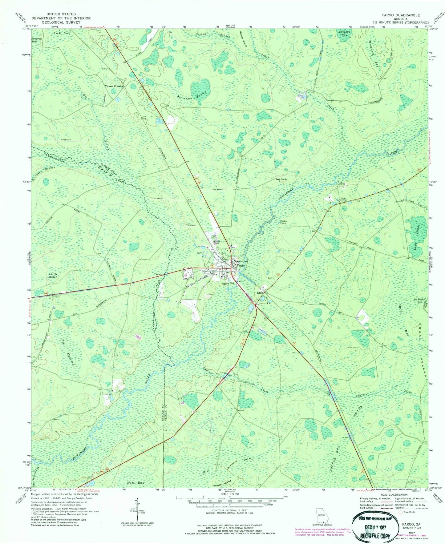
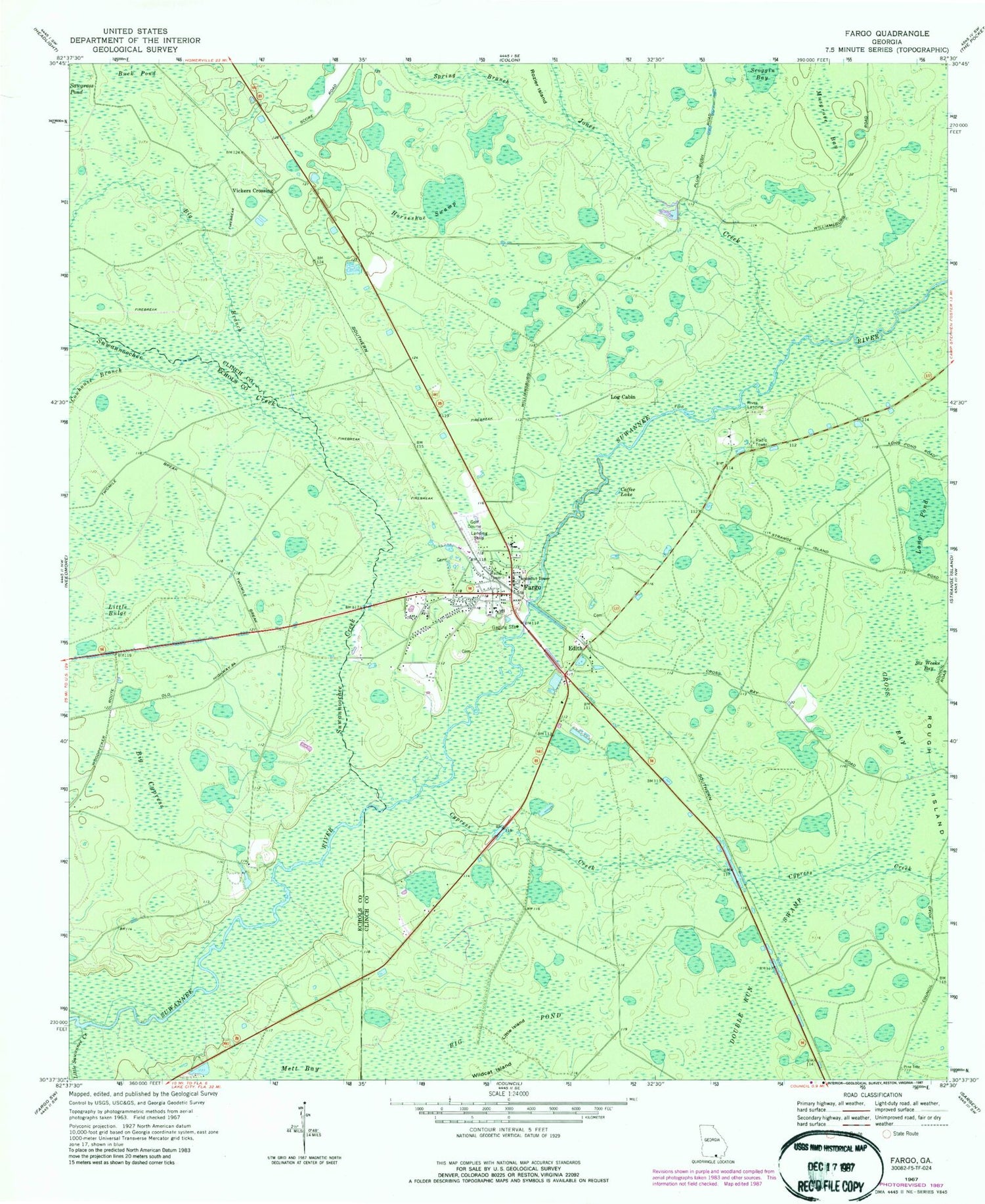
Classic USGS Fargo Georgia 7.5'x7.5' Topo Map
Couldn't load pickup availability
Historical USGS topographic quad map of Fargo in the state of Georgia. Map scale may vary for some years, but is generally around 1:24,000. Print size is approximately 24" x 27"
This quadrangle is in the following counties: Clinch, Echols.
The map contains contour lines, roads, rivers, towns, and lakes. Printed on high-quality waterproof paper with UV fade-resistant inks, and shipped rolled.
Contains the following named places: Big Branch, Big Cypress, Big Pond, Buck Pond, City of Fargo, Clinch County Elementary School Fargo Campus, Clinch County Fire Department Station 3 - Fargo Volunteer Fire Station, Coffee Lake, Cowhouse Branch, Cross Bay, Cypress Creek, Double Run Swamp, Edith, Edith Church, Fargo, Fargo Airport, Fargo Church, Fargo Post Office, Fargo Recreation Golf Course, Horseshoe Swamp, Jones Creek, Little Bulge, Little Island, Little Suwannee Creek, Log Cabin, Long Pond, Mett Bay, Musgrove Bay, Rives Landing, Rozier Island, Scoggin Bay, Spring Branch, Stephen Foster Memorial Monument, Suwannoochee Creek, Sweetwater Creek, Vickers Crossing, Wildcat Island