
MyTopo
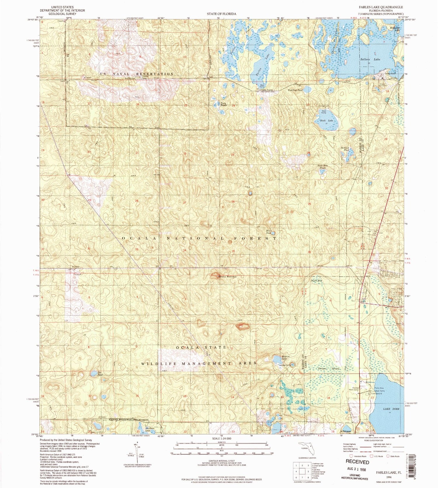
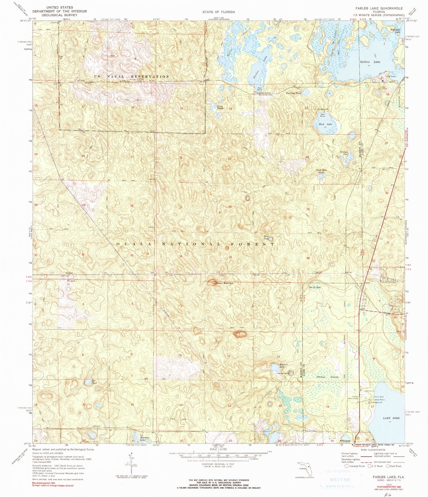
Classic USGS Farles Lake Florida 7.5'x7.5' Topo Map
Couldn't load pickup availability
Historical USGS topographic quad map of Farles Lake in the state of Florida. Typical map scale is 1:24,000, but may vary for certain years, if available. Print size: 24" x 27"
This quadrangle is in the following counties: Lake, Marion.
The map contains contour lines, roads, rivers, towns, and lakes. Printed on high-quality waterproof paper with UV fade-resistant inks, and shipped rolled.
Contains the following named places: Baptist Lake, Beakman Lake, Blue Sink, Buck Lake, Camp Ocala, Chain O Lakes, Devils Bay, Doe Pond, Farles Lake, Farles Prairie, Farles Prairie Recreation Area, Greens Waterhole, Pittman Swamp, Pittman Work Center, Sellers Lake, Sink Hole Ponds, Summit Pond, Twin Ponds, Yearling Pond, Lake Dorr Recreation Area, Buck Lake Recreation Area, Baptist Lake Trasil, Lake Dorr Mobile Home Park, Pinecastle Impact Range, Lake County Fire Rescue Station 11


