MyTopo
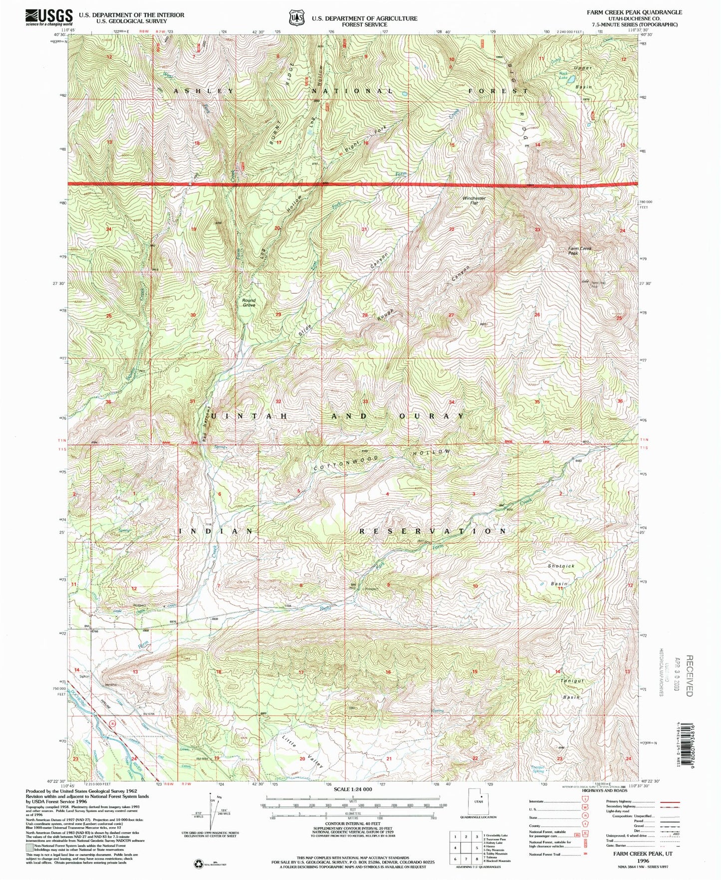
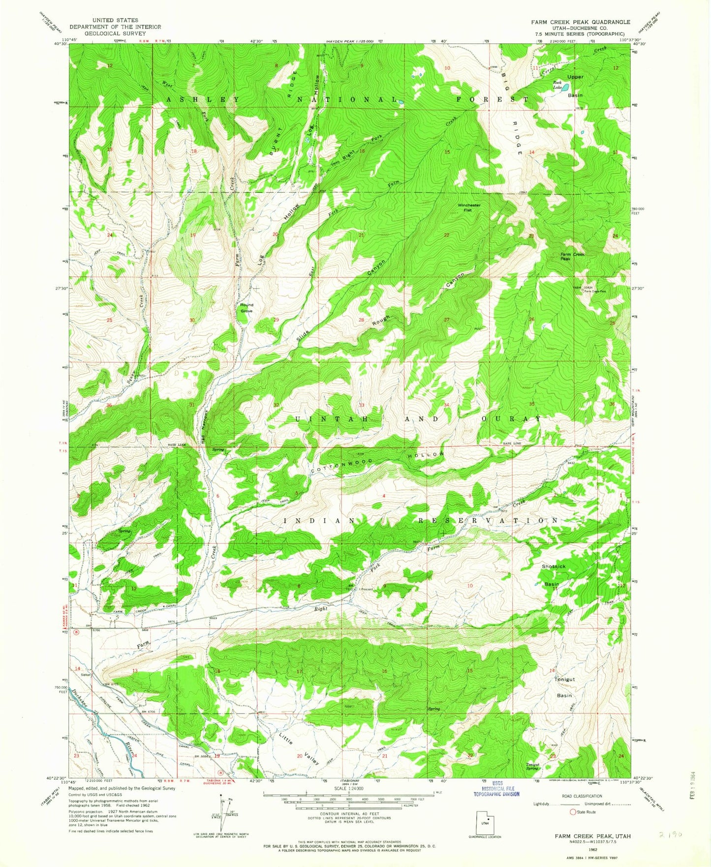
Classic USGS Farm Creek Peak Utah 7.5'x7.5' Topo Map
Couldn't load pickup availability
Historical USGS topographic quad map of Farm Creek Peak in the state of Utah. Map scale may vary for some years, but is generally around 1:24,000. Print size is approximately 24" x 27"
This quadrangle is in the following counties: Duchesne.
The map contains contour lines, roads, rivers, towns, and lakes. Printed on high-quality waterproof paper with UV fade-resistant inks, and shipped rolled.
Contains the following named places: Cottonwood Hollow, East Fork Farm Creek, Farm Creek, Farm Creek Canal, Farm Creek Peak, Little Farm Creek Canal, Log Hollow, Red Narrows, Right Fork Farm Creek, Right Fork Log Hollow, Rock Lake, Rough Canyon, Round Grove, Shotnick Basin, Slide Canyon, Tonigut Basin, Tonigut Spring, Upper Basin, West Fork Farm Creek, Winchester Flat