
MyTopo
Classic USGS Farmer City South Illinois 7.5'x7.5' Topo Map
Couldn't load pickup availability
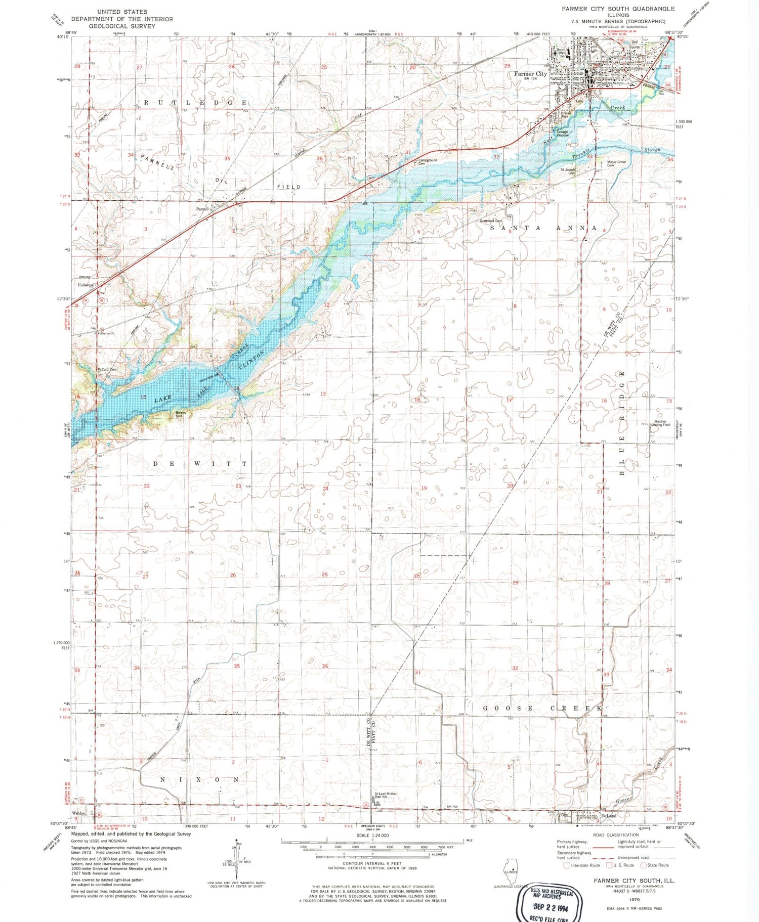
Historical USGS topographic quad map of Farmer City South in the state of Illinois. Map scale may vary for some years, but is generally around 1:24,000. Print size is approximately 24" x 27"
This quadrangle is in the following counties: De Witt, Piatt.
The map contains contour lines, roads, rivers, towns, and lakes. Printed on high-quality waterproof paper with UV fade-resistant inks, and shipped rolled.
Contains the following named places: Barnes Cemetery, Black School, Blue Ridge High School, Bosserman School, Campground Cemetery, Champion School, City Cemetery, City of Farmer City, De Land Cemetery, Deland-Weldon High School, DeWitt County EMS Station 2, Excelsior School, Farmer City, Farmer City Fire Department, Farmer City Police Department, Farmer City Post Office, Farmer City Public Pool, First Baptist Church, First Christian Church, Fullerton, Fullerton Church, Greenleaf Cemetery, Greenleaf School, Maple Grove Cemetery, McCord Cemetery, Mount Vernon School, Parnell, Parnell Oil Field, Parnell School, Ruth M Schneider Elementary School, Sacred Heart Church, Saint Joseph Cemetery, South Prairie School, Swigart School, Township of De Witt, Township of Santa Anna, Trenkle Slough, Turner School, Watson School, Weedman Park, Weedman School, Western School, Wisegarver School, ZIP Codes: 61839, 61842


