
MyTopo
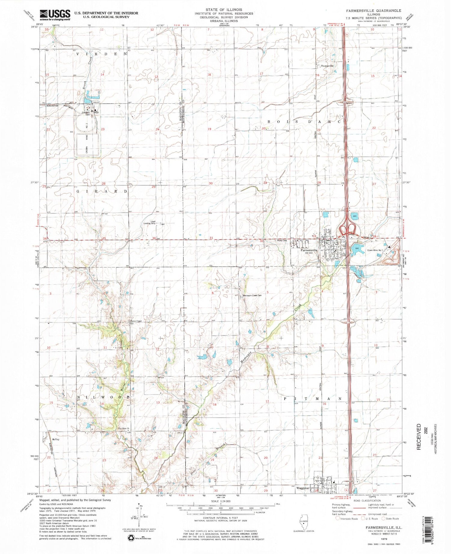
Classic USGS Farmersville Illinois 7.5'x7.5' Topo Map
Couldn't load pickup availability
Historical USGS topographic quad map of Farmersville in the state of Illinois. Map scale may vary for some years, but is generally around 1:24,000. Print size is approximately 24" x 27"
This quadrangle is in the following counties: Macoupin, Montgomery.
The map contains contour lines, roads, rivers, towns, and lakes. Printed on high-quality waterproof paper with UV fade-resistant inks, and shipped rolled.
Contains the following named places: Ball School, Bartlett School, Boston Chapel Christian Church, Boston Chapel School, Crown Mine Number 1, Crown Mine Number 2, Crown Mine Pond, Crown Mine Pond Dam, East Union School, Farmersville, Farmersville - Waggoner Ambulance Service, Farmersville - Waggoner Fire Department, Farmersville Elementary School, Farmersville Post Office, Horse Creek, Lake School, Lloyd Airport, Macoupin Creek Cemetery, McVey, New Hope Church, New Hope School, Prairiedale School, Rovey Cemetery, Saint Marys Catholic Church, South Bois d'Arc School, Star School, Studebaker School, Thomasville, Township of Pitman, Village of Farmersville, Village of Waggoner, Waggoner, White School, Zion Lutheran Church


