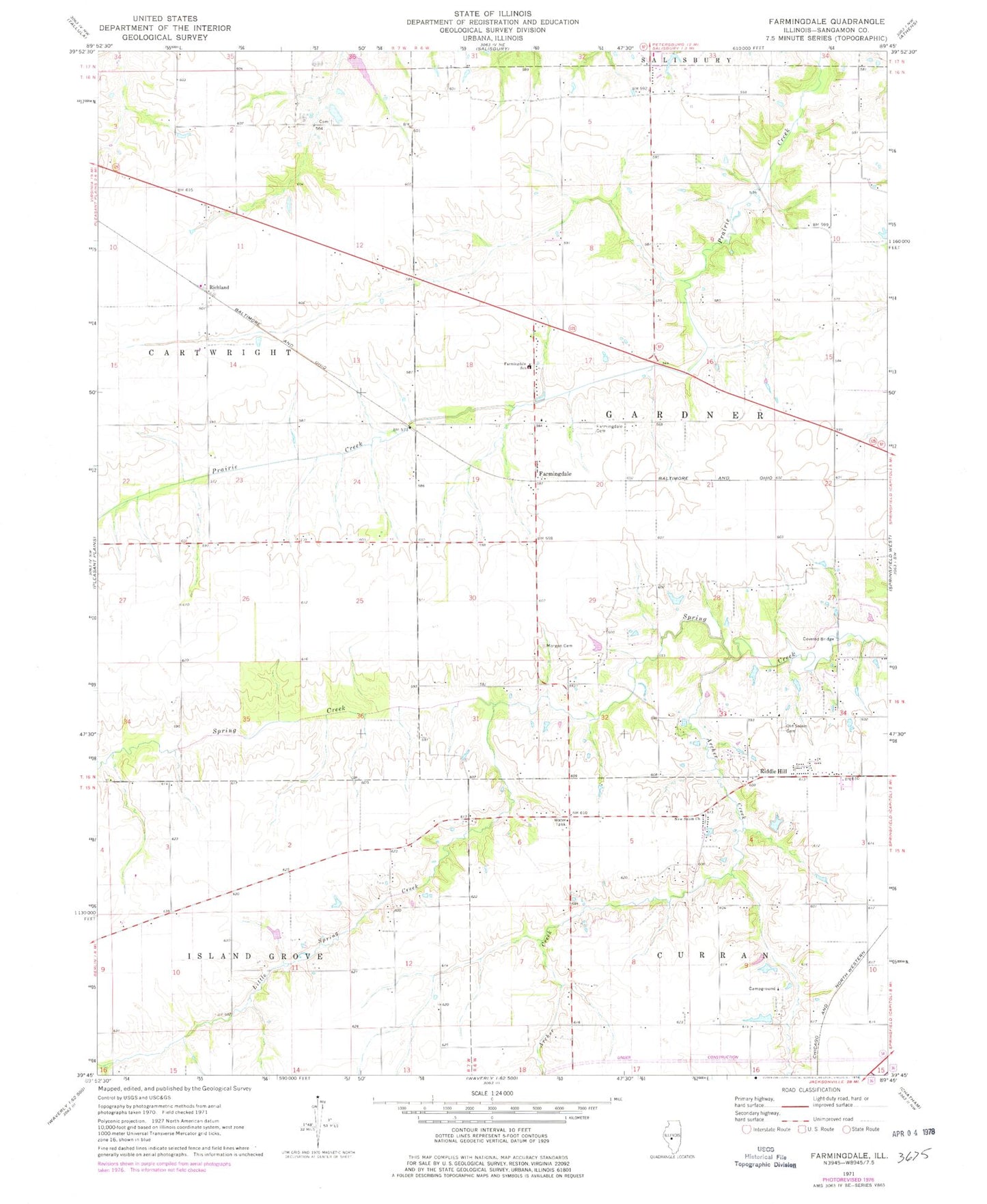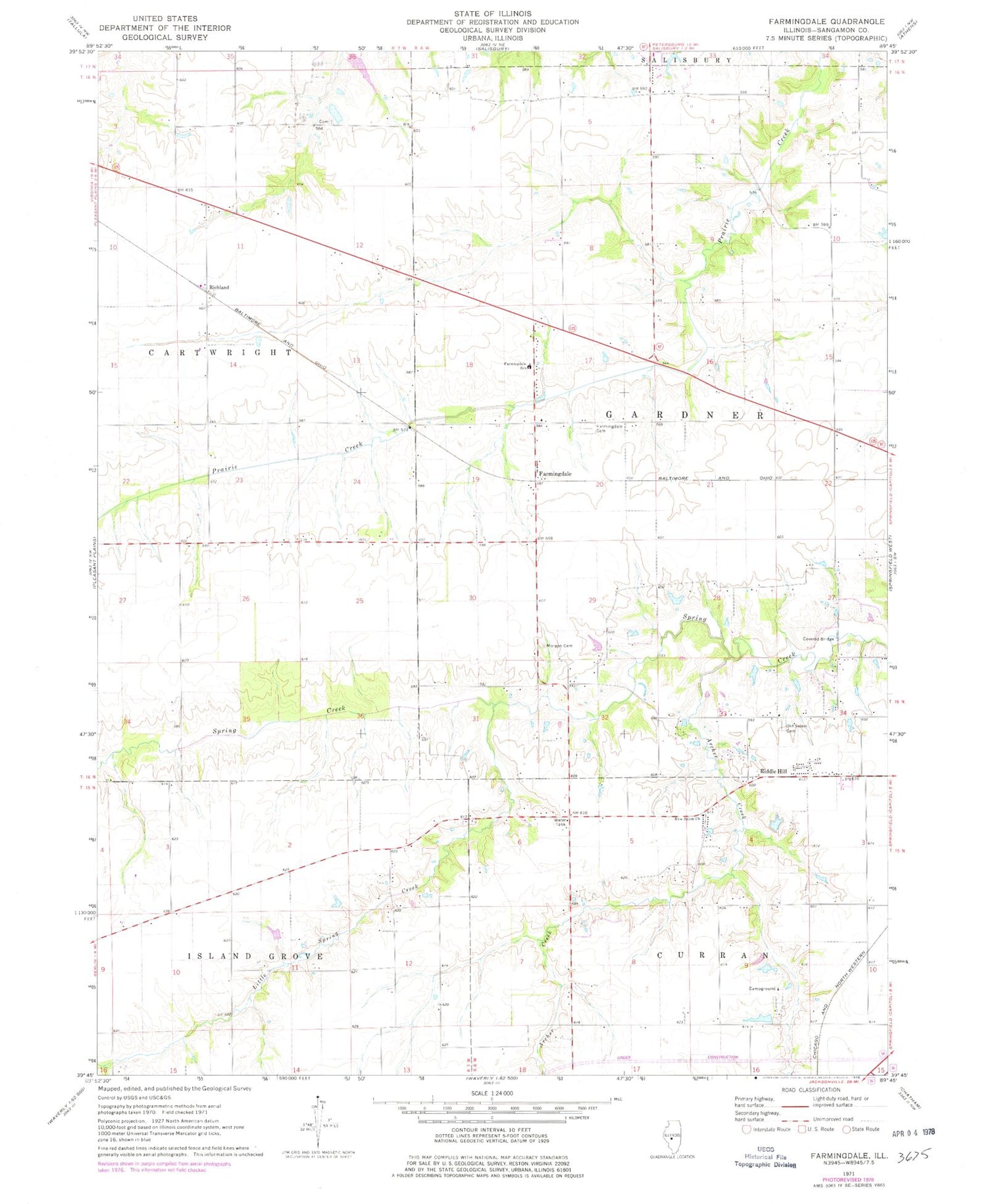
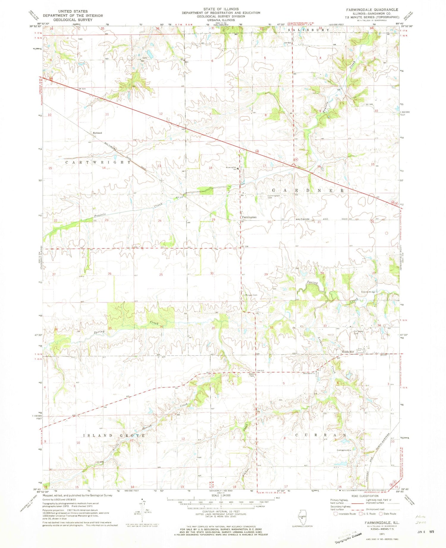
MyTopo
Classic USGS Farmingdale Illinois 7.5'x7.5' Topo Map
Couldn't load pickup availability
Historical USGS topographic quad map of Farmingdale in the state of Illinois. Map scale may vary for some years, but is generally around 1:24,000. Print size is approximately 24" x 27"
This quadrangle is in the following counties: Sangamon.
The map contains contour lines, roads, rivers, towns, and lakes. Printed on high-quality waterproof paper with UV fade-resistant inks, and shipped rolled.
Contains the following named places: Anderson Cemetery, Archer Creek, Cross Plains Post Office, Farmingdale, Farmingdale Cemetery, Farmingdale Elementary School, Illinois Department of Transportation Number 6 Heliport, Morgan Cemetery, New Salem Church, Old Salem Cemetery, Pasfield, Richland, Riddle Hill, Township of Gardner