
MyTopo
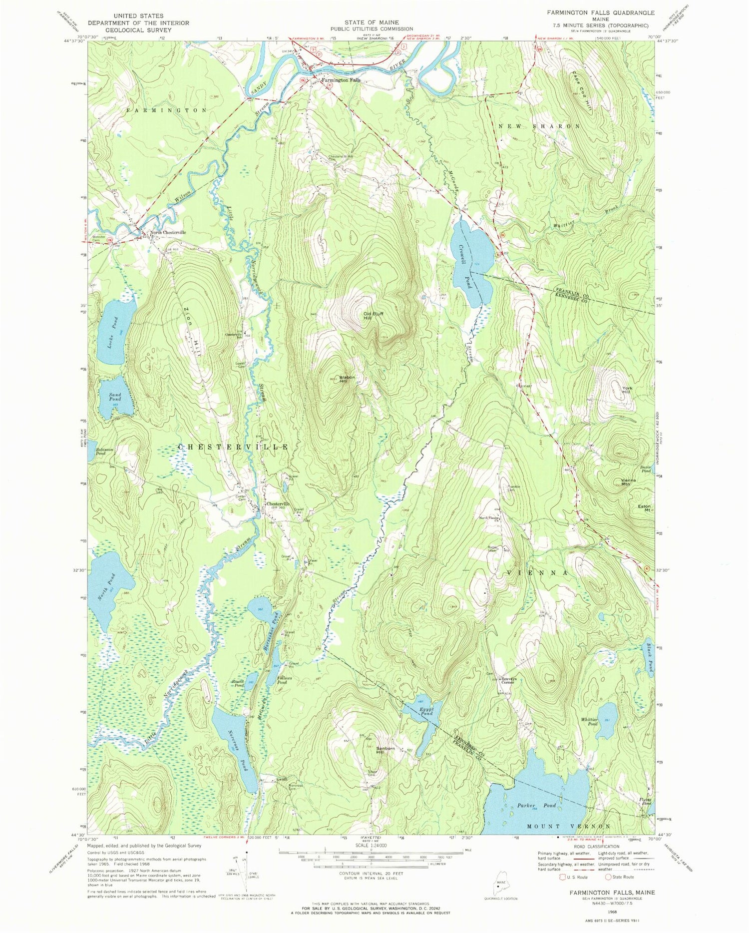
Classic USGS Farmington Falls Maine 7.5'x7.5' Topo Map
Couldn't load pickup availability
Historical USGS topographic quad map of Farmington Falls in the state of Maine. Typical map scale is 1:24,000, but may vary for certain years, if available. Print size: 24" x 27"
This quadrangle is in the following counties: Franklin, Kennebec.
The map contains contour lines, roads, rivers, towns, and lakes. Printed on high-quality waterproof paper with UV fade-resistant inks, and shipped rolled.
Contains the following named places: Blabon Hill, Black Pond, Cape Cod Hill, Center Cemetery, Chesterville, Chesterville Hill Cemetery, Chesterville School, Crowell Pond, Eaton Mountain, Egypt Pond, Farmington Falls, Fellows Pond, Franklin Cemetery, Horseshoe Pond, Little Norridgewock Stream, Locke Pond, Lowell Cemetery, McGurdy Stream, Norcross Cemetery, Norcross Pond, North Chesterville, North Pond, North Vienna Church, Old Bluff Hill, Robinson Pond, Round Pond, Sanborn Hill, Sand Pond, Soper Cemetery, Sugar Brook, Vienna Mountain, Webster Cemetery, Whittier Brook, Whittier Pond, Wilson Stream, York Hill, Zion Hill, North Chesterfield Cemetery, Seaveys Corner, Town of Chesterville, Town of Vienna, Mercer Dam, Little Norridgewock Stream Reservoir, Cape Cod Hill School, Chesterville Wildlife Management Area, Farmington Falls Post Office, Farmington Falls Union Baptist Church, Farmington Falls Fire Department, Chesterville Volunteer Fire Station, Chapman Cemetery, Seaveys Corner Cemetery


