MyTopo
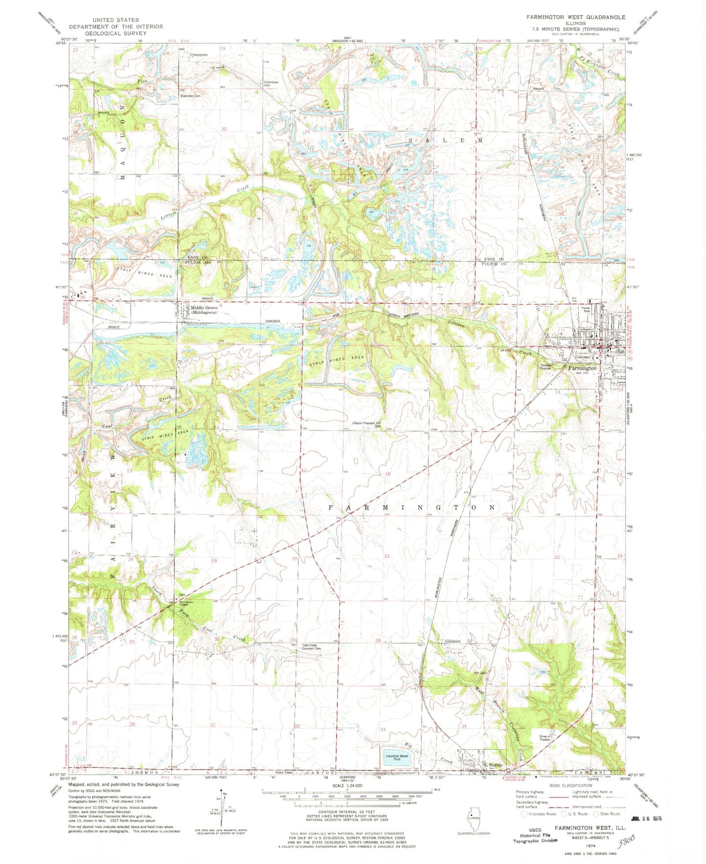
Classic USGS Farmington West Illinois 7.5'x7.5' Topo Map
Couldn't load pickup availability
Historical USGS topographic quad map of Farmington West in the state of Illinois. Map scale may vary for some years, but is generally around 1:24,000. Print size is approximately 24" x 27"
This quadrangle is in the following counties: Fulton, Knox.
The map contains contour lines, roads, rivers, towns, and lakes. Printed on high-quality waterproof paper with UV fade-resistant inks, and shipped rolled.
Contains the following named places: Alden Mine Number 5, Alden Mine Number 6, Bear School, Blakeslee Cemetery, Chapin Pleasant Hill Cemetery, Chapman Middle School, City of Farmington, Clair School, Coal Creek Cemetery, Copperas Creek Fire Protection District Norris Unit, Cottonwood School, Cox School, Farmington, Farmington City Hall, Farmington Community Fire Protection District, Farmington Police Department, Farmington Post Office, Farmington Public Library, First Baptist Church, First Methodist Episcopal Church, First Presbyterian Church, Forty Acres, Gilchrist, Hanson Cemetery, Harris Elementary School, Hill Cemetery, Liberty School, Maplewood Mine Number 1, Maplewood Mine Number 2, Middlegrove, Middlegrove Post Office, Midland Employee Lake, Midland Employee Lake Dam, National Mine, New Gilchrist School, Norris, Norris Grade School, Norris Post Office, Oak Ridge Cemetery, Oakland School, Pease Hill School, Providence Chapel, Providence Chapel Cemetery, Retreat School, Saint Matthews Catholic Church, Shad Hill School, Smith School, Township of Farmington, Uniontown, Uniontown Cemetery, United Methodist Church, Village of Norris, Washington School, ZIP Codes: 61531, 61553