MyTopo
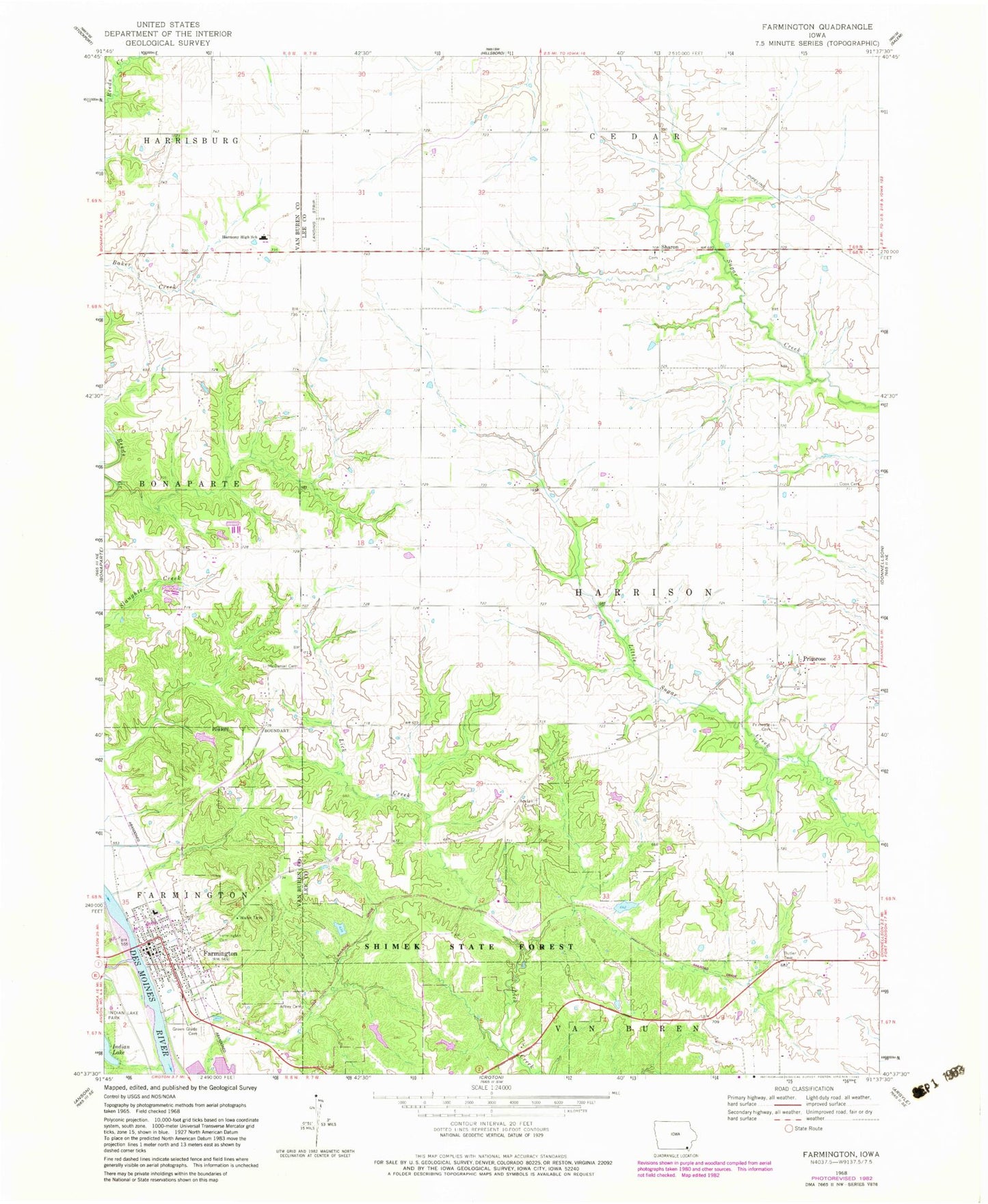
Classic USGS Farmington Iowa 7.5'x7.5' Topo Map
Couldn't load pickup availability
Historical USGS topographic quad map of Farmington in the state of Iowa. Map scale may vary for some years, but is generally around 1:24,000. Print size is approximately 24" x 27"
This quadrangle is in the following counties: Lee, Van Buren.
The map contains contour lines, roads, rivers, towns, and lakes. Printed on high-quality waterproof paper with UV fade-resistant inks, and shipped rolled.
Contains the following named places: Acklam Cemetery, Alfrey Cemetery, Assembly of God Church, Big Indian Creek, Butler Cemetery, Christy Clinic, Church of the Nazarene, City of Farmington, Cook Cemetery, Farmington, Farmington Cemetery, Farmington City Hall, Farmington Clinic, Farmington Fire Department and Emergency Medical Services, Farmington Post Office, Farmington Public Library, First Baptist Church, Frost Grove Cemetery, George Perkins Historical Marker, Green Glade Cemetery, H Banla Grounds Cemetery, Harmony Elementary School, Harmony Middle School, Indian Lake Park Trail, Kennedy Farm Cemetery, Keteban Switch, McDaniel Cemetery, Pioneer Historical Museum, Plymouth, Primrose, Primrose Cemetery, Primrose Post Office, Reid Farm Cemetery, Riverview Campground, Sax Cemetery, Sharon, Sharon Cemetery, Sharon United Presbyterian Church, Shimek Forest Dam Three, Shimek Forest Pond Two, Shimek Forest Trail, Shimek State Forest Wildlife Management Area - Donnellson Unit, Shimek State Forest Wildlife Management Area - Farmington Unit, Snyder Cemetery, Township of Harrison, United Methodist Church