MyTopo
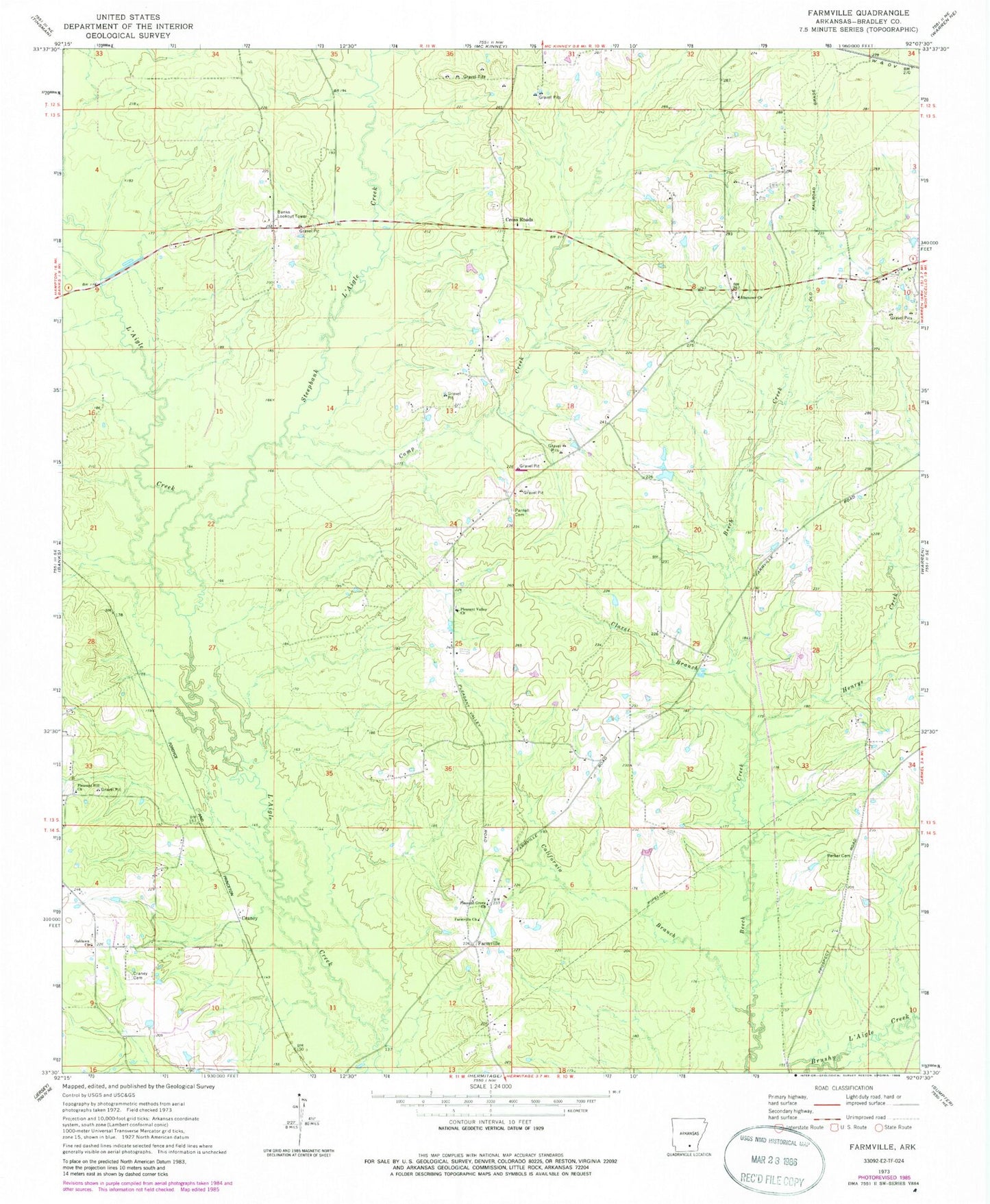
Classic USGS Farmville Arkansas 7.5'x7.5' Topo Map
Couldn't load pickup availability
Historical USGS topographic quad map of Farmville in the state of Arkansas. Map scale may vary for some years, but is generally around 1:24,000. Print size is approximately 24" x 27"
This quadrangle is in the following counties: Bradley.
The map contains contour lines, roads, rivers, towns, and lakes. Printed on high-quality waterproof paper with UV fade-resistant inks, and shipped rolled.
Contains the following named places: Banks Lookout Tower, California Branch, Camp Creek, Claret Branch, Craney, Craney Cemetery, Cross Roads, Cross Roads Baptist Church, Crossroads Cemetery, Crossroads School, Ebenezer Baptist Church, Ebenezer Cemetery, Ebenezer School, Farmville, Farmville Missionary Baptist Church, Farmville School, Gin, Henrys Creek, Mill Creek, Oaklawn Church, Parker Cemetery, Parnell Cemetery, Pleasant Grove Baptist Church, Pleasant Hill Church, Pleasant Valley Cemetery, Pleasant Valley Church, Pleasant Valley School, Pleasantville Rural Volunteer Fire Department, Prospect School, South Oak Grove School, Steepbank L'Aigle Creek