MyTopo
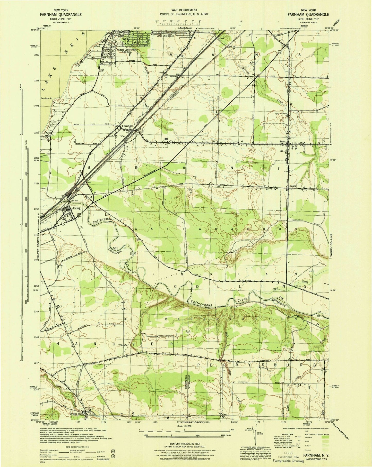
Classic USGS Farnham New York 7.5'x7.5' Topo Map
Couldn't load pickup availability
Historical USGS topographic quad map of Farnham in the state of New York. Map scale may vary for some years, but is generally around 1:24,000. Print size is approximately 24" x 27"
This quadrangle is in the following counties: Cattaraugus, Chautauqua, Erie.
The map contains contour lines, roads, rivers, towns, and lakes. Printed on high-quality waterproof paper with UV fade-resistant inks, and shipped rolled.
Contains the following named places: Angola Lake Shore Addition, Big Indian Creek, Brant, Brant Cemetery, Brant Elementary School, Brant Post Office, Brant Volunteer Fire Company 1, Camp Forty Acres, Cattaraugus Creek Bridge, Cattaraugus Reservation, Clear Creek, Clear Creek Bridge, District Number 2 School, Evangola State Park, Farnham, Farnham Point, Farnham Post Office, Farnham Volunteer Fire Department, Gage Chapel, Good Shepard Church, Good Shepherd Church, Holy Cross Lutheran Cemetery, Irving, Irving Fire Department, Irving Post Office, Kingdom Hall of Jehovah's Witnesses, Lake Erie Beach, Lake Erie Beach Census Designated Place, Lotus Bay, Mount Zion Church, Our Lady of Mount Carmel Church, Pleasant Valley Baptist Church, Rathburn Cemetery, Rose Brook Golf Course, Saint Anthony's Roman Catholic Church, Silver Creek Toll Plaza, Smiths Mill Cemetery, Steiger Farms, Town of Brant, United Mission, Vacco Farms, Versailles Cemetery, Village of Farnham, West Creek Mobile Home Park, ZIP Codes: 14061, 14081