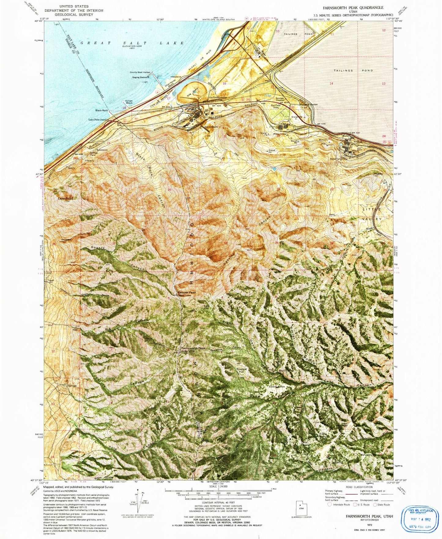
MyTopo
Classic USGS Farnsworth Peak Utah 7.5'x7.5' Topo Map
Couldn't load pickup availability
Historical USGS topographic quad map of Farnsworth Peak in the state of Utah. Map scale may vary for some years, but is generally around 1:24,000. Print size is approximately 24" x 27"
This quadrangle is in the following counties: Salt Lake, Tooele.
The map contains contour lines, roads, rivers, towns, and lakes. Printed on high-quality waterproof paper with UV fade-resistant inks, and shipped rolled.
Contains the following named places: Arthur, Big Canyon, Black Rock, Black Rock Beach, Black Rock Canyon, BP Minerals-Garfield Heliport, Coyote Canyon, Farnsworth Peak, Fern Flat, Garfield, Garfield Junction, Georgiana Canyon, Green Ravine, KDAB-FM (Ogden), Kennecott Tailings Pond Number One Dam, Kennecott Tailings Pond Number Two, Kennecott Tailings Pond Number Two Dam, Kesler Canyon, Kesler Peak, KISN-FM (Salt Lake City), Knee Weakener, KQPD-FM (Ogden), KRCL-FM (Salt Lake City), KRSP-FM (Salt Lake City), KSFI-FM (Salt Lake City), KSLT-TV (Salt Lake City), KSOP-FM (Salt Lake City), KSTU-TV (Salt Lake City), KWHO-FM (Salt Lake City), KZAN-FM (Ogden), Lake Point, Lake Point Junction, Left Hand Fork Coon Canyon, Lewis Canyon, Little Farnsworth Peak Heliport, Little Valley, Ludson Hollow, Mahogany Hill, Maple Spring, Maple Spring Hollow, Mud Spring, Pole Canyon, Porter Hollow, Right Hand Fork Coon Canyon, Rogers Canyon, Rosebud Flat, Silver Sands Beach, Soldier Bench, Sunset Beach, Viewpoint, Wallace Canyon, Willow Creek, Willow Spring, ZIP Code: 84044