MyTopo
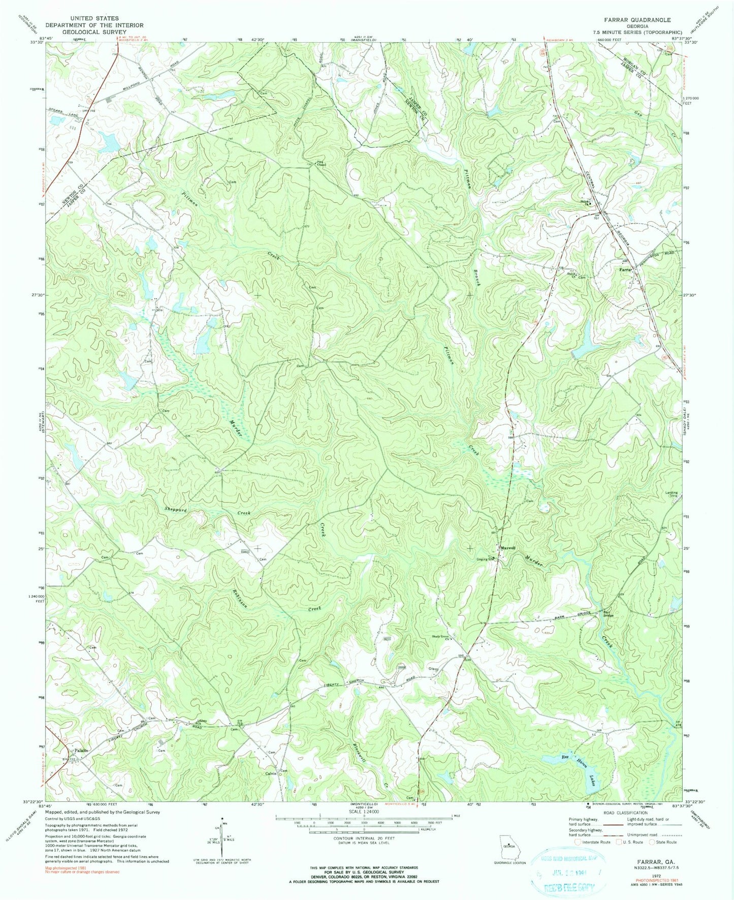
Classic USGS Farrar Georgia 7.5'x7.5' Topo Map
Couldn't load pickup availability
Historical USGS topographic quad map of Farrar in the state of Georgia. Typical map scale is 1:24,000, but may vary for certain years, if available. Print size: 24" x 27"
This quadrangle is in the following counties: Jasper, Morgan, Newton.
The map contains contour lines, roads, rivers, towns, and lakes. Printed on high-quality waterproof paper with UV fade-resistant inks, and shipped rolled.
Contains the following named places: Barr Bridge, Liberty Church, Pittman Branch, Pittman Creek, Pitts Chapel, Rex Haven Lakes, Robinson Creek, Shady Grove Church, Sheppard Creek, Shiloh Church, Shiloh Church, Palato, Calvin, Farrar, Maxwell, Quailwood Lake Dam, Quailwood Lake, Rex Haven Lake Number Two Dam, Rex Haven Lake Number Two, Rex Haven Lake Number One Dam, Rex Haven Lake Number One, Sheppard Lake Dam, Sheppard Lake, Murder Creek Lake Dam, Murder Creek Lake, Boyle Lake Dam Number Three, Boyle Lake Number Three, Boyle Lake Dam Number One, Boyle Lake Number One, Boyle Lake Dam Number Five, Boyle Lake Number Five, Boyle Lake Dam Number Two, Boyle Lake Number Two, Boyle Lake Number Four Dam, Boyle Lake Number Four, Boyle Lake Northeast Dam, Boyle Lake Northeast, Lake Celeste Dam, Lake Celeste, Boyle Murder Lake Dam, Boyle Murder Lake, Hopewell Baptist Church, Loyd Cemetery, Murder Creek Church (historical), Rock Hill School (historical), Hopewell Baptist Cemetery, Murder Creek Cemetery, Shiloh Cemetery, Palalto Airport (historical), Eudora Division, Jasper County Emergency Services Station 7 Farrar