MyTopo
Classic USGS Farrow Mountain Maine 7.5'x7.5' Topo Map
Couldn't load pickup availability
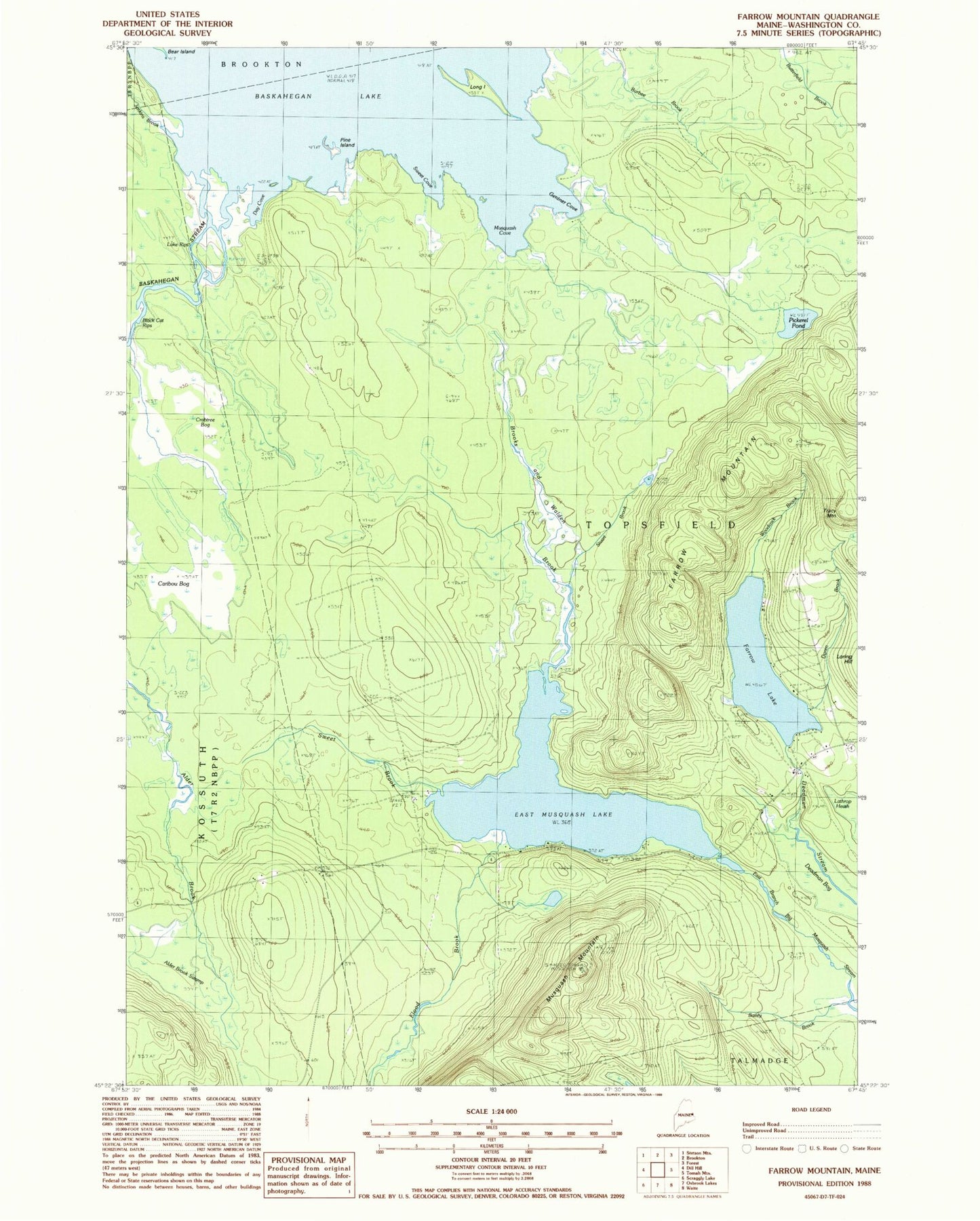
Historical USGS topographic quad map of Farrow Mountain in the state of Maine. Map scale may vary for some years, but is generally around 1:24,000. Print size is approximately 24" x 27"
This quadrangle is in the following counties: Washington.
The map contains contour lines, roads, rivers, towns, and lakes. Printed on high-quality waterproof paper with UV fade-resistant inks, and shipped rolled.
Contains the following named places: Alder Brook Swamp, Bailey Brook, Baskahegan Stream, Brooks and Walden Brook, Caribou Bog, Crabtree Bog, Day Cove, Deadman Bog, Doren Brook, East Musquash Lake, Farrow Lake, Farrow Mountain, Flood Brook, Gentner Cove, Jenkins Brook, Lake Rips, Long Island, Musquash Cove, Musquash Mountain, Pickerel Pond, Pine Island, Stuart Brook, Sweet Brook, Sweet Cove, Town of Topsfield, Tracy Mountain, Woodcock Brook, ZIP Code: 04490