MyTopo
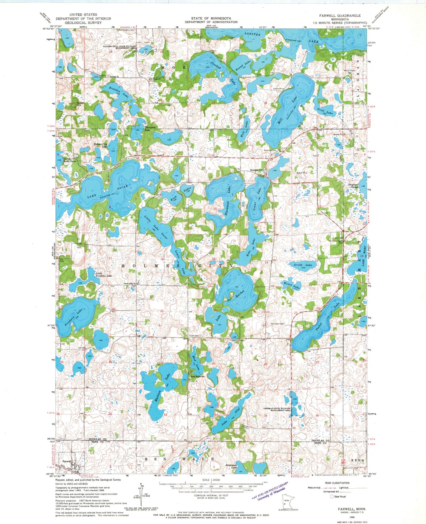
Classic USGS Farwell Minnesota 7.5'x7.5' Topo Map
Couldn't load pickup availability
Historical USGS topographic quad map of Farwell in the state of Minnesota. Map scale may vary for some years, but is generally around 1:24,000. Print size is approximately 24" x 27"
This quadrangle is in the following counties: Douglas, Pope.
The map contains contour lines, roads, rivers, towns, and lakes. Printed on high-quality waterproof paper with UV fade-resistant inks, and shipped rolled.
Contains the following named places: Blackwell Lake, Bly Creek, Brandon Lake, Chermak State Wildlife Management Area, Christian Union Cemetery, City of Farwell, Crooked Lake, East Mill Nine Golf Course, Echo Lake, Farwell, Farwell Post Office, Finnish Cemetery, Finnish Church, Freeborn Lake, Grant Lake, Grill Lake, Grubb Lake, Holmes City, Holmes City Lake, Holmes City Post Office, Kron Lakes, Lake Olaf, Lake Oscar, Lake Rachel, Lewis Lake, Little Freeborn Lake, Little Lake Oscar, Mattson Lake, Mill Lake, Mud Lake, Oscar Lake Cemetery, Oscar Lake Church, Park Region School, Pioneer Trail State Wildlife Management Area, Pocket Lake, Rose Hill Cemetery, Round Lake, Saint Paul's Cemetery, Saint Pauls Church, Sun Valley Resort and Campground, Thompson Lake, Tower Hill, Township of Holmes City, Trysil Cemetery, Van Loon Cemetery, Wesen Lake, White Garden Cemetery, Wildridge Campgrounds, Wolf Lake, ZIP Code: 56327