MyTopo
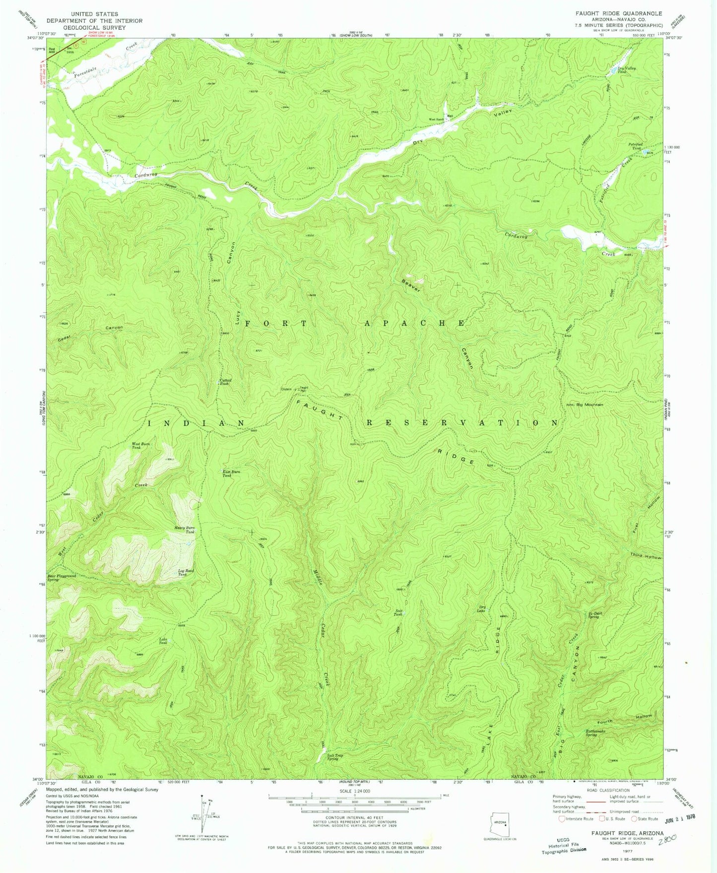
Classic USGS Faught Ridge Arizona 7.5'x7.5' Topo Map
Couldn't load pickup availability
Historical USGS topographic quad map of Faught Ridge in the state of Arizona. Map scale may vary for some years, but is generally around 1:24,000. Print size is approximately 24" x 27"
This quadrangle is in the following counties: Gila, Navajo.
The map contains contour lines, roads, rivers, towns, and lakes. Printed on high-quality waterproof paper with UV fade-resistant inks, and shipped rolled.
Contains the following named places: Beaver Canyon, Big Mountain, Cattail Rush, Dry Lake, Dry Valley, Dry Valley Tank, East Burn Tank, Faught Ridge, Faught Ridge Lookout, First Hollow, Fourth Hollow, Heavy Burn Tank, Lake Ridge, Lake Tank, Log Road Tank, Lucy Canyon, Petrified Creek, Petrified Tank, Rattlesnake Spring, Salt Tank, Salt Trap Spring, Third Hollow, Twentyfour-Dart Spring, West Burn Tank, West Ranch