MyTopo
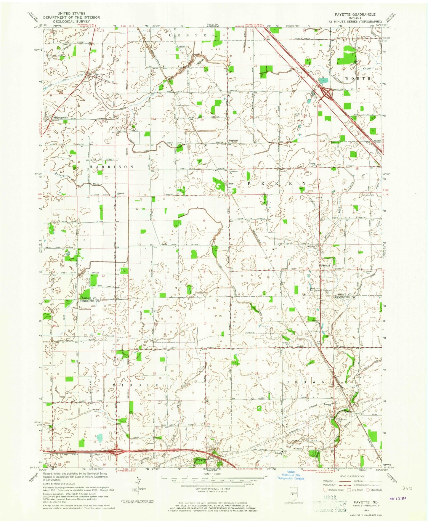
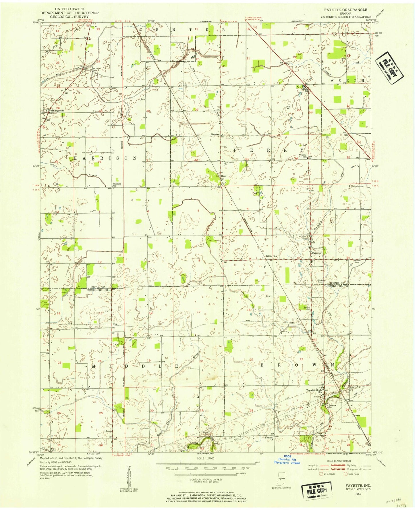
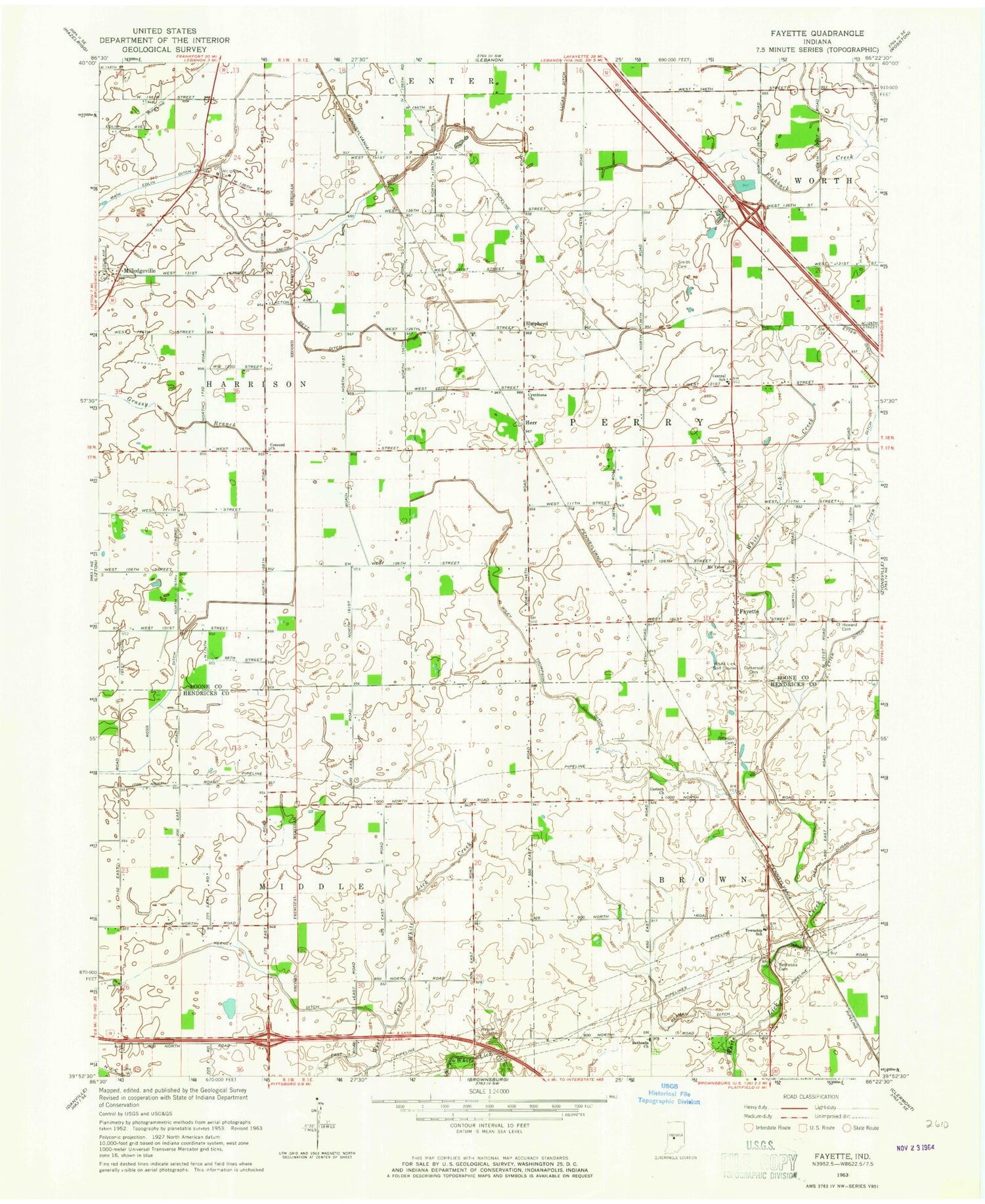
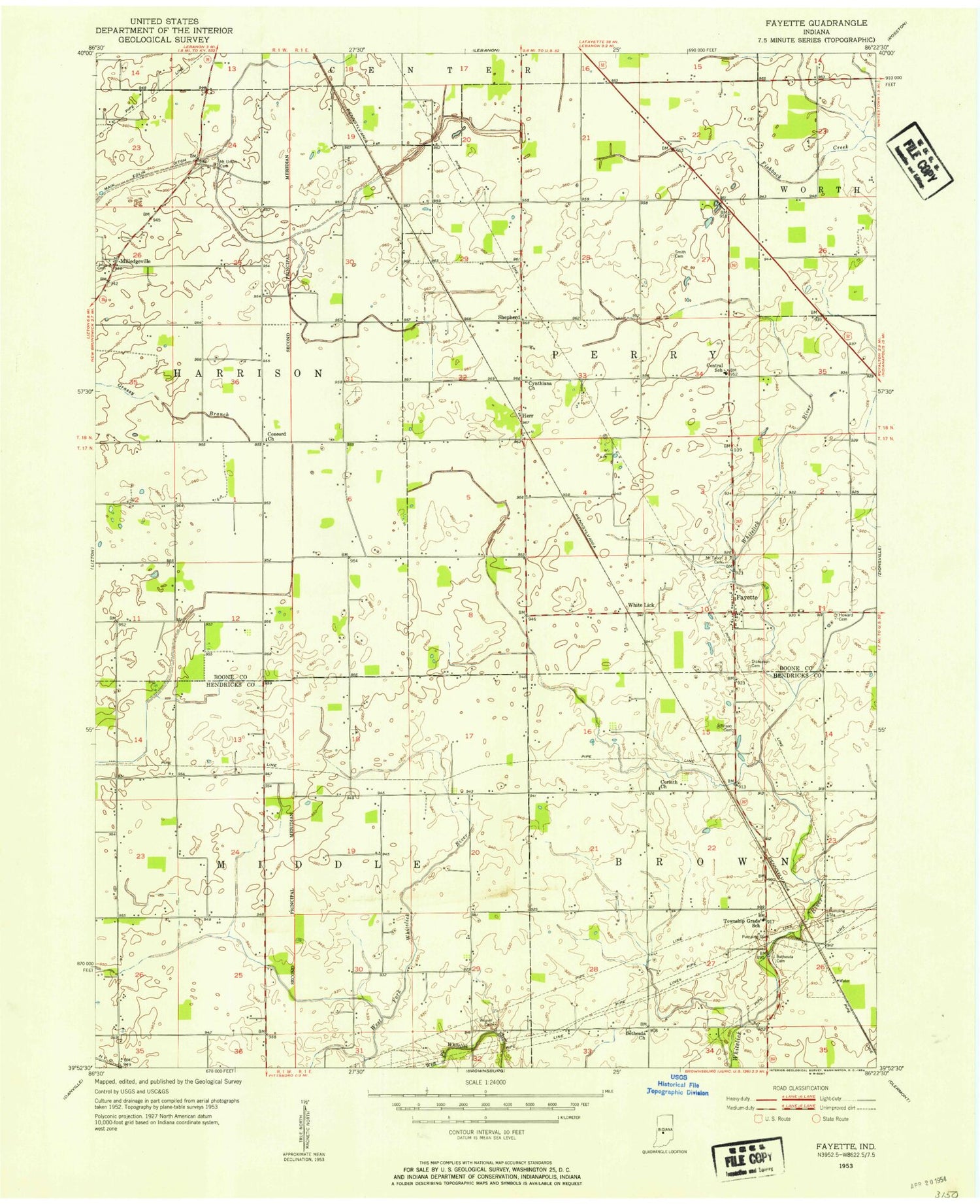
Classic USGS Fayette Indiana 7.5'x7.5' Topo Map
Couldn't load pickup availability
Historical USGS topographic quad map of Fayette in the state of Indiana. Map scale may vary for some years, but is generally around 1:24,000. Print size is approximately 24" x 27"
This quadrangle is in the following counties: Boone, Hendricks.
The map contains contour lines, roads, rivers, towns, and lakes. Printed on high-quality waterproof paper with UV fade-resistant inks, and shipped rolled.
Contains the following named places: Beaman Ditch, Bethesda Cemetery, Bethesda Church, Bett Ditch, Brock Ditch, Brownsburg Fire Station 132, Central School, Concord Church, Corinth Church, Cynthiana Church, Dickerson Cemetery, Edlin Ditch, Fayette, Herr, Howards Cemetery, Johnson Cemetery, Keeney Ditch, Main Edlin Ditch, Martin Dugan Ditch, Milledgeville, Mount Tabor Church, Mount Union Cemetery, Perry Township Volunteer Fire Department, Seven Mile Prairie, Shepherd, Smith - Shepherd Cemetery, Smith Cemetery, Township of Brown, Township of Harrison, Township of Perry, Weaver Cemetery, White Lick Golf Course, Wiley Thompson Ditch, WNON-FM (Lebanon), ZIP Code: 46167