MyTopo
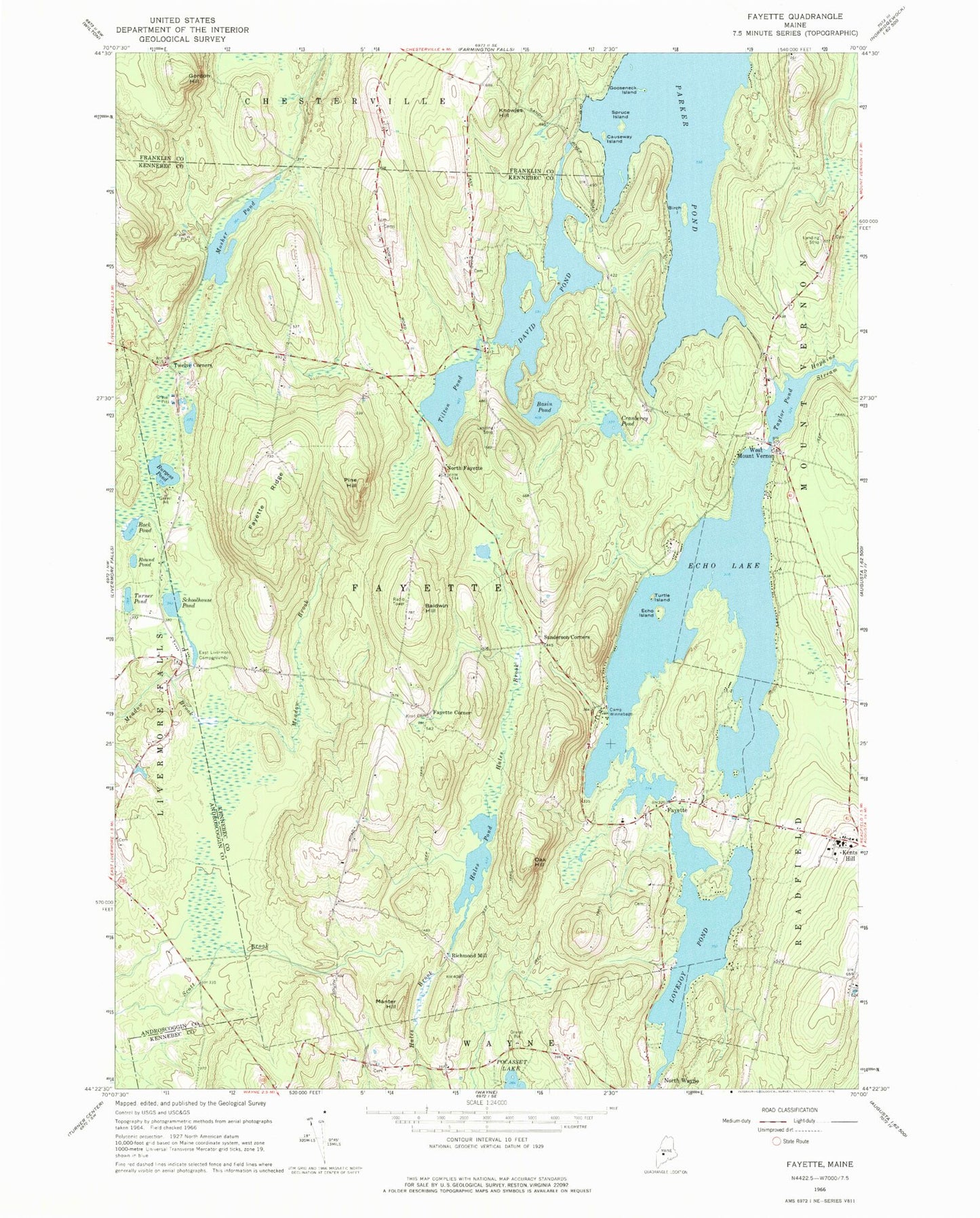
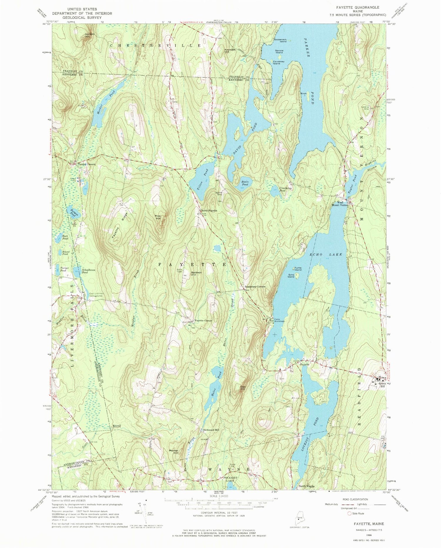
Classic USGS Fayette Maine 7.5'x7.5' Topo Map
Couldn't load pickup availability
Historical USGS topographic quad map of Fayette in the state of Maine. Typical map scale is 1:24,000, but may vary for certain years, if available. Print size: 24" x 27"
This quadrangle is in the following counties: Androscoggin, Franklin, Kennebec.
The map contains contour lines, roads, rivers, towns, and lakes. Printed on high-quality waterproof paper with UV fade-resistant inks, and shipped rolled.
Contains the following named places: Baldwin Hill, Basin Pond, Birch Island, Burgess Pond, Camp Winnebago, Causeway Island, Cranberry Pond, David Pond, East Livermore Campgrounds, Echo Island, Echo Lake, Fayette, Fayette Ridge, Gooseneck Island, Gordon Hill, Hales Pond, Hopkins Stream, Kent Cemetery, Kents Hill, Knowles Hill, Lovejoy Pond, Manter Hill, Oak Hill, Parker Pond, Pine Hill, Rack Pond, Round Pond, Schoolhouse Pond, Spruce Island, Taylor Pond, Tilton Pond, Turner Pond, Turtle Island, West Mount Vernon, Fayette Corner, North Fayette, Richmond Mill, Sanderson Corners, Twelve Corners, Mosher Pond, Town of Fayette, Taylor Pond Dam, Echo Lake Dam Number 1, Echo Lake Dam Number 2, Fayette Volunteer Fire Department, Butler Cemetery, Fayette Corner Cemetery, Fayette Mills Cemetery, Gordon Cemetery, Lake Side Cemetery, North Fayette Cemetery, Old North Fayette Cemetery, Kents Hill School, Fayette Central School, Underwood Memorial Library, Mount Winnebago