MyTopo
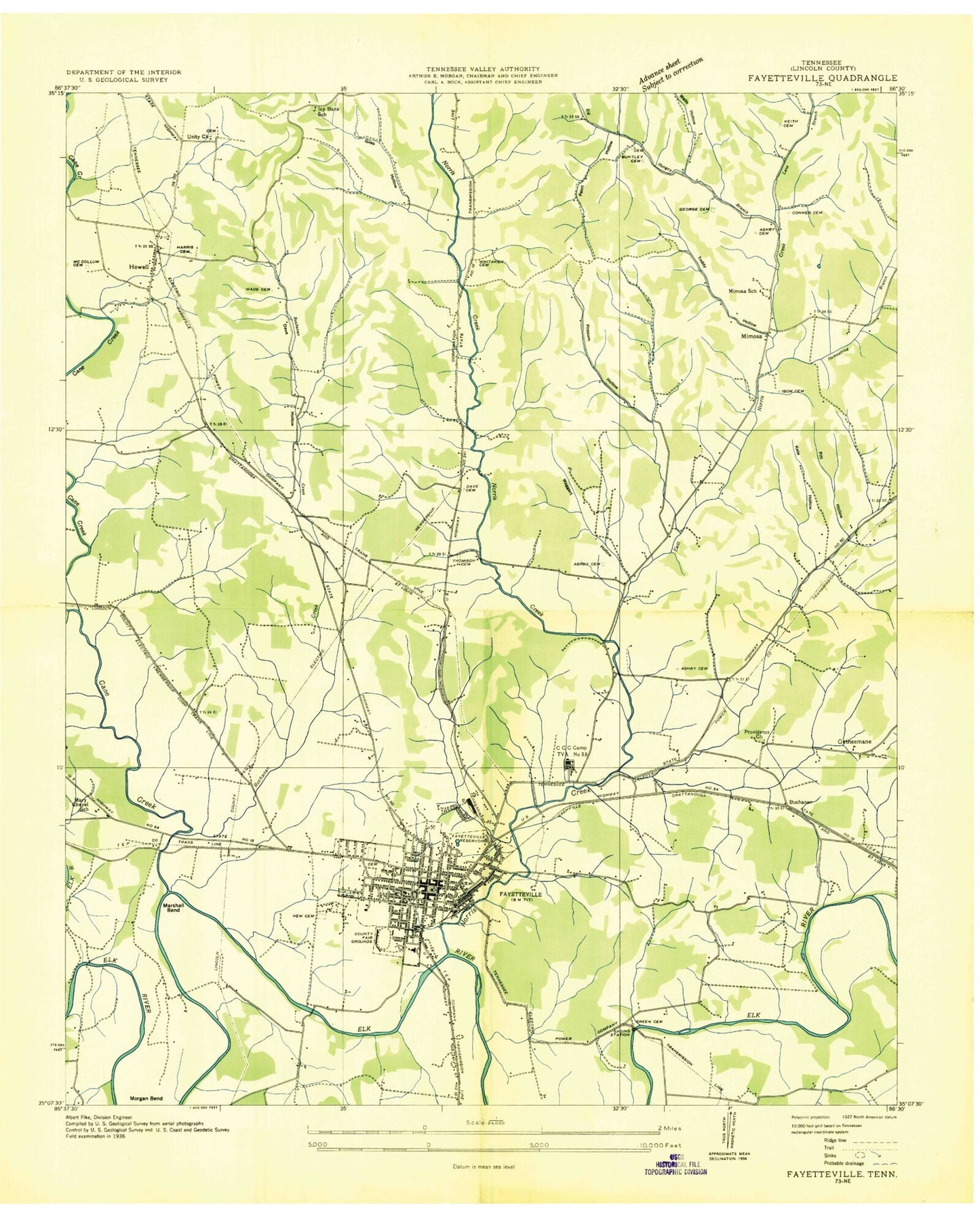
Classic USGS Fayetteville Tennessee 7.5'x7.5' Topo Map
Couldn't load pickup availability
Historical USGS topographic quad map of Fayetteville in the state of Tennessee. Map scale may vary for some years, but is generally around 1:24,000. Print size is approximately 24" x 27"
This quadrangle is in the following counties: Lincoln.
The map contains contour lines, roads, rivers, towns, and lakes. Printed on high-quality waterproof paper with UV fade-resistant inks, and shipped rolled.
Contains the following named places: Abd Bridge, Alexander Cemetery, Armstrong Moore Cemetery, Ashby Cemetery, Ashby School, Beech Grove Church, Big Hungry Branch, Bradford Farms, Brogan Street Baptist Church, Buchanan Cemetery, Buchanan Creek, Buchanan Crossing, Buckeye Church, Buntley Cemeteries, Calvary Church, Cane Creek, Central High School, Charles Bagley School, Chennault Ford, Church of Christ, City of Fayetteville, Civilian Conservatino Corps Camp TVA Number 33, Clarks Ferry, Clarks Ford, Commissioner District 6, Concord Church, Conger Cemetery, Conner Cemetery, Cotton Mill Branch, Cowen Cemetery, Crawford Cemetery, Creson, Cunningham - Creson Addition Cemetery, Cunningham Cemetery, Dave Cemetery, Dave Hollow, Donalson Hospital, Eighth District Elementary School, Eldad Bridge, Elk Mill Village, Elmwood Terrace, Fayetteville, Fayetteville Cemetery, Fayetteville City Hall, Fayetteville Division, Fayetteville Elementary School, Fayetteville Fire Department Station 1, Fayetteville Fire Department Station 2, Fayetteville First Baptist Church, Fayetteville Golf and Country Club, Fayetteville Junior High School, Fayetteville Police Department, Fayetteville Post Office, First Assembly of God Church, First Presbyterian Church, First United Methodist Church, Gains Cemetery, George Cemetery, Gethsemane, Gethsemane Church, Gibson Cemetery, Giles Cemetery, Giles Hollow, Green Cemetery, Hamestring Branch, Harris Cemetery, Hayes Branch, Haysland Church, Higgins Cemetery, Hopper Hollow, Howell, Howell First Baptist Church, Howell School, Hulsey Cemetery, Icy Bank Ridge, Icy Bank School, Isom Cemetery, Johnson Cemetery, Kate Hollow, Keith Cemetery, Kent Hollow, Kimes Cemetery, Lady Jane Airport, Lane Branch, Lincoln County, Lincoln County Courthouse, Lincoln County Fairgrounds, Lincoln County High School, Lincoln County Highway Department Quarry, Lincoln County Hospital, Lincoln County Sheriff's Department, Lincoln Medical Center, Little Norris Creek, Long Hollow, Lucinda Bend, Madden Homes, Marches Zion Church, Marshall Bend, Martin Hollow, Mayberry Courts, Mays Chapel, McCollum Cemetery, McDaniel Cemetery, Mimosa, Mimosa School, Morgan Bend, Mount Zion Baptist Church, Mulberry-Washington-Lincoln Historic District, Norris Cemetery, Norris Creek, Northside Church, Old Fayetteville City Cemetery, Paint Hollow, Pamplin Cemetery, Parker Cemetery, Parks Cemetery, Pitt Cemetery, Pitt Hollow, Pleasant View Cemetery, Posey Farm, Possum Hollow, Providence Church, Rambo Lake, Redd Hollow, Reubin Hunter Cemetery, Rhea Cemetery, Riverview Cemetery, Robert E Lee School, Roper Ferry, Rose Hill Cemetery, Saint Mary Magdalene Episcopal Church, Saint Paul African Methodist Episcopal Church, Scott Hill, Sharp Cemetery, Sharwa Farms, Shull Cemetery, Slater Cemetery, Slip Hill, Solomon Cemetery, South Elk Street Historic District, Stone Cemetery, Suggs Bend, Sunset Acres Farms, Tanyard Branch, Terrapin Hollow, Thomison Cemetery, Timber Lake, Timber Lake Dam, Tonie Stone Ridge, Unity Cemetery, Unity Church, Wade Cemetery, Waggart Hollow, Walker Cemetery, WEKR-AM (Fayetteville), Wells Hollow, West End Baptist Church, West End High School, Whitaker Cemetery, Whitaker Higgins Cemetery, Wilks Airport, WIXC-AM (Fayetteville), Woodroof Cemetery, WYTM-FM (Fayetteville), ZIP Code: 37334


