
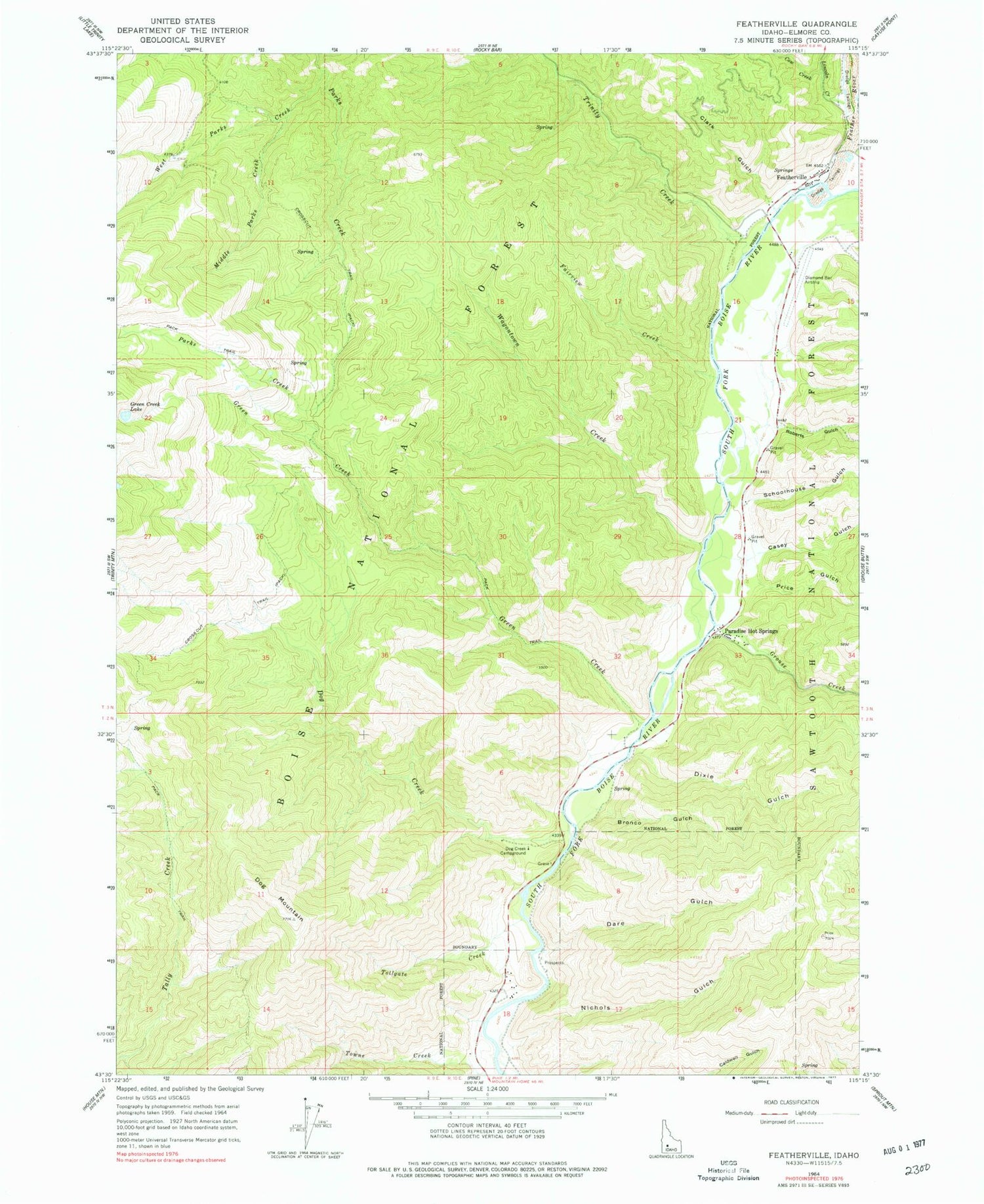
MyTopo
Classic USGS Featherville Idaho 7.5'x7.5' Topo Map
Couldn't load pickup availability
Historical USGS topographic quad map of Featherville in the state of Idaho. Map scale may vary for some years, but is generally around 1:24,000. Print size is approximately 24" x 27"
This quadrangle is in the following counties: Elmore.
The map contains contour lines, roads, rivers, towns, and lakes. Printed on high-quality waterproof paper with UV fade-resistant inks, and shipped rolled.
Contains the following named places: Bronco Gulch, Casey Gulch, Clark Gulch, Cow Creek, Dare Gulch, Dixie Gulch, Dog Creek, Dog Creek Campground, Dog Mountain, Fairview Creek, Feather River, Featherville, Green Creek, Grouse Creek, Lincoln Creek, Middle Parks Creek, Nichols Gulch, Paradise Hot Springs, Pine Gulch, Price Gulch, Roberts Gulch, Schoolhouse Gulch, Tollgate Creek, Trinity Creek, Wagontown Creek, West Parks Creek


