MyTopo
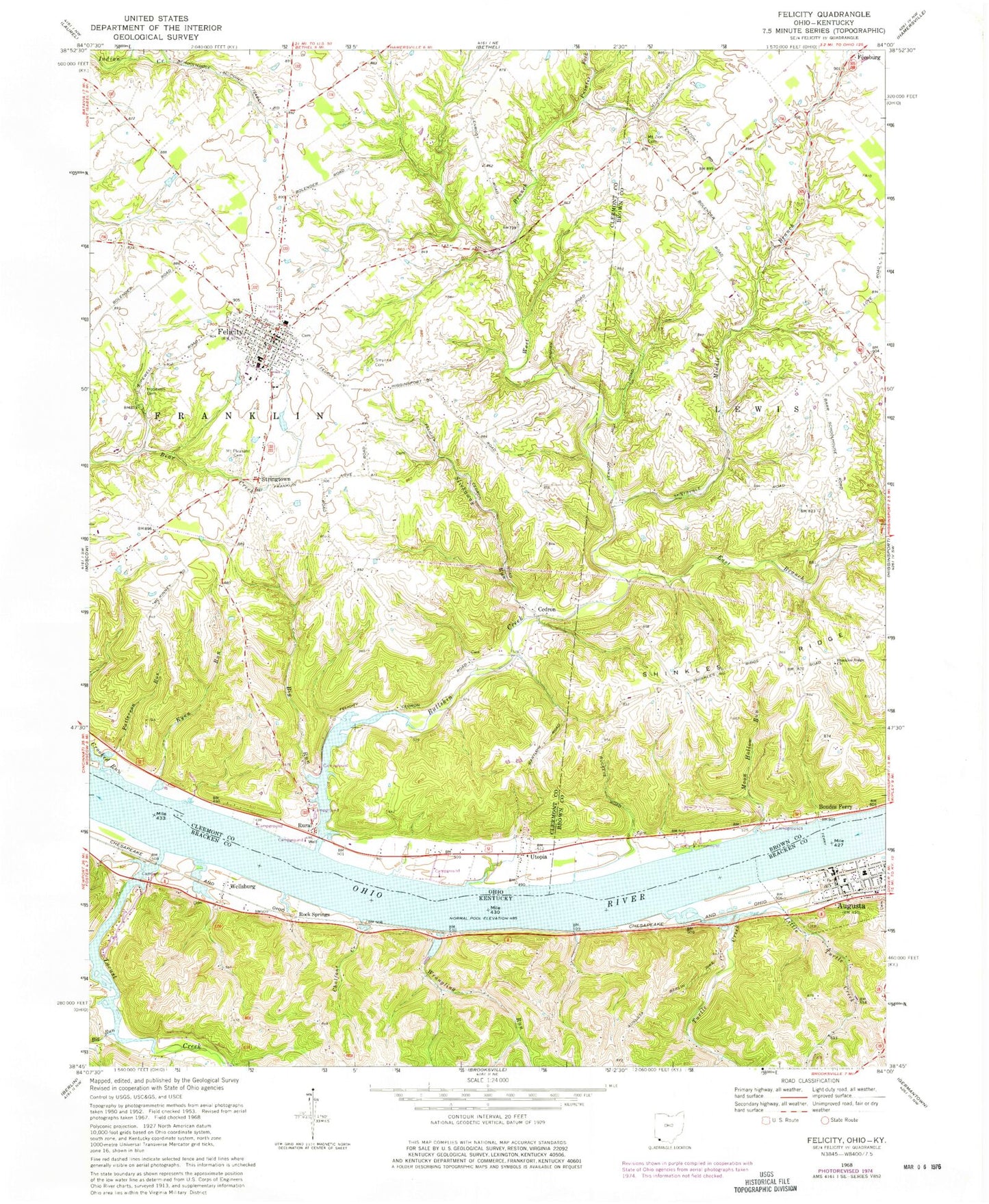
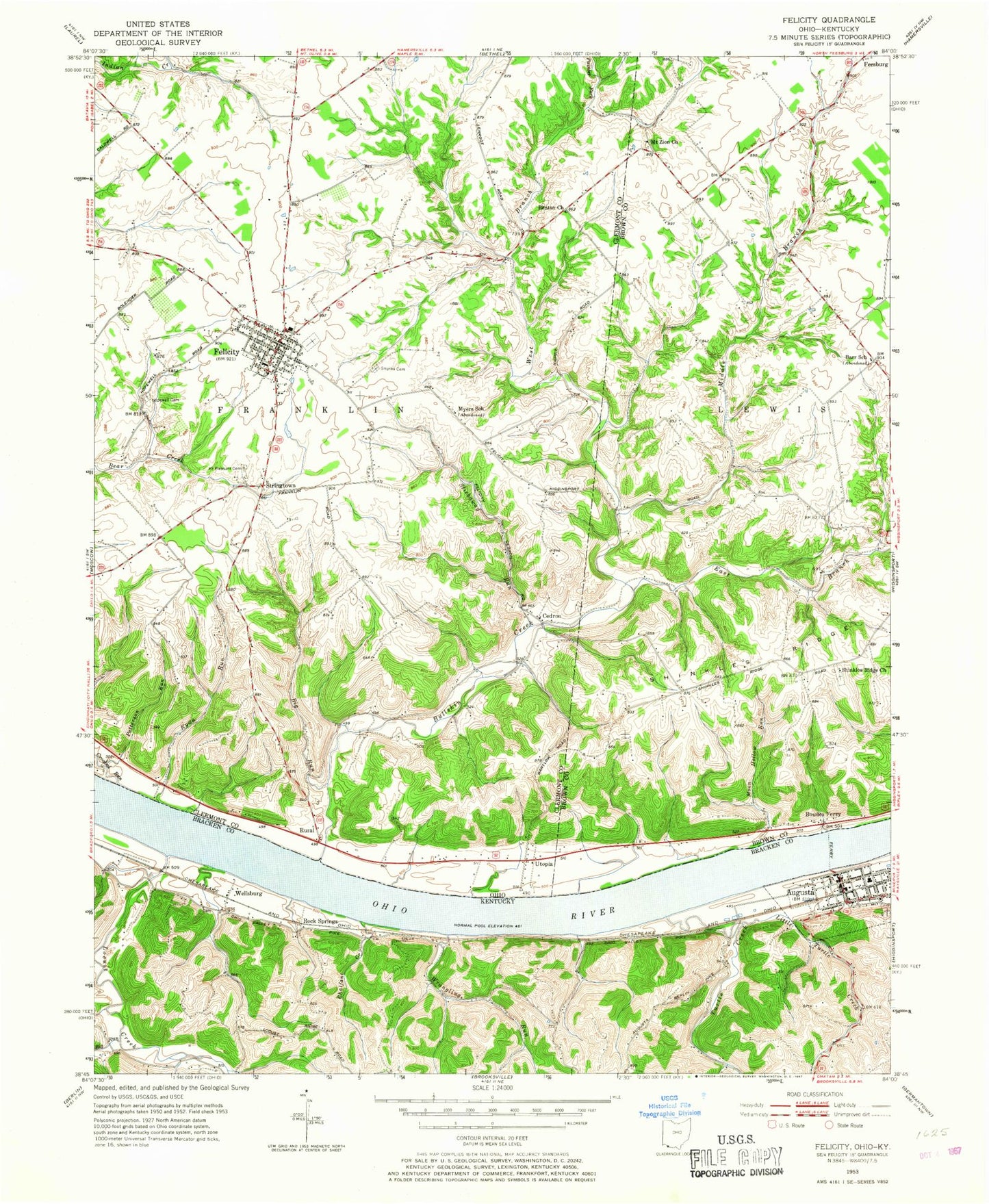
Classic USGS Felicity Ohio 7.5'x7.5' Topo Map
Couldn't load pickup availability
Historical USGS topographic quad map of Felicity in the states of Ohio, Kentucky. Typical map scale is 1:24,000, but may vary for certain years, if available. Print size: 24" x 27"
This quadrangle is in the following counties: Bracken, Brown, Clermont.
The map contains contour lines, roads, rivers, towns, and lakes. Printed on high-quality waterproof paper with UV fade-resistant inks, and shipped rolled.
Contains the following named places: Big Run, East Branch Bullskin Creek, Hopewell Cemetery, Middle Branch Bullskin Creek, Mount Pleasant Cemetery, Mount Zion Cemetery, Shinkles Ridge Church, Slickaway Run, Smyrna Cemetery, West Branch Bullskin Creek, Stringtown, Buckeye School (historical), Mount Vernon School (historical), Rice School (historical), Wilson School (historical), Myers School (historical), Benton School (historical), Linroot School (historical), Goodwin School (historical), Mount Auburn School (historical), Richards School (historical), Franklin School (historical), Felicity-Franklin High School, Felicity-Franklin Elementary School, Smith Landing, Patterson Run, Augusta Bar, Ryan Run, Boudes Ferry, Crooked Run, Cedron, Felicity, Rural, Utopia, Bullskin Creek, Moon Hollow Run, Painter Fork, Barr School (historical), Township of Franklin, Bartlow Cemetery, Hard Scrabble Cemetery, Shinkle Ridge Cemetery, Felicity Cemetery, Rural Cemetery, Felicity Post Office, Rural Post Office (historical), Utopia Post Office (historical), Cedron Post Office (historical), Village of Felicity, Utter Field, Felicity - Franklin Fire Department, Felicity - Franklin Emergency Medical Services, Clarkson Dairy Farm, Seibert Swine Farms, Felicity Police Department, Felicity Water Treatment Plant, Augusta, Big Run, Chalfant Creek, Little Turtle Creek, Locust Creek, Turtle Creek, Wrangling Run, Rock Springs, Wellsburg, Brooksville Railroad Junction (historical), Centennial Rock School (historical), Cherry Grove School Number Fourteen (historical), County Alms Poor House (historical), Elmgrove Post Office (historical), Locust Mill (historical), Ohio Valley School Number Five (historical), Rock Springs Landing (historical), School Number Four (historical), Tietzville Post Office (historical), Valley View, City of Augusta, Augusta Volunteer Fire Department, Augusta Police Department, Augusta Post Office