MyTopo
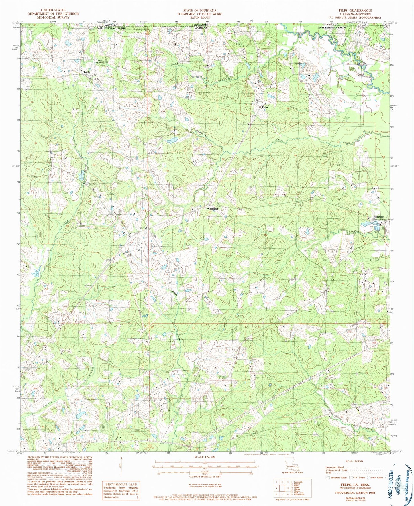
Classic USGS Felps Louisiana 7.5'x7.5' Topo Map
Couldn't load pickup availability
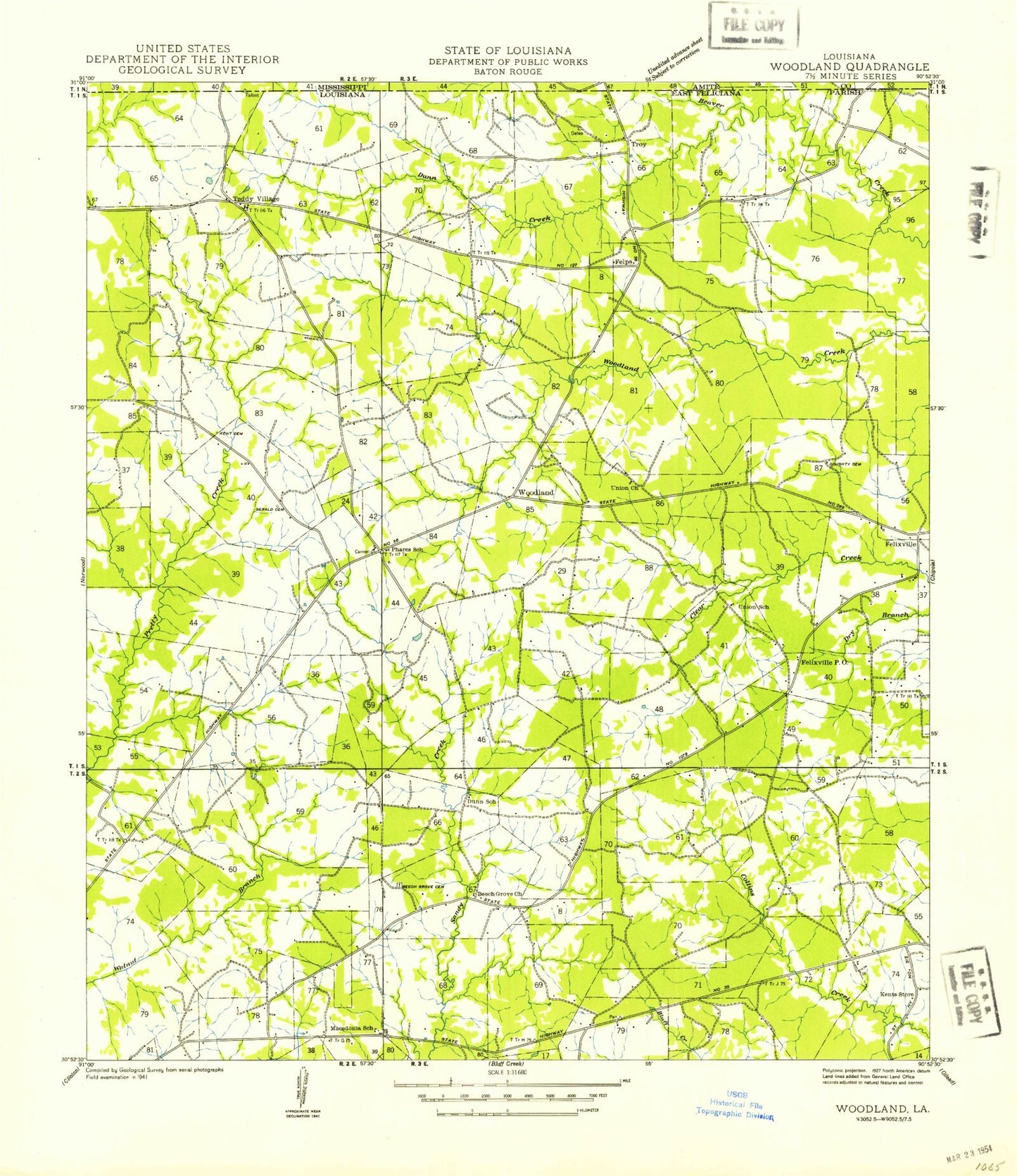
Historical USGS topographic quad map of Felps in the state of Louisiana. Map scale may vary for some years, but is generally around 1:24,000. Print size is approximately 24" x 27"
This quadrangle is in the following counties: Amite, East Feliciana.
The map contains contour lines, roads, rivers, towns, and lakes. Printed on high-quality waterproof paper with UV fade-resistant inks, and shipped rolled.
Contains the following named places: Beech Grove Baptist Church Cemetery, Beech Grove Church, Beech Grove School, Camp Atakapa, Camp Avondale, Clear Creek African Methodist Episcopal Church, Clear Creek School, Clinton Lookout Tower, Crooked Branch, Day School, Days Chapel, Doughty Cemetery, Dunn Creek, East Feliciana Elementary School, Eighth Ward School, Felixville, Felixville Post Office, Felps, First United Pentecostal Church, Freeman Landing Strip, Gerald Cemetery, Greater Macedonia Baptist Church, Hepzibah Church, Holland Lake Dam, Holy Grove Plantation, Kent Cemetery, Kents Store, Littlefield Airport, Macedonia Church, Mount Calvary Church, Mount Carmel Church, Pineville School, Poverty Bayou, Teddy, Troy, Union Church, Union School, Ward Eight, Wattles Branch, Woodland, Woodland Church, Woodland Community Center, Woodland Volunteer Fire Department, Woody Perkins Lake Dam