
MyTopo
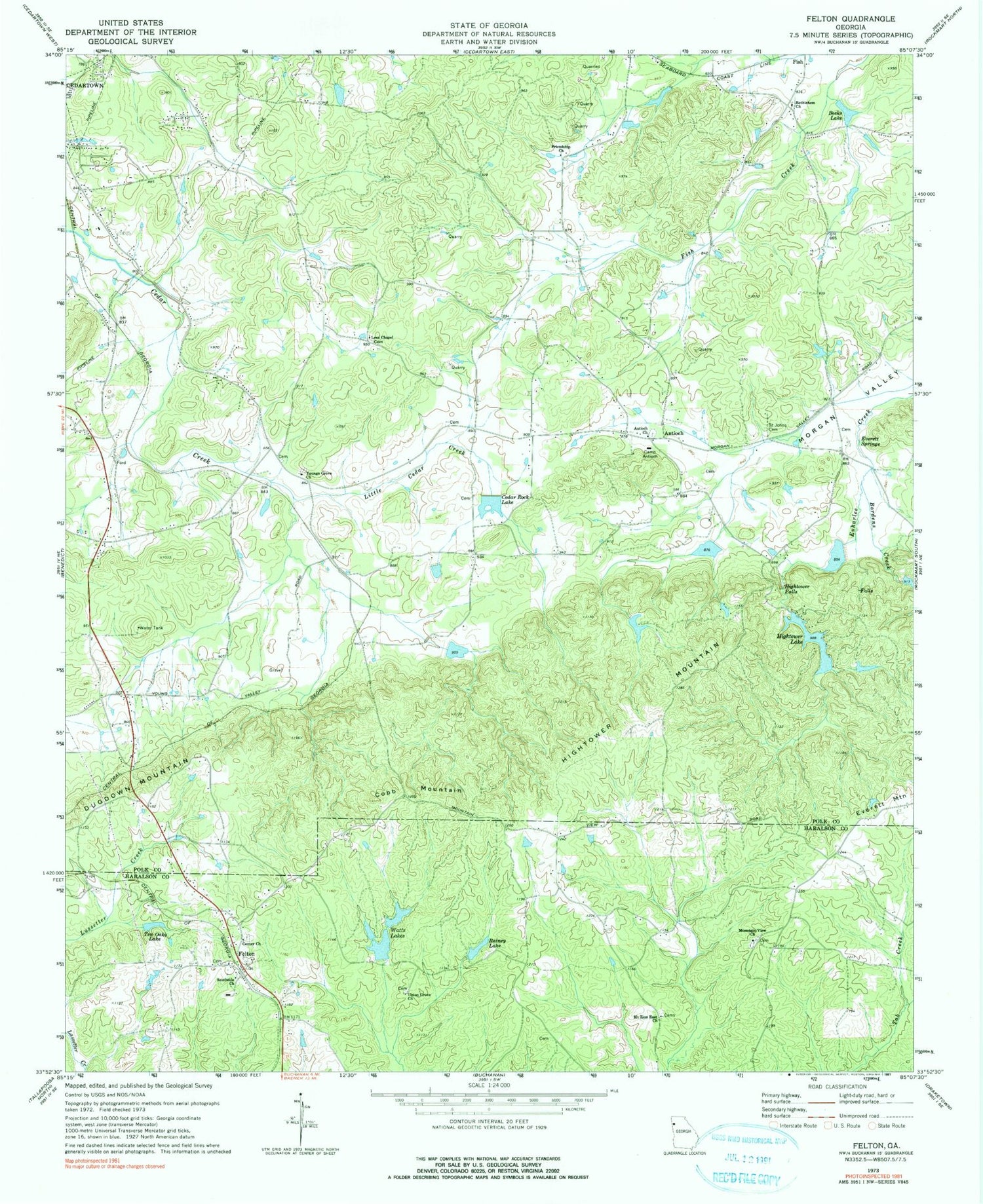
Classic USGS Felton Georgia 7.5'x7.5' Topo Map
Couldn't load pickup availability
Historical USGS topographic quad map of Felton in the state of Georgia. Map scale may vary for some years, but is generally around 1:24,000. Print size is approximately 24" x 27"
This quadrangle is in the following counties: Haralson, Polk.
The map contains contour lines, roads, rivers, towns, and lakes. Printed on high-quality waterproof paper with UV fade-resistant inks, and shipped rolled.
Contains the following named places: Antioch, Antioch Cemetery, Antioch Church, Antioch School, Becks Lake, Bethlehem Church, Big Cedar Creek Structure Number 50 Dam, Biggers School, Bordens Creek, Camp Antioch, Cedar Rock Lake, Cedar Rock Lake Dam, Center Church, Center Church Cemetery, Cobb Mountain, Davis Lake, Euharlee Creek Structure Number 51 Dam, Euharlee Creek Structure Number 76 Dam, Euharlee Creek Structure Number Four Dam, Everett Springs, Felton, Felton Cemetery, Felton Junior High School, Felton Post Office, Fish, Freedom Church, Friendly Baptist Church, Friendship Church, Haralson County Fire Department Station 11, Haralson County Fire Department Station 3, Hickman Junction, Hightower Cemetery, Hightower Falls, Hightower Lake, Hightower Lake Dam Number One, Hightower Mill, Hightower Mountain, Hobson Lake, Hobson Lake Dam, Lees Chapel, Lindsey Lake, Little Cedar Creek, Lower Hightower Falls Lake, Mount Zion East Church, Mount Zion East Church Cemetery, Mountain View Church, Mountain View School, North Watts Lake, North Watts Lake Dam, Philpott Spring, Polk County Fire Department Youngs Station, Polk County Volunteer Fire Department Antioch Station, Rainey Lake, Saint Johns Cemetery, Salem Church, Southside Church, Ten Oaks Lake, Union Grove Church, Watts Lakes, Winkles, Youngs, Youngs Grove Church, Youngs Spring


