
MyTopo
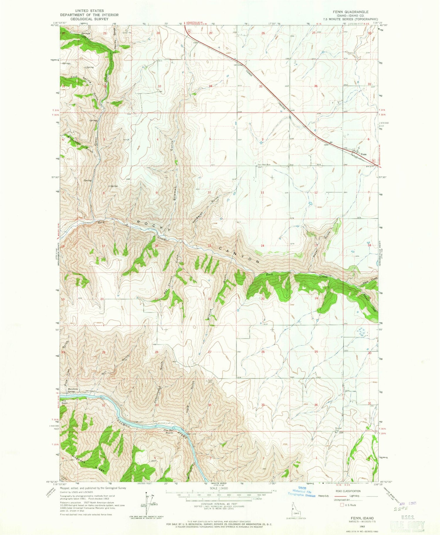
Classic USGS Fenn Idaho 7.5'x7.5' Topo Map
Couldn't load pickup availability
Historical USGS topographic quad map of Fenn in the state of Idaho. Map scale may vary for some years, but is generally around 1:24,000. Print size is approximately 24" x 27"
This quadrangle is in the following counties: Idaho.
The map contains contour lines, roads, rivers, towns, and lakes. Printed on high-quality waterproof paper with UV fade-resistant inks, and shipped rolled.
Contains the following named places: Blackburn Gulch, Boise Trail, Bowman Gulch, Cold Spring Gulch, Cottonwood Gulch, Fenn, Gill Gulch, Grave Creek, Hanley Gulch, Hells Gate Creek, Hogback Ridge, Johns Creek, Long Gulch, Meyer Gulch, Murdicks Spring, Pine Bar Rapids, Pine Tree Gulch, Ray Church Gulch, Telcher Creek, Vonberge Gulch, Wilkins Gulch


