MyTopo
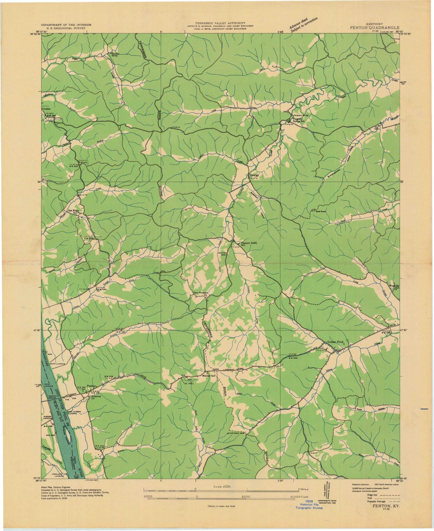
Classic USGS Fenton Kentucky 7.5'x7.5' Topo Map
Couldn't load pickup availability
Historical USGS topographic quad map of Fenton in the state of Kentucky. Typical map scale is 1:24,000, but may vary for certain years, if available. Print size: 24" x 27"
This quadrangle is in the following counties: Marshall, Trigg.
The map contains contour lines, roads, rivers, towns, and lakes. Printed on high-quality waterproof paper with UV fade-resistant inks, and shipped rolled.
Contains the following named places: Bald Knob, Barnett Bay, Barnett Creek, Boardinghouse Hollow, Crooked Creek, Crooked Creek Bay, Eggner Ferry Bridge, Elbow Creek, Energy, Energy Lake, Franklin Creek, Golden Pond, Gordon Hill, Gordon Hollow, Grace Creek, Higgins Branch, Jenny Ridge Cemetery, Little Creek, Long Creek, Matheny Cemetery, North Fork Sugar Creek, Oakley Hollow, Pleasant Valley Cemetery, Rhodes Bay, Rhodes Creek, Savells Branch, Scout Trail, Shaw Branch, South Fork Sugar Creek, Turner Hollow, Vickers Bay, Vickers Creek, Kentucky Woodlands National Wildlife Refuge, Fenton, Ferguson Spring, Golden Pond, Land Between the Lakes Division, Bald Knob, Barnett Bay, Barnett Creek, Boardinghouse Hollow, Crooked Creek, Crooked Creek Bay, Eggner Ferry Bridge, Elbow Creek, Energy, Energy Lake, Franklin Creek, Golden Pond, Gordon Hill, Gordon Hollow, Grace Creek, Higgins Branch, Jenny Ridge Cemetery, Little Creek, Long Creek, Matheny Cemetery, North Fork Sugar Creek, Oakley Hollow, Pleasant Valley Cemetery, Rhodes Bay, Rhodes Creek, Savells Branch, Scout Trail, Shaw Branch, South Fork Sugar Creek, Turner Hollow, Vickers Bay, Vickers Creek, Kentucky Woodlands National Wildlife Refuge, Fenton, Ferguson Spring, Golden Pond, Land Between the Lakes Division


