MyTopo
Classic USGS Fergus NE Montana 7.5'x7.5' Topo Map
Regular price
$16.95
Regular price
Sale price
$16.95
Unit price
per
Couldn't load pickup availability
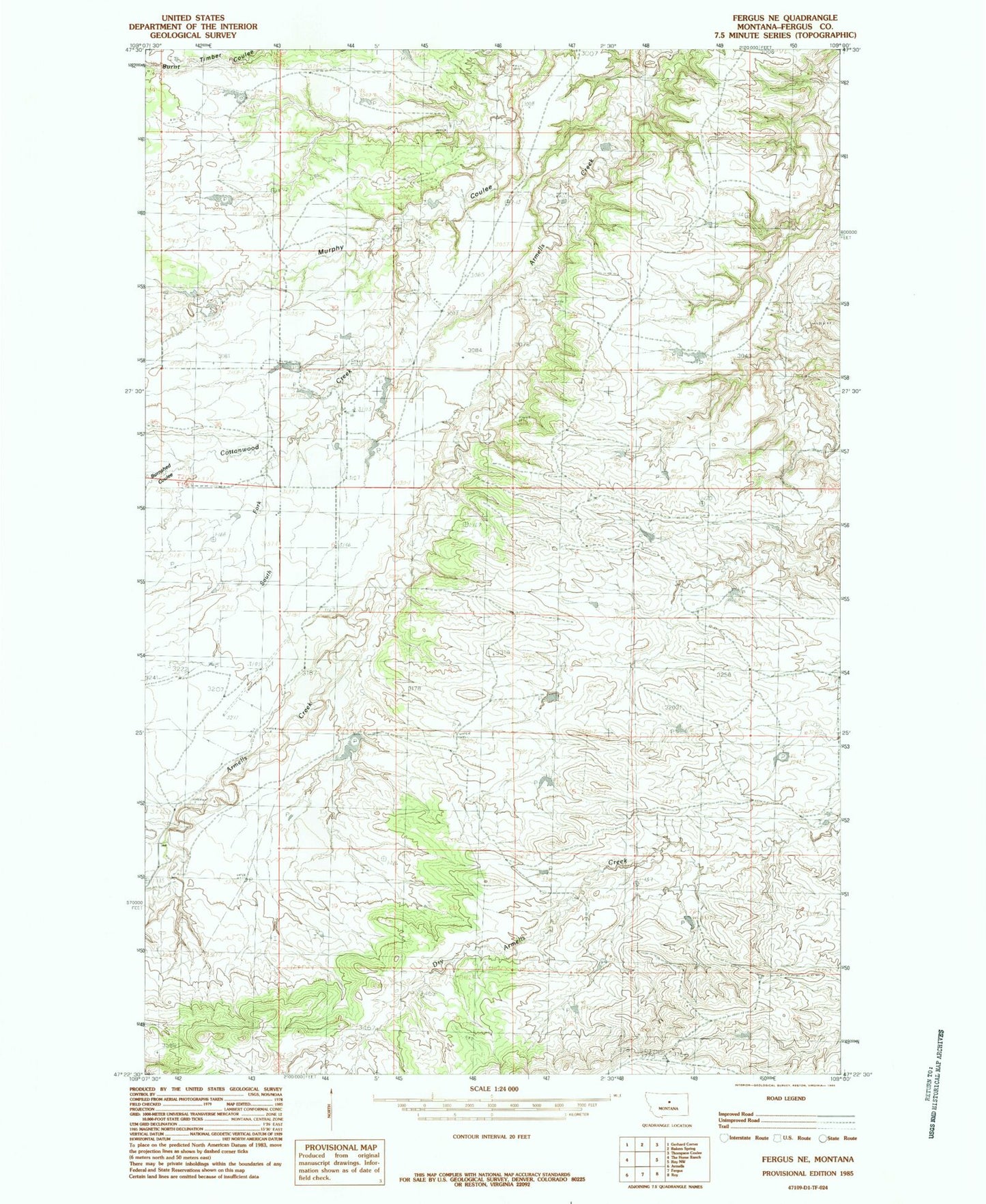
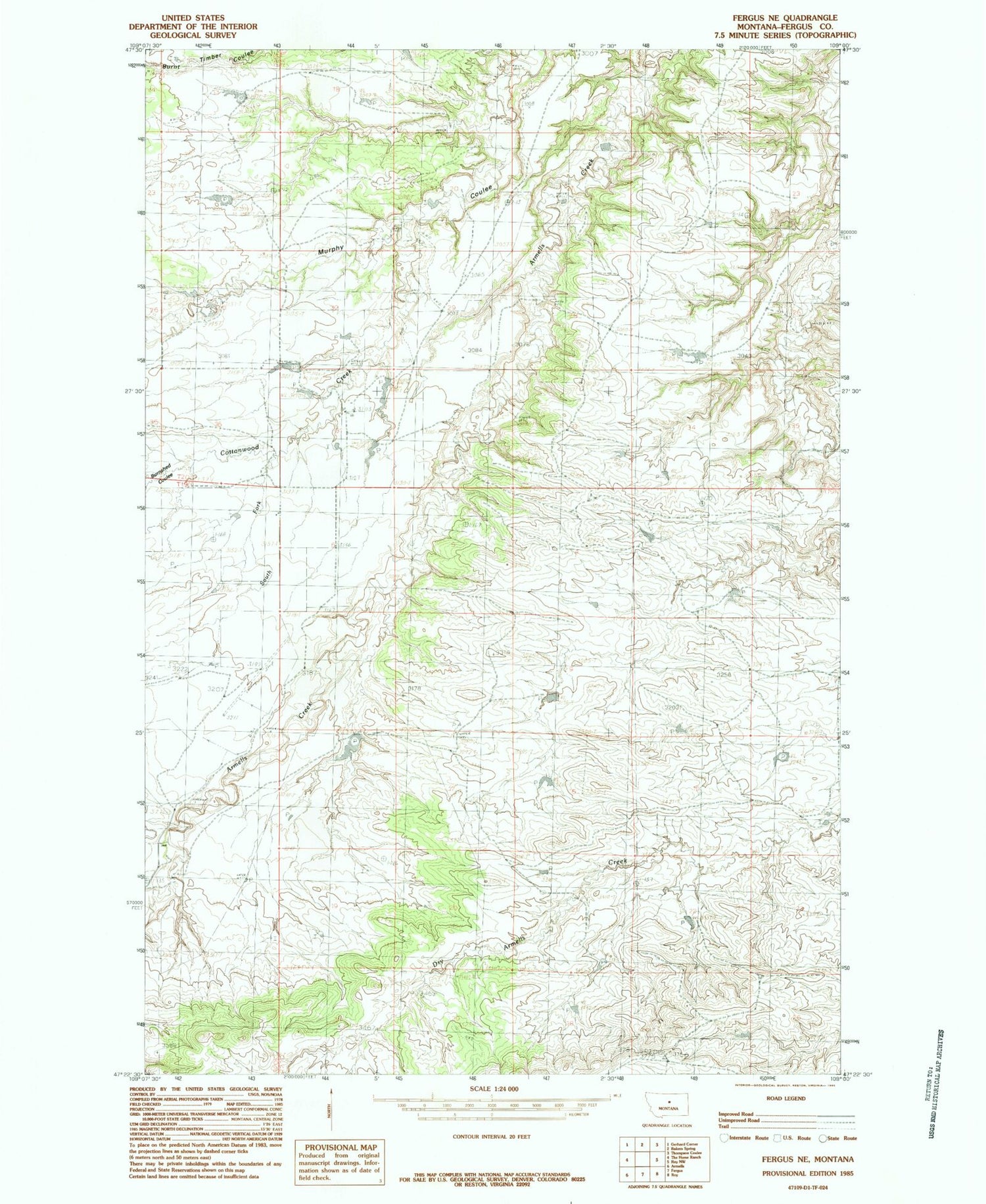
Historical USGS topographic quad map of Fergus NE in the state of Montana. Map scale may vary for some years, but is generally around 1:24,000. Print size is approximately 24" x 27"
This quadrangle is in the following counties: Fergus.
The map contains contour lines, roads, rivers, towns, and lakes. Printed on high-quality waterproof paper with UV fade-resistant inks, and shipped rolled.
Contains the following named places: 19N20E13DD__01 Well, 19N20E24DB__01 Well, 19N21E17BBA_01 Well, 20N21E19DA__01 Well, 20N21E26CA__01 Well, 20N21E29BC__01 Well, 20N21E29DA__01 Well, 20N21E32DB__01 Well, Burnshed Coulee, Cottonwood Creek, Petranek Dam, Petranek Reservoir Dam, Satterfield Dam, South Fork Cottonwood Creek