MyTopo
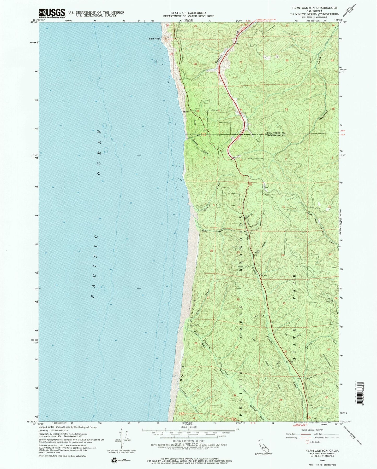
Classic USGS Fern Canyon California 7.5'x7.5' Topo Map
Couldn't load pickup availability
Historical USGS topographic quad map of Fern Canyon in the state of California. Map scale may vary for some years, but is generally around 1:24,000. Print size is approximately 24" x 27"
This quadrangle is in the following counties: Del Norte, Humboldt.
The map contains contour lines, roads, rivers, towns, and lakes. Printed on high-quality waterproof paper with UV fade-resistant inks, and shipped rolled.
Contains the following named places: Boat Creek, Brown Creek, Butler Creek, Crea Trail, Fern Canyon, Foothill Trail, Gold Bluffs Beach, Home Creek, Hope Creek, Hope Creek Trail, James Irvine Trail, Johnson Creek, Little Creek, Loop Trail, Murrelet State Wilderness, Ossagon Creek, Prairie Creek Redwoods State Park, Redwood National Park, Rhododendron Trail, South Fork Trail, Split Rock, Squashan Creek, Ten Tapo Trail, West Ridge Trail, Zigzag Trail, Zigzag Trail Three, Zigzag Trail Two