MyTopo
Classic USGS Ferndale Arkansas 7.5'x7.5' Topo Map
Couldn't load pickup availability
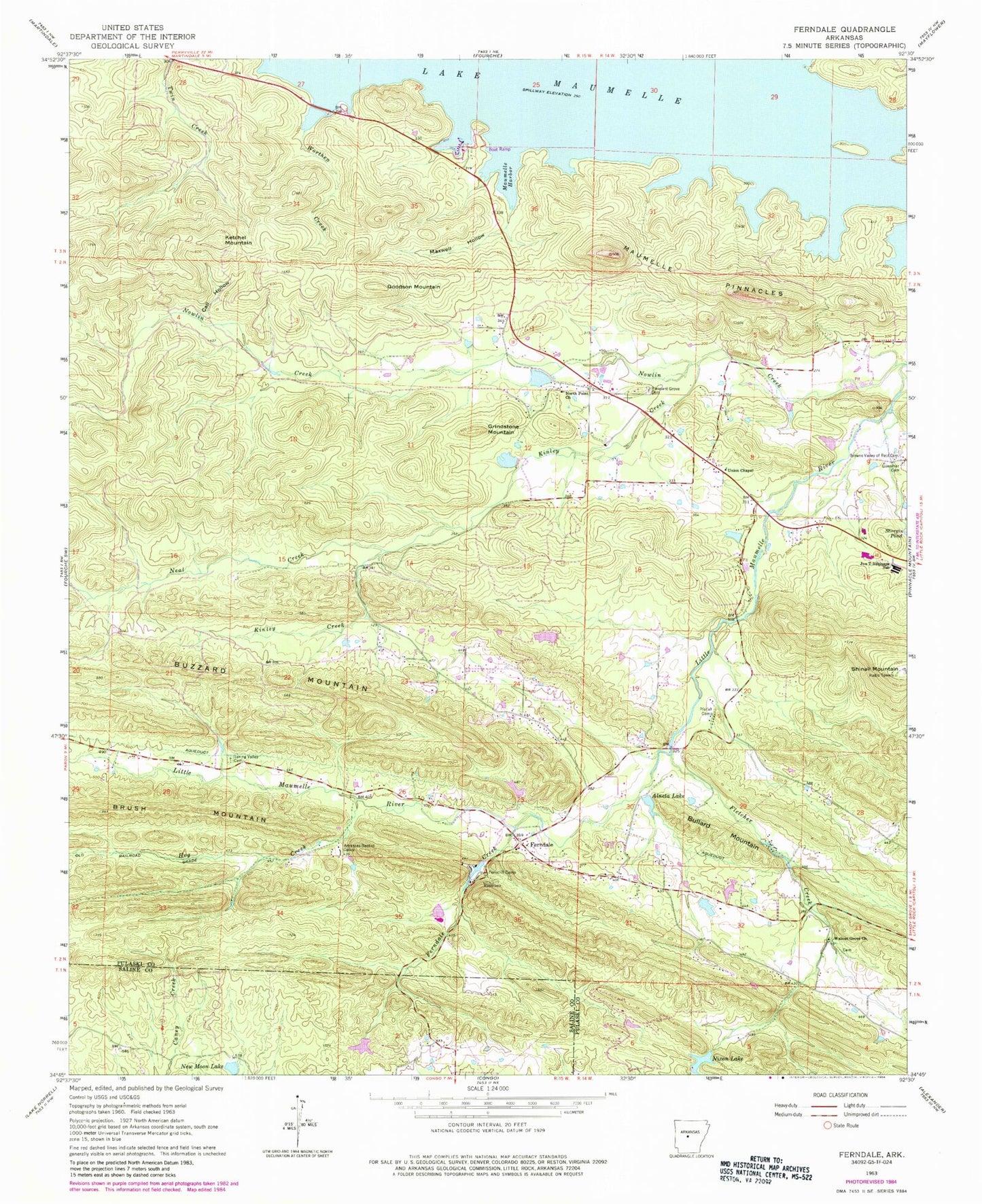
Historical USGS topographic quad map of Ferndale in the state of Arkansas. Typical map scale is 1:24,000, but may vary for certain years, if available. Print size: 24" x 27"
This quadrangle is in the following counties: Pulaski, Saline.
The map contains contour lines, roads, rivers, towns, and lakes. Printed on high-quality waterproof paper with UV fade-resistant inks, and shipped rolled.
Contains the following named places: Arkansas Baptist Camp, Browns Valley of Rest Cemetery, Call Hollow, Ferncliff Camp, Fletcher Creek, Guenther and Presley Cemetery, Hog Creek, Maumelle Harbor, Maxwell Hollow, Neal Creek, North Point Church, Nowlin Creek, Pfeifer Camp, Pleasant Grove Cemetery, Spring Valley Cemetery, Union Chapel, Worthen Creek, Bullard Mountain, Ferndale, Goodson Mountain, Grindstone Mountain, Ketchel Mountain, Ball Mountain, Bland Hollow, Camp Grundy, Camp Okatoma, Fletcher Spring School (historical), Lee School (historical), North Point School (historical), Northpoint, Protho Camp Grounds (historical), Robinson Elementary School, Robinson High School, Slaty Branch, Spring Valley Church (historical), Township of Owen (historical), Buzzard Mountain, Ferndale Creek, Kinley Creek, Maumelle Pinnacles, Walnut Grove Methodist Church, Happy Valley Lake Dam, Happy Valley Lake, Lake New Moon Dam, Lake New Moon, Montgomery Lake Dam, Montgomery Lake, Baldwin Lake Dam, Baldwin Lake, Dougan Lake Dam, Dougan Lake, Sturgis Pond Dam, Alneta Lake Dam, Alneta Lake, Sam Gray Lake Dam, Grays Lake, Nixon Lake Dam, Nixon Lake, Ginger Hill Lake Dam, Ginger Hill Lake, Robinson Junior High School, Joe T Robinson Elementary School, Robinson High School, Wildwood Creek, Joe T Robinson Middle School, West Pulaski Fire Department Station 2, West Pulaski Fire Department Station 3, Pulaski County Sheriff's Office, Bufflehead Bay Trail, Farkleberry Trail, Loon Park