MyTopo
Classic USGS Ferron Canyon Utah 7.5'x7.5' Topo Map
Couldn't load pickup availability
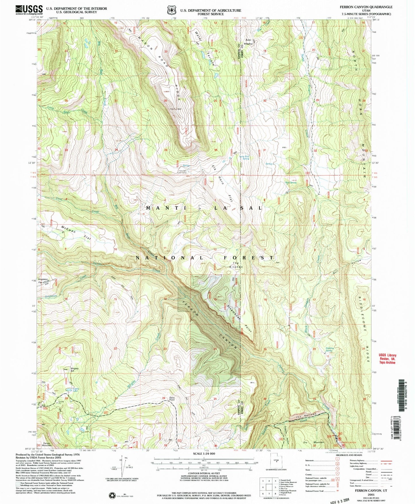
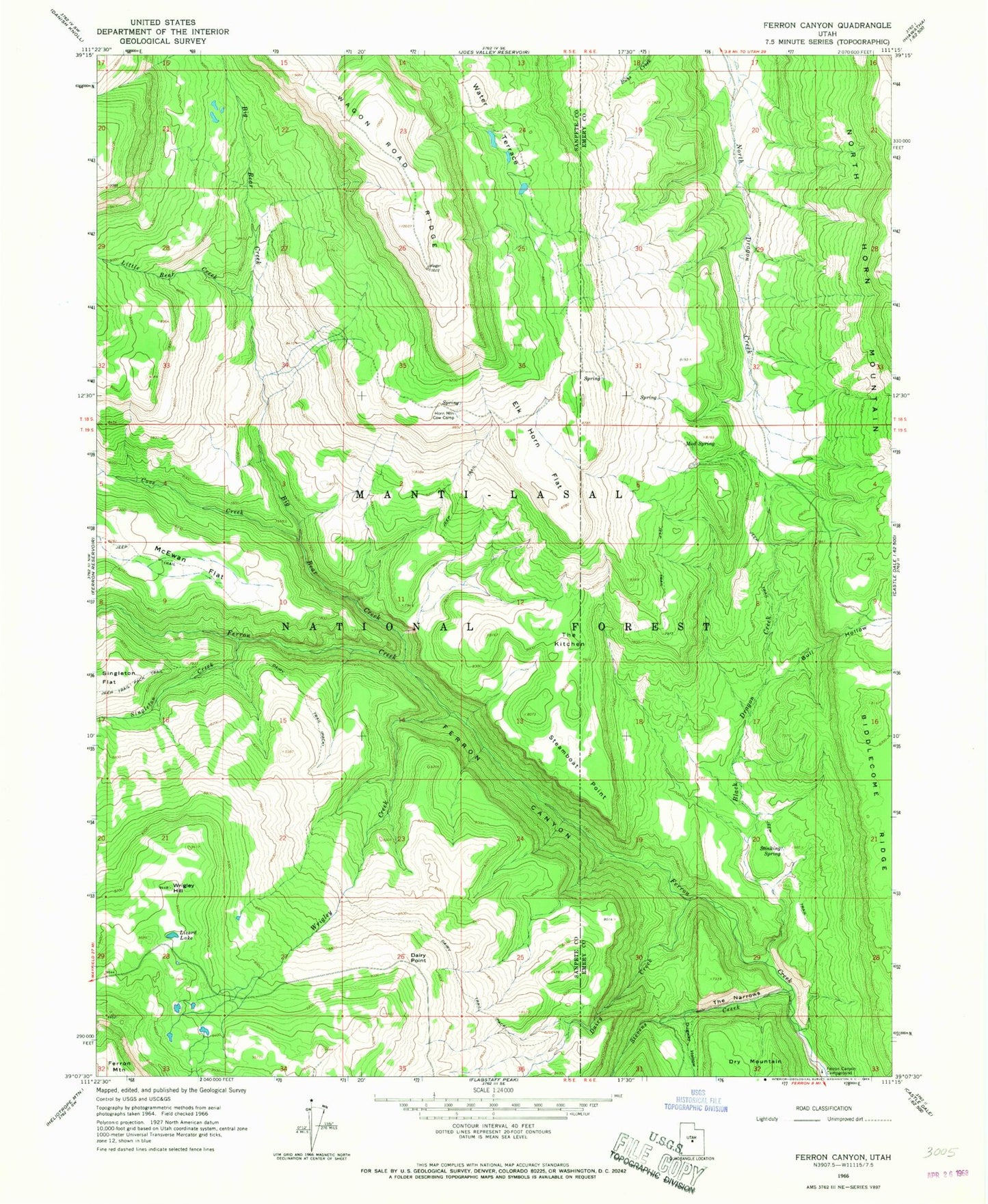
Historical USGS topographic quad map of Ferron Canyon in the state of Utah. Map scale may vary for some years, but is generally around 1:24,000. Print size is approximately 24" x 27"
This quadrangle is in the following counties: Emery, Sanpete.
The map contains contour lines, roads, rivers, towns, and lakes. Printed on high-quality waterproof paper with UV fade-resistant inks, and shipped rolled.
Contains the following named places: Biddlecome Ridge, Big Bear Creek, Black Dragon Creek, Bull Hollow, Cove Creek, Dairy Creek, Dairy Point, Dairy Trail, Dugway Hollow, Elk Horn Flat, Ferron Canyon, Horn Mountain Cow Camp, Little Bear Creek, Lizard Lake, Lone Pine Spring, Lone Tree, Manti-La Sal National Forest, McEwan Flat, Mud Spring, Singleton Creek, Steamboat Point, Stevens Creek, Stinking Spring, The Kitchen, The Narrows, Water Terrace, Wrigley Creek, Wrigley Hill