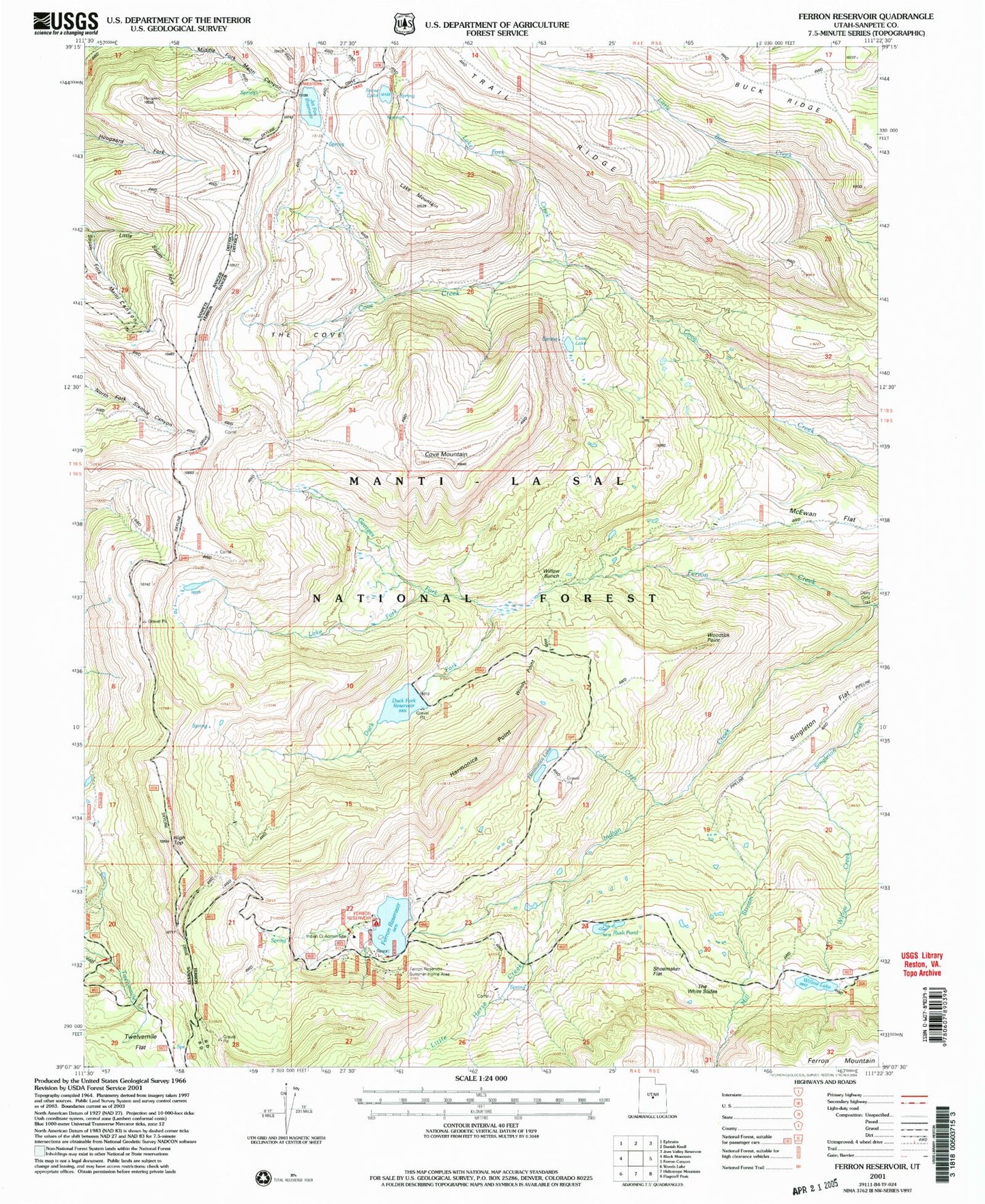
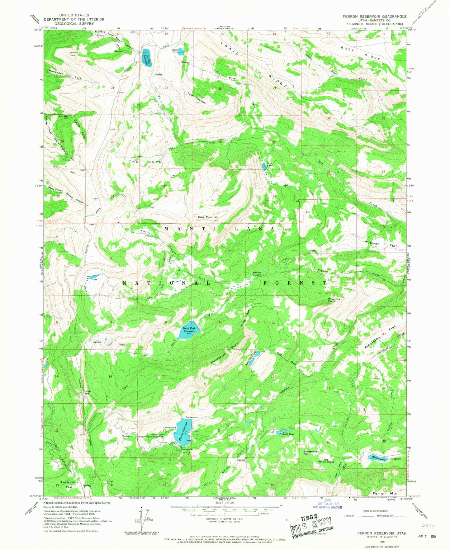
MyTopo
Classic USGS Ferron Reservoir Utah 7.5'x7.5' Topo Map
Couldn't load pickup availability
Historical USGS topographic quad map of Ferron Reservoir in the state of Utah. Typical map scale is 1:24,000, but may vary for certain years, if available. Print size: 24" x 27"
This quadrangle is in the following counties: Sanpete.
The map contains contour lines, roads, rivers, towns, and lakes. Printed on high-quality waterproof paper with UV fade-resistant inks, and shipped rolled.
Contains the following named places: Buck Ridge, Cold Creek, Cove Lake, Cove Mountain, Duck Fork, Ferron Reservoir, Georges Fork, Harmonica Lake, Harmonica Point, High Top, Indian Creek, Indian Creek Administrative Site, Jet Fox Reservoir, Lake Fork, Lake Fork Creek, Lake Mountain, Little Horse Creek, Little South Fork Manti Canyon, Mill Stream, Rush Pond, Shoemaker Flat, Singleton Flat, Snow Lake, The Cove, The White Slides, Twelvemile Flat, Willow Bunch, Willow Creek, Willow Lake, Windy Point, Woodtick Point, Willow Lake Dam, Ferron Dam, Duck Fork Reservoir, Duck Fork Dam, Ferron Reservoir Campground, Ferron Campground, Ferron Campground, Ferron Reservoir Summer Home Area, Willow Lake Campground, Petty Peak