MyTopo
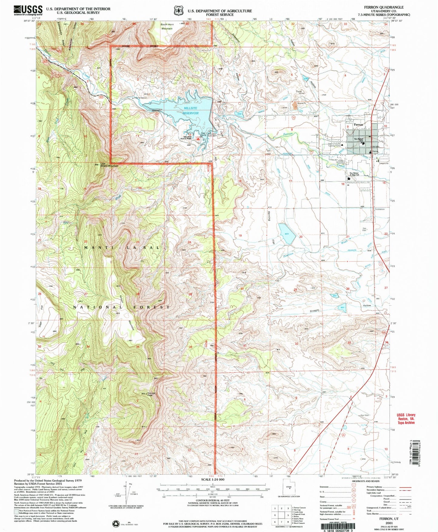
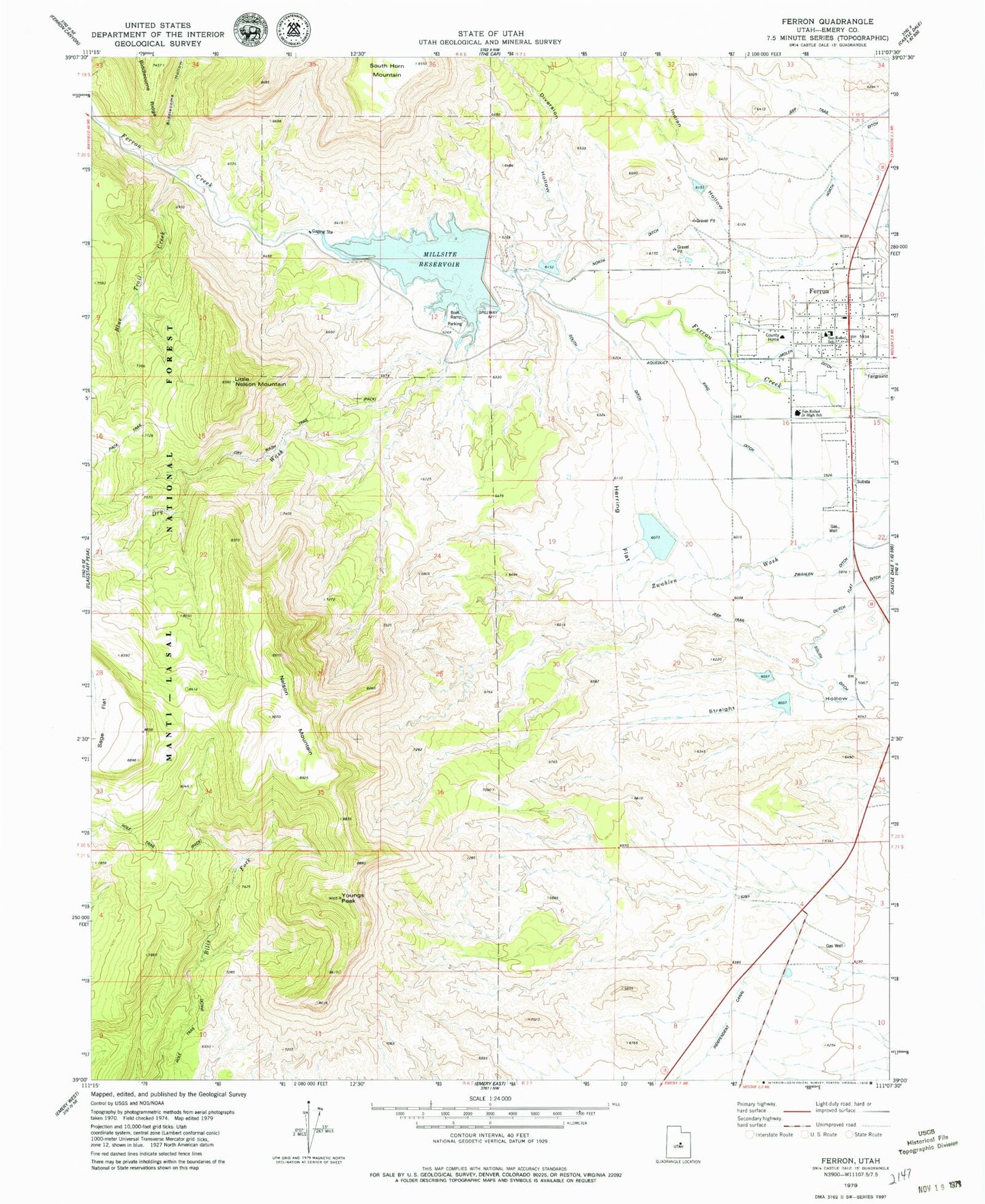
Classic USGS Ferron Utah 7.5'x7.5' Topo Map
Couldn't load pickup availability
Historical USGS topographic quad map of Ferron in the state of Utah. Map scale may vary for some years, but is generally around 1:24,000. Print size is approximately 24" x 27"
This quadrangle is in the following counties: Emery.
The map contains contour lines, roads, rivers, towns, and lakes. Printed on high-quality waterproof paper with UV fade-resistant inks, and shipped rolled.
Contains the following named places: Biddlecome Hollow, Bills Fork, Blue Dugway, Blue Trail, Blue Trail Creek, Cattle Country Mobile Home Campground, City of Ferron, Diversion Hollow, Diversion Hollow Debris Basin Reservoir, Dry Wash, Dry Wash Trail, Emery County Ambulance - Ferron, Emery County Home, Ferron, Ferron Debris Basin Number Five Dam, Ferron Debris Basin Number Four Dam, Ferron Debris Basin Number One Dam, Ferron Debris Basin Number Three Dam, Ferron Debris Basin Number Two Dam, Ferron District Ranger Station, Ferron Elementary School, Ferron Fire Department, Ferron Mill, Ferron Post Office, First Baptist Church, Herring Flat, Hole Trail, Indian Hollow, Indian Hollow Debris Basin Reservoir, King Ditch, Little Nelson Mountain, Mill Site Campground, Millsite Dam, Millsite Golf Course, Millsite Reservoir, Millsite State Park, Nelson Mountain, Peterson Ranch, San Rafael Junior High School, South Ditch, Straight Hollow North Debris Basin Reservoir, Straight Hollow South Debris Basin Reservoir, The Church of Jesus Christ of Latter Day Saints, The Hole, Youngs Peak, Zwahlen Wash, Zwahlen Wash Debris Basin Reservoir, ZIP Code: 84523