MyTopo
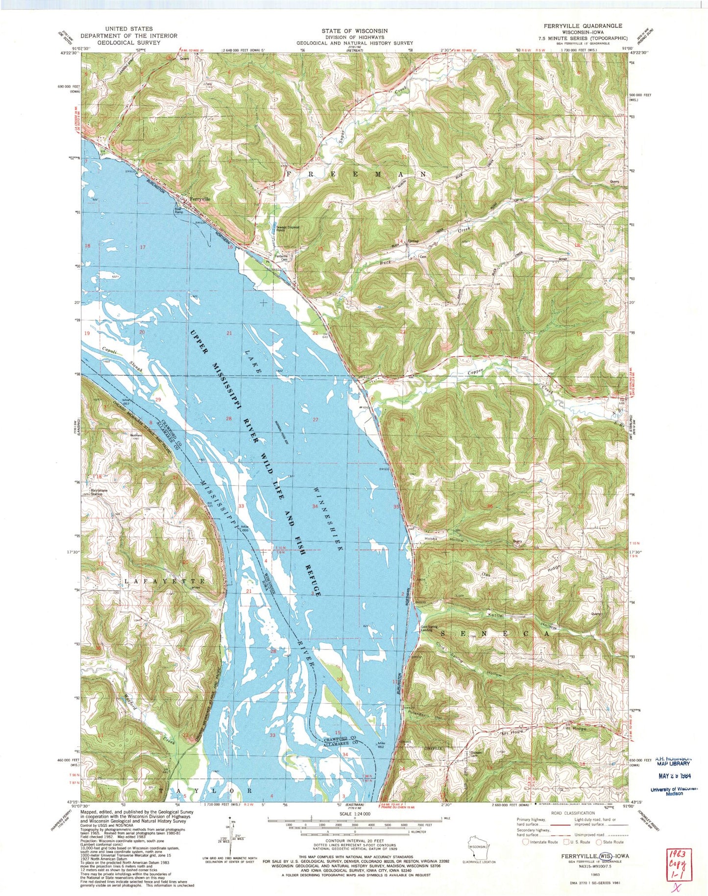
Classic USGS Ferryville Wisconsin 7.5'x7.5' Topo Map
Couldn't load pickup availability
Historical USGS topographic quad map of Ferryville in the states of Wisconsin, Iowa. Map scale may vary for some years, but is generally around 1:24,000. Print size is approximately 24" x 27"
This quadrangle is in the following counties: Allamakee, Crawford.
The map contains contour lines, roads, rivers, towns, and lakes. Printed on high-quality waterproof paper with UV fade-resistant inks, and shipped rolled.
Contains the following named places: Buck Creek, Buck Creek School, Capoli Slough, Cold Spring Hollow, Cold Spring Landing, Columbus Lake, Copper Creek, Crooked Slough, Dickson Cemetery, Ferryville, Ferryville Cemetery, Ferryville Fire Department and Emergency Medical Responders, Ferryville Post Office, Heytmans Station, Hobbs Hollow, Island Number One Hundred Fifty-One, Island Number One Hundred Fifty-Six, Kettle Hollow, Lake Winneshiek, Lost Channel, Mount Hope Ridge, Mount Hope School, North Branch Copper Creek, Oak Grove School, Oak Ridge, Pool 9 Island, Pool Nine Island, South Branch Copper Creek, Sugar Creek, Sugar Creek Bluff State Natural Area, Town of Freeman, Turkey Bluff Airport, Village of Ferryville, Wexford Creek, ZIP Code: 54628