MyTopo
Classic USGS Fiatt Illinois 7.5'x7.5' Topo Map
Couldn't load pickup availability
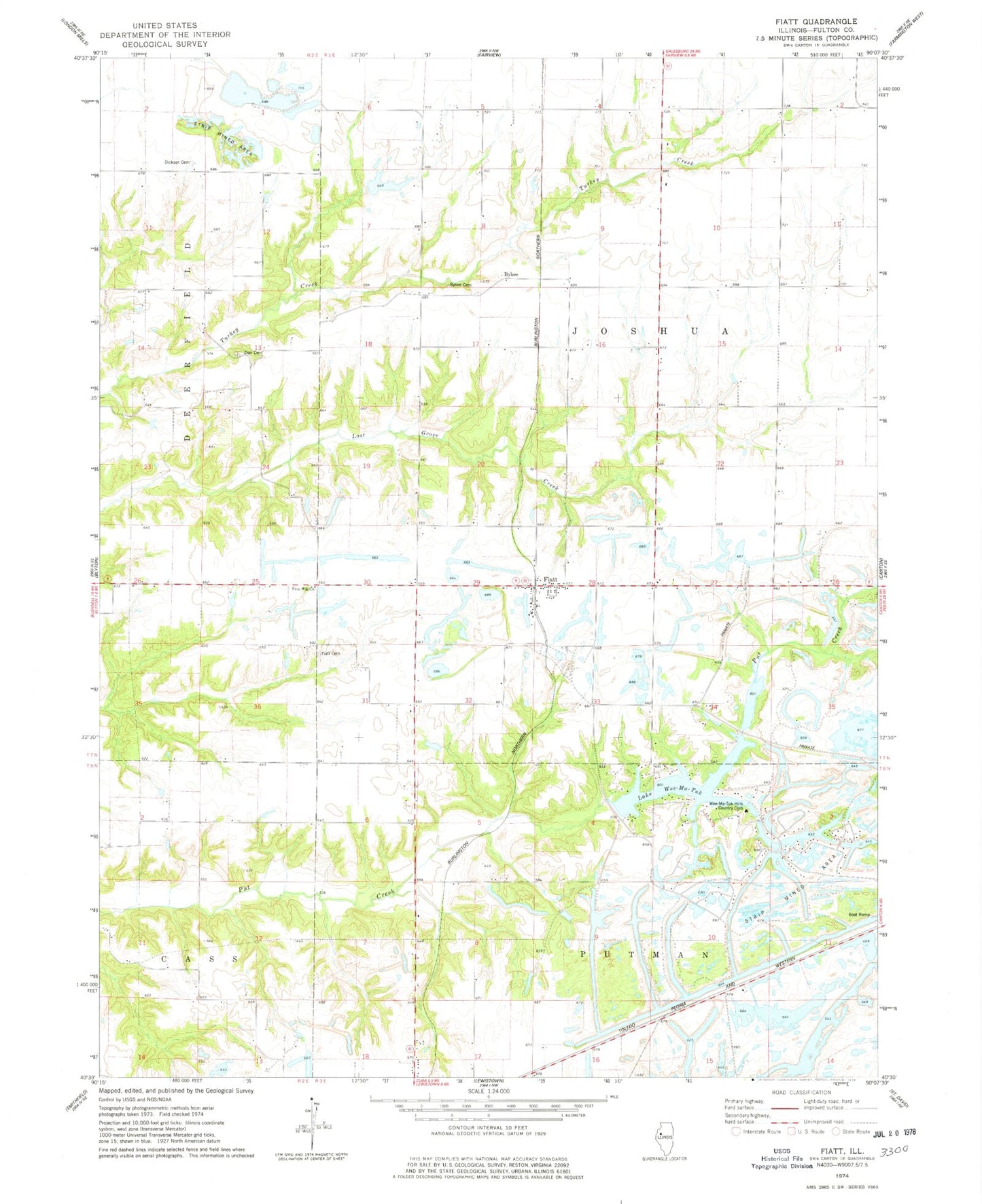
Historical USGS topographic quad map of Fiatt in the state of Illinois. Map scale may vary for some years, but is generally around 1:24,000. Print size is approximately 24" x 27"
This quadrangle is in the following counties: Fulton.
The map contains contour lines, roads, rivers, towns, and lakes. Printed on high-quality waterproof paper with UV fade-resistant inks, and shipped rolled.
Contains the following named places: Boyce Orchard, Brick Fiatt School, Brokaw School, Bybee, Bybee Cemetery, Bybee Station, Bybee Station Cemetery, CBS Gun Club Lake, CBS Gun Club Lake Dam, Clayburg School, Dickson Cemetery, Dickson School, Fiatt, Fiatt Cemetery, Fiatt Post Office, Fiatt Scott School, Fisher Lake, Franklin School, Free Will Church, Frog Lake, Genes Pond, Hipple School, Jones School, Lake Louise, Lake Marie, Lake Marie Dam, Lake Wee-Ma-Tuk, Lone Elm School, Long Lake, Long Lake Dam, Mason Lake, Pleasant Row Orchard, Pleasant View School, Roberts School, Rose Lake, Seller Mine, Springtown School, Star Mine Number 1, Star Mine Number 2, Stevens Lake, Sunnyside School, Swimming Lake, Township of Joshua, Traer Lake, Traer Lake Dam, Truax Lake, Truax Lake Dam, Wee Ma Tuk Lake Dam, Wee-Ma-Tuk Hills Country Club, Wee-Ma-Tuk-Lake-South, Wee-Ma-Tuk-Lake-South Dam, Woods Lake, Woods Lake Dam, Zion Cemetery, ZIP Codes: 61427, 61433