MyTopo
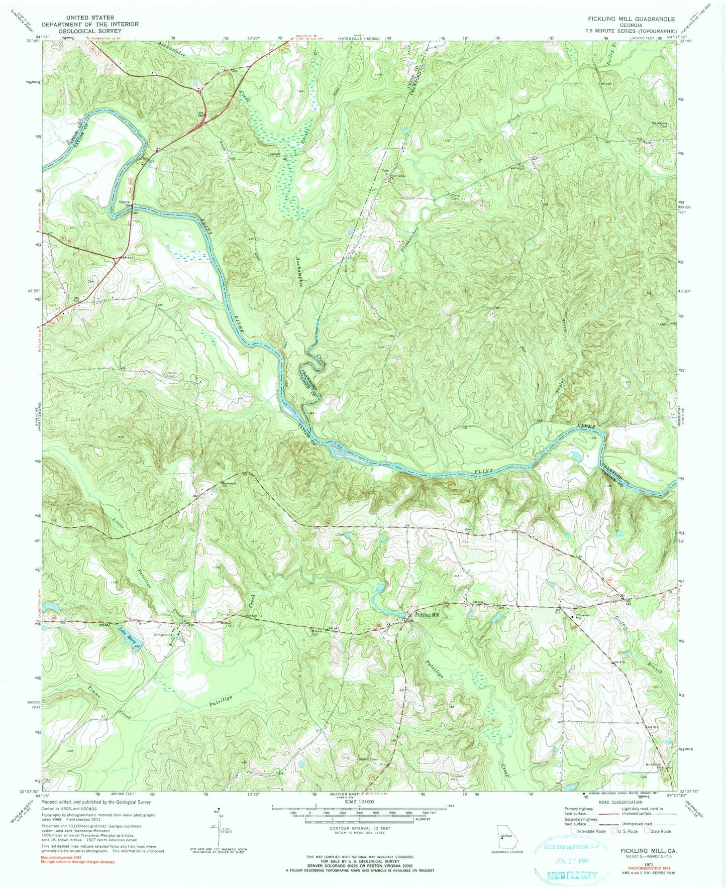
Classic USGS Fickling Mill Georgia 7.5'x7.5' Topo Map
Couldn't load pickup availability
Historical USGS topographic quad map of Fickling Mill in the state of Georgia. Map scale may vary for some years, but is generally around 1:24,000. Print size is approximately 24" x 27"
This quadrangle is in the following counties: Crawford, Taylor, Upson.
The map contains contour lines, roads, rivers, towns, and lakes. Printed on high-quality waterproof paper with UV fade-resistant inks, and shipped rolled.
Contains the following named places: Auchumpkee Creek, Bailey Branch, Carsonville Division, Crowell Church Cemetery, Crowells Church, Damascus Church, Damascus School, Elam Cemetery, Fickling Mill, Grays Ferry, Harris Cemetery, Harris Island, Hollis Road Cemetery, Islands Ford, Lake Mary, Lake Mary Dam, Little Patsiliga Creek, Lockhart Cemetery, Macedonia Cemetery, Midway Cemetery, Midway Church, Mount Gilliard Church, Olive Grove Cemetery, Olive Grove Church, Raines Branch, Reeves Island, Reeves Shoals, Sulenojuhnene Ford, Taylor County Fire and Rescue Department Panhandle Station, Taylor County Holiness Camp Ground, Taylor Creek, Timms Creek, Trices Ferry, Ulcohatchee Creek, Wainwright Cemetery