MyTopo
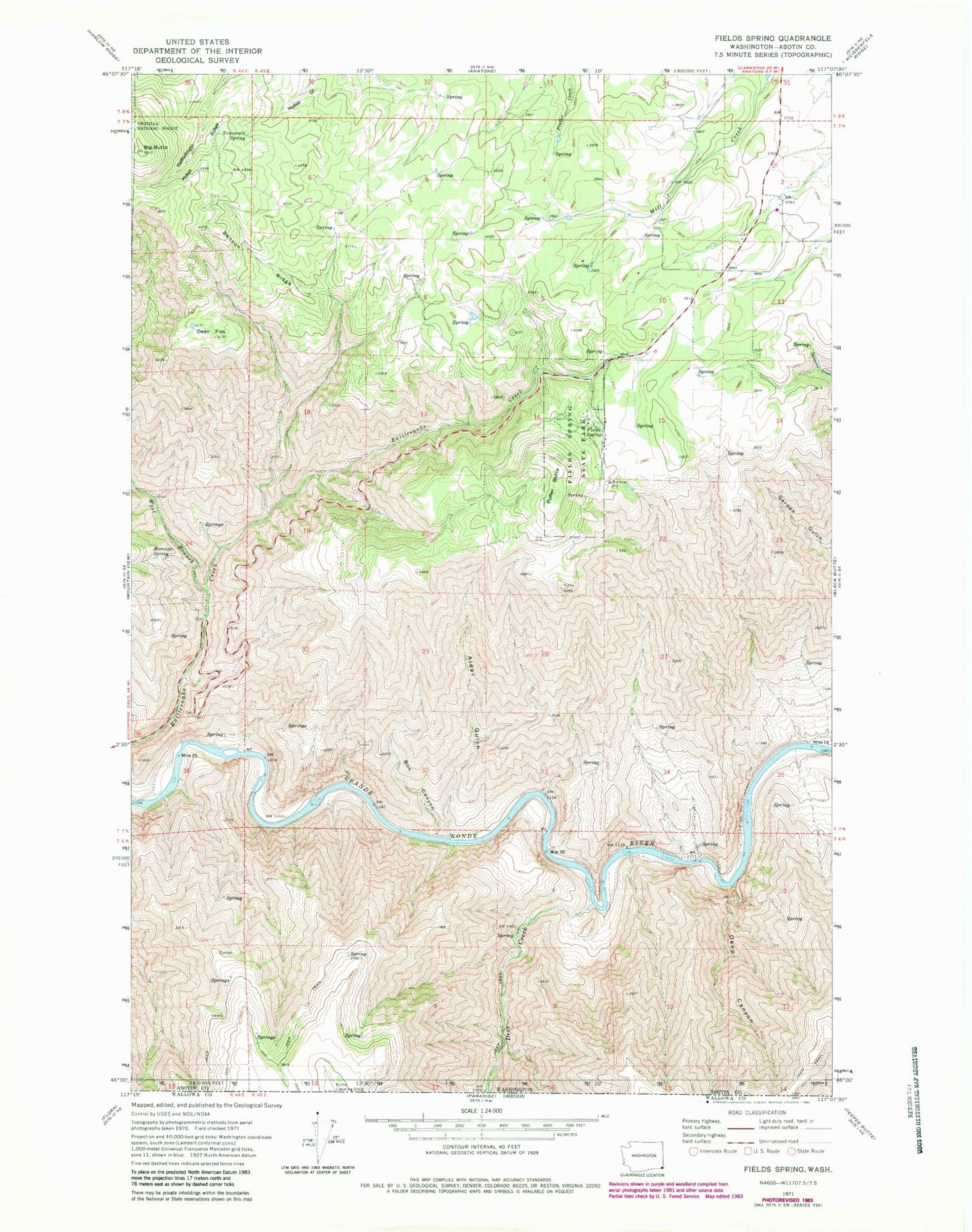
Classic USGS Fields Spring Washington 7.5'x7.5' Topo Map
Regular price
$16.95
Regular price
Sale price
$16.95
Unit price
per
Couldn't load pickup availability
Historical USGS topographic quad map of Fields Spring in the state of Washington. Map scale may vary for some years, but is generally around 1:24,000. Print size is approximately 24" x 27"
This quadrangle is in the following counties: Asotin.
The map contains contour lines, roads, rivers, towns, and lakes. Printed on high-quality waterproof paper with UV fade-resistant inks, and shipped rolled.
Contains the following named places: Alder Gulch, Benson Ridge, Big Butte, Box Canyon, Deep Canyon, Deer Creek, Deer Flat, Fields Spring, Fields Spring State Park, Morengo Spring, Puffer Butte, Ray School, Tamarack Spring, West Branch Rattlesnake Creek, ZIP Code: 99401