
MyTopo
Classic USGS Filer Idaho 7.5'x7.5' Topo Map
Couldn't load pickup availability
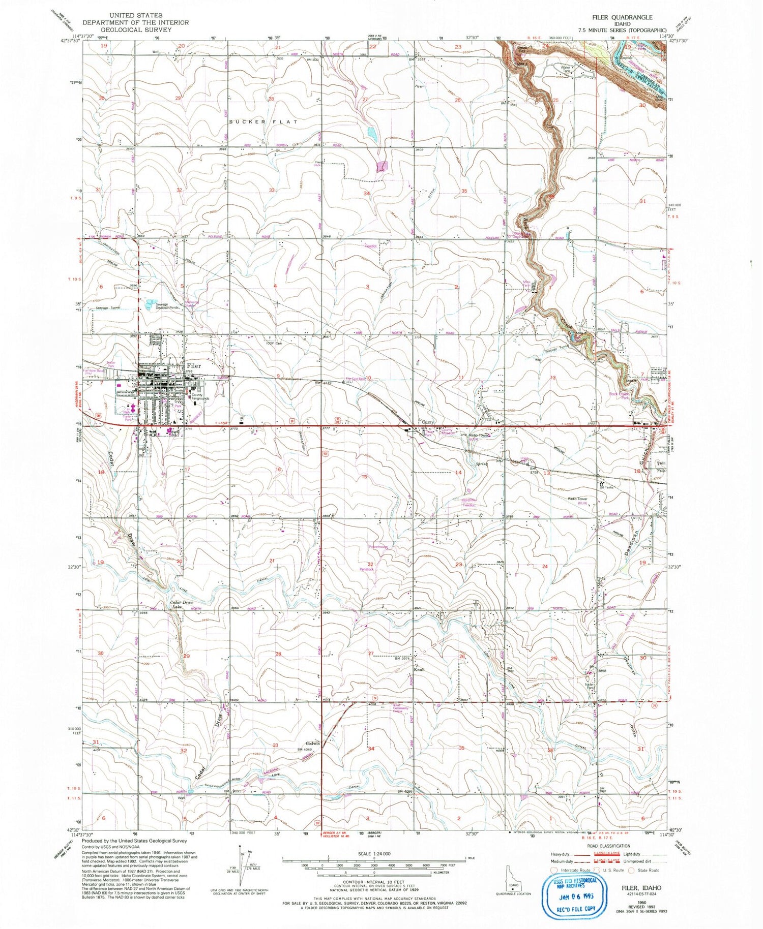
Historical USGS topographic quad map of Filer in the state of Idaho. Map scale may vary for some years, but is generally around 1:24,000. Print size is approximately 24" x 27"
This quadrangle is in the following counties: Jerome, Twin Falls.
The map contains contour lines, roads, rivers, towns, and lakes. Printed on high-quality waterproof paper with UV fade-resistant inks, and shipped rolled.
Contains the following named places: Cedar Draw Lake, City of Filer, Curry, Curry Station, Deadman Gulch, Elmwood Elementary School, Filer, Filer City Police Department, Filer Community Park, Filer Elementary School, Filer Fire Department, Filer High School, Filer Junior High School, Filer Middle School, Filer Post Office, Filer Senior High School, Godwin, High Line Canal, Independent Order of Odd Fellows Cemetery, KLIX Radio Tower (Twin Falls), KLIX-FM (Twin Falls), Knull, Knull Community Center, KTFI Radio Tower (Twin Falls), KTFI-AM (Twin Falls), Low Line Canal, Maroa School, Rock Creek Park, Sucker Flat, Twin Falls County Fairgrounds, Twin Falls County Museum, Union School, Vierstra Dairy, ZIP Code: 83328


