MyTopo
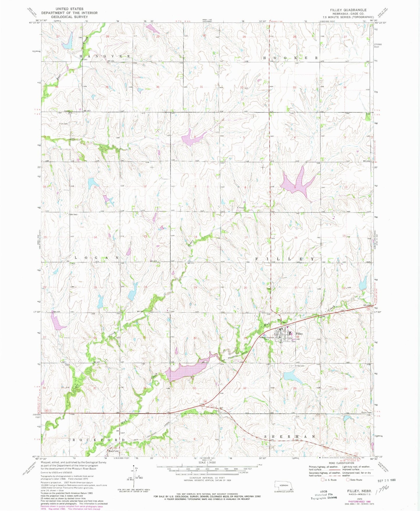
Classic USGS Filley Nebraska 7.5'x7.5' Topo Map
Couldn't load pickup availability
Historical USGS topographic quad map of Filley in the state of Nebraska. Map scale may vary for some years, but is generally around 1:24,000. Print size is approximately 24" x 27"
This quadrangle is in the following counties: Gage.
The map contains contour lines, roads, rivers, towns, and lakes. Printed on high-quality waterproof paper with UV fade-resistant inks, and shipped rolled.
Contains the following named places: Bear Creek Dam 7-C, Bear Creek Dam 7-D, Bear Creek Dam 8-B, Bear Creek Dam 8-C, Bear Creek Reservoir 7-C, Bear Creek Reservoir 7-D, Bear Creek Reservoir 8-B, Bear Creek Reservoir 8-C, Cedar Creek Dam 9-A, Cedar Creek Dam 9-B, Cedar Creek Dam 9-C, Cedar Creek Dam 9-E, Cedar Creek Dam 9-F, Cedar Creek Reservoir 9-A, Cedar Creek Reservoir 9-B, Cedar Creek Reservoir 9-C, Cedar Creek Reservoir 9-E, Cedar Creek Reservoir 9-F, Filley, Filley Cemetery, Filley Post Office, Filley Public Schools, Filley Rural Fire Protection District, Iron Horse Trail State Wildlife Management Area, Mud Creek Dam 2-A, Mud Creek Dam 2-C, Mud Creek Dam 5-1, Mud Creek Dam 5-A, Mud Creek Reservoir 2-A, Mud Creek Reservoir 2-C, Mud Creek Reservoir 5-1, Mud Creek Reservoir 5-A, Rockford, Rockford Post Office, Rockford School, Searcey Grain Company Elevator, Township of Filley, United Methodist Church, Village of Filley, Zion Church, Zion Evangelical Lutheran Cemetery, ZIP Code: 68357