MyTopo
Classic USGS Fillmore Illinois 7.5'x7.5' Topo Map
Couldn't load pickup availability
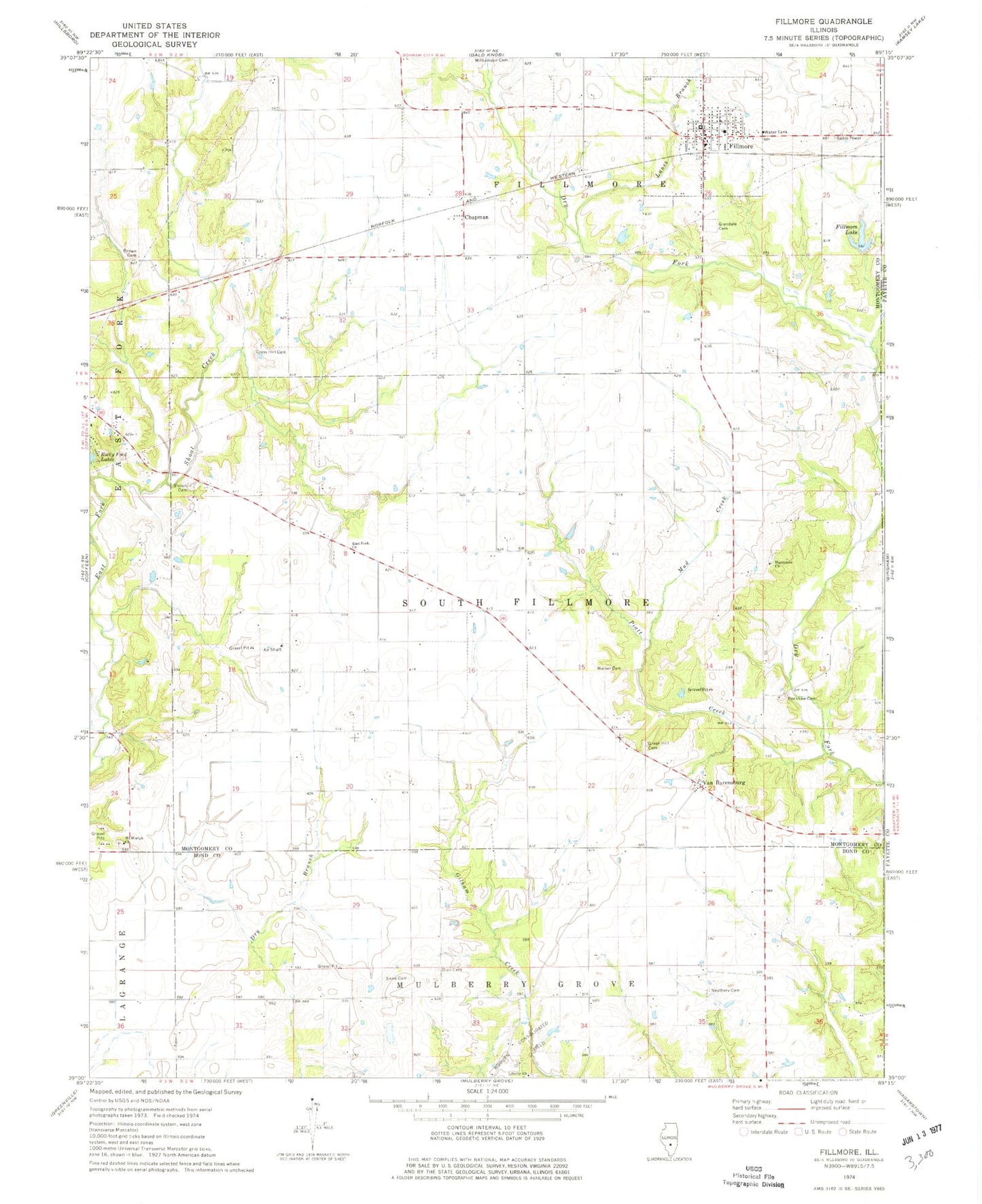
Historical USGS topographic quad map of Fillmore in the state of Illinois. Map scale may vary for some years, but is generally around 1:24,000. Print size is approximately 24" x 27"
This quadrangle is in the following counties: Bond, Fayette, Montgomery.
The map contains contour lines, roads, rivers, towns, and lakes. Printed on high-quality waterproof paper with UV fade-resistant inks, and shipped rolled.
Contains the following named places: Alexander School, Brown Cemetery, Chapman, Crab Apple School, Cress Cemetery, Durr Cemetery, East Fork Church, East Fork School, Egypt School, Fillmore, Fillmore Baptist Church, Fillmore Community Fire Protection District, Fillmore Lake, Fillmore Lake Dam, Fillmore Post Office, Forsee Vineyards, Gilham School, Glendale Cemetery, Green Hill Cemetery, Hurricane Church, Jerusalem School, Lanes Branch, Liberty Church, Mount Moriah Church, Mud Creek, Neathery Cemetery, Neathery School, New Boston School, Piatt Creek, Renshaw Cemetery, Saint Matthew Lutheran Church, Shiloh Cemetery, Shiloh Church, Snow Cemetery, Township of Fillmore Consolidated, Township of South Fillmore, Van Burensburg, Village of Fillmore, Walker Cemetery, Whitten Cemetery, Williamson Cemetery, ZIP Codes: 62017, 62032