MyTopo
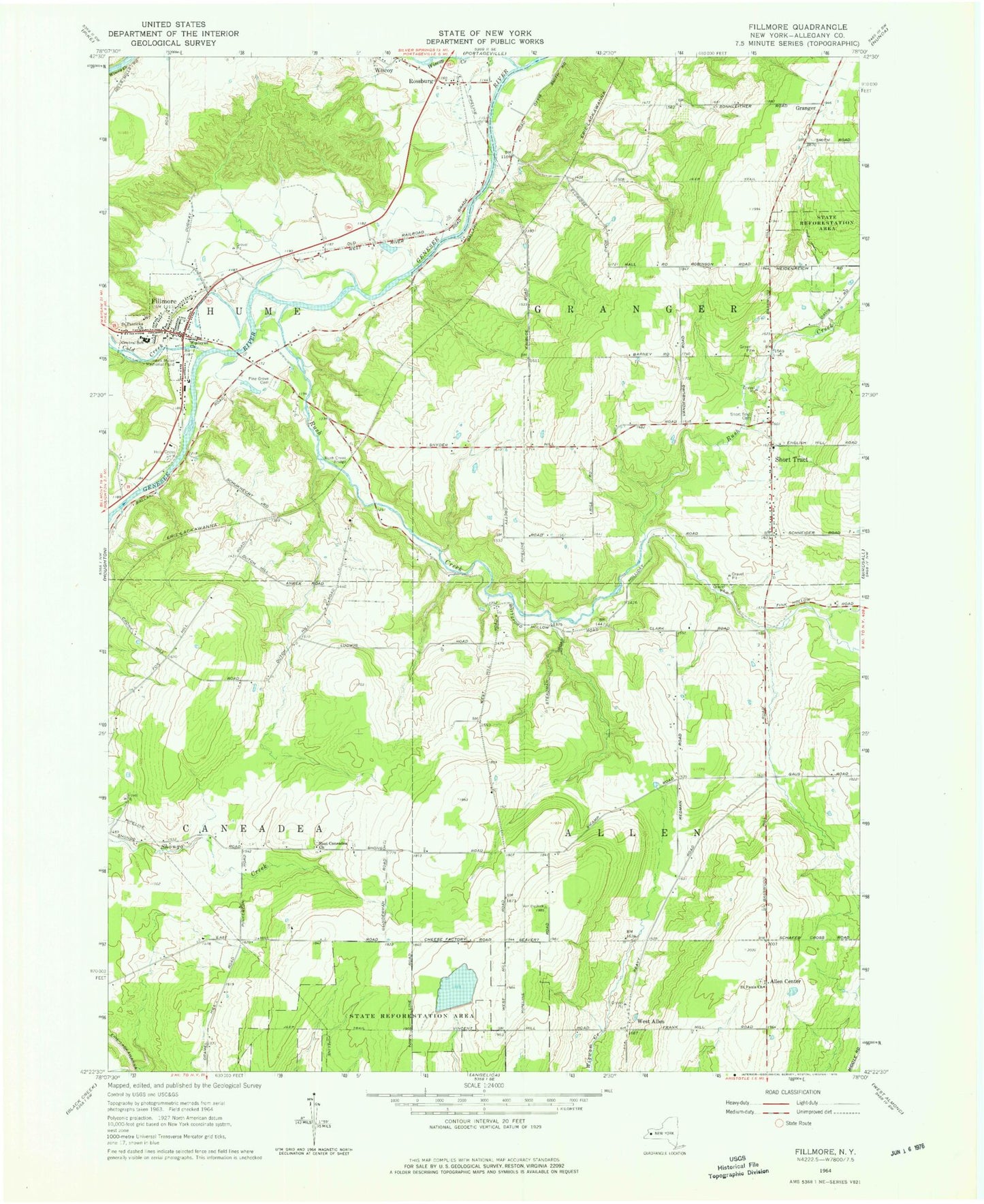
Classic USGS Fillmore New York 7.5'x7.5' Topo Map
Couldn't load pickup availability
Historical USGS topographic quad map of Fillmore in the state of New York. Map scale may vary for some years, but is generally around 1:24,000. Print size is approximately 24" x 27"
This quadrangle is in the following counties: Allegany.
The map contains contour lines, roads, rivers, towns, and lakes. Printed on high-quality waterproof paper with UV fade-resistant inks, and shipped rolled.
Contains the following named places: Allen Center, Central School, Cold Creek, East Caneadea Cemetery, East Caneadea Church, Fillmore, Fillmore Census Designated Place, Fillmore Fire Department, Fillmore Post Office, Granger, Hank Miller Memorial Field, Holy Cross Cemetery, Hume Town Hall, New York State Police Fillmore Station, Pine Grove Cemetery, Riverland Dairy Farms, Rossburg, Rush Creek, Rush Creek Bridge, Saint Patricks Church, Saint Pauls Church, Saint Pauls Lutheran Church Cemetery, Short Tract, Short Tract Cemetery, Short Tract Fire Company, Town of Allen, Town of Granger, Wesleyan Church, West Allen, Wide Awake Club Library, Wiscoy - Rossburg Fire Company, Wiscoy Cemetery, Wiscoy Creek, ZIP Code: 14735