MyTopo
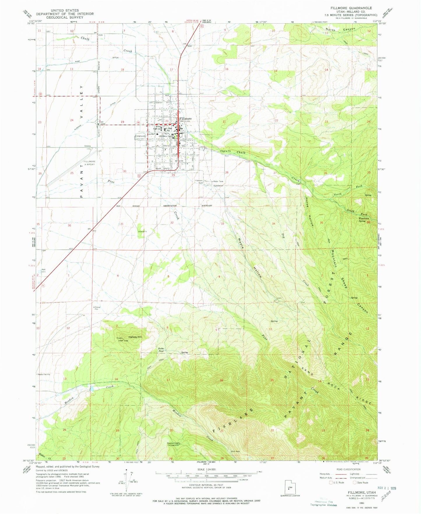
Classic USGS Fillmore Utah 7.5'x7.5' Topo Map
Couldn't load pickup availability
Historical USGS topographic quad map of Fillmore in the state of Utah. Map scale may vary for some years, but is generally around 1:24,000. Print size is approximately 24" x 27"
This quadrangle is in the following counties: Millard.
The map contains contour lines, roads, rivers, towns, and lakes. Printed on high-quality waterproof paper with UV fade-resistant inks, and shipped rolled.
Contains the following named places: Almond Ditch, Black Cedar Hill Wildlife Management Area, Cemetery Wildlife Management Area, City of Fillmore, Deer Pasture, Dry Creek, Fillmore, Fillmore Cemetery, Fillmore Community Medical Center, Fillmore Community Medical Center Heliport, Fillmore Elementary School, Fillmore Fire Department, Fillmore Middle School, Fillmore Municipal Airport, Fillmore Post Office, Halfway Hill, Halfway Hill Wildlife Management Area, Horse Hollow, Maple Hollow, Meadow Creek Campground, Millard County Ambulance Service Fillmore Station, Millard County Sheriff's Office, Millard High School, Mountain Sheep Canyon, North Fork Chalk Creek, Pole Canyon, Ruths Pond, Sink Ditch, South Fork Chalk Creek, Territorial Statehouse, The Church of Jesus Christ of Latter Day Saints, United States Forest Service Fiire Station Fillmore Ranger District, Utah Highway Patrol Section 14 Fillmore Office, Wagons West RV Campground, Watercrest Spring