MyTopo
Classic USGS Fingerville West South Carolina 7.5'x7.5' Topo Map
Couldn't load pickup availability
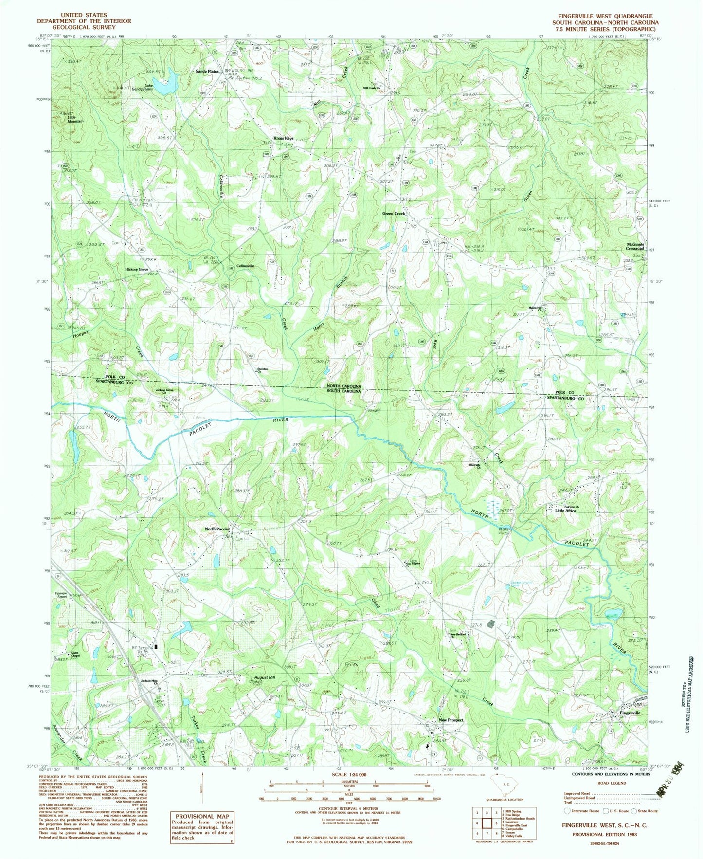
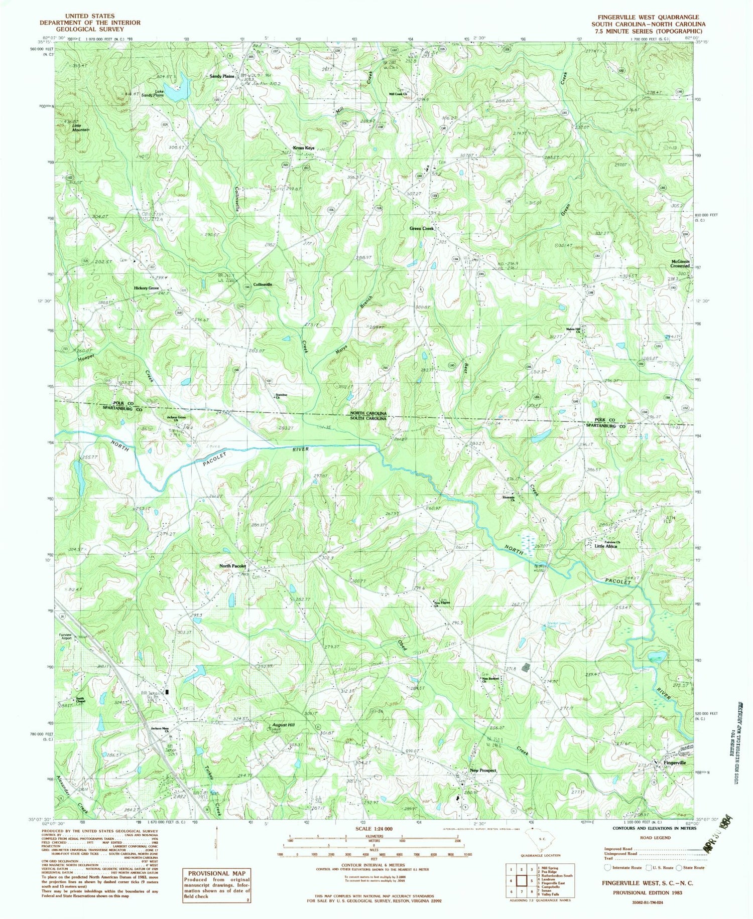
Historical USGS topographic quad map of Fingerville West in the states of South Carolina, North Carolina. Typical map scale is 1:24,000, but may vary for certain years, if available. Print size: 24" x 27"
This quadrangle is in the following counties: Polk, Spartanburg.
The map contains contour lines, roads, rivers, towns, and lakes. Printed on high-quality waterproof paper with UV fade-resistant inks, and shipped rolled.
Contains the following named places: Bear Creek, Camps Bridge, New Prospect, Riverside Church, Fingerville, Little Africa, North Pacolet, South Carolina Noname 42020 D-1682 Dam, Fairview Farms Pond, C Barre Pond Dam D-3301, C Barre Pond, D Honey Number One Pond Dam D-3302, D Honey Number One Pond, D Honey Pond Dam Number Three D-3303, D Honey Incorporated Pond, T Steppe Pond Dam D-3299, Steppes Pond, Collinsville Creek, August Hill, Fairview Church, Jackson Memorial Church, Jackson Grove United Methodist Church, Africa School (historical), Bryants Store (historical), Burns Mill (historical), Carpenter Bridge, Jackson Grove United Methodist Church Graveyard, New Bedford School (historical), New Pilgrim School (historical), New Prospect Baptist Church, New Prospect Elementary School, North Pacolet Church, North Pacolet School (historical), Obed (historical), Rutledge Bridge, Smith Chapel, Smiths Chapel School (historical), Wakeforest School (historical), Fairview Airport, Fingerville Division, New Prospect Fire Department, Fingerville Census Designated Place, Riverside Free Will Baptist Church Graveyard, Mount Lebanon Cemetery, Crossroads Baptist Church Graveyard, Fairview Christian Methodist Episcopal Church Graveyard, New Bedford Baptist Church Cemetery, Fingerville United Methodist Church Cemetery, New Prospect Baptist Church Cemetery, Green Creek, Greens Creek School, Hughes Creek, Little Mountain, McGinnis Crossroads, Melvin Hill Church, Mill Creek Church, Sandy Plains, Lake Sandy Plains, Sandy Plains Dam, Marys Branch, Stateline Church, Kross Keys, Hickory Grove, Collinsville, Hooper Creek, Township of Greens Creek, Green Creek Volunteer Fire Department Station 1, Green Creek Volunteer Fire Department Station 2, Wheat Field, Melvin Hill Church of the Brethren Graveyard, State Line Baptist Church Cemetery, New Freedom Baptist Church Graveyard, Sandy Plains Presbyterian Church Graveyard, Green Creek First Baptist Church Graveyard